Distance:
From Scofield Road: 5.42 miles round trip
Over the tunnel: 4.52 miles round trip
Walk duration:
From Scofield Road: 2 hours 30 minutes;
Over the tunnel: 2 hours
Elevation change:
From Scofield Road: 471 feet in elevation change
Over the tunnel: 170 feet in elevation change
Travel time to trail head: 33.9 miles or 40 Minutes.
Directions to Scofield Rd.:
This approach has the advantage that it avoids a short stretch of private property that has been posted directly above the tunnel. This approach uses timber lands that are accessible on foot. Total distance to this access point is 32.7 miles from I-405 & West Burnside. Travel .03 miles south to jct with Sunset Highway and then travel 32.4 miles west to the junction with Scofield Road. Park on Scofield Road and cross the Sunset highway (Highway 26) on foot to enter a dirt track immediately opposite Scofield Road. This track is actually a portion of the Ridge Road that traverses the eastern slope of this hill from Strassel Road all the way to the Sunset Highway. It is only open to vehicular traffic for a portion of this distance, but continues on as a forest track.
Directions to roadway crossing over the tunnel:
This approach has the advantage that it connects directly with the trail approaching from the north, but it also requires ignoring no trespassing admonitions for a very short stretch of road (1/10 mile) immediately above the tunnel.
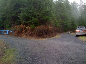
Total distance to this access point is 41.1 miles from I-405 & West Burnside. Travel .3 miles south to jct with Sunset Highway and then travel 33.6 miles west. This will place you just beyond the first tunnel on US 26. On your right you will see a solitary house. Turn right onto the verge here and you will see a dirt road heading back in an easterly direction. Drive up this short dirt road until you come to an intersection with a blue gate on the left and two roads veering off to the right. Park off the road here.
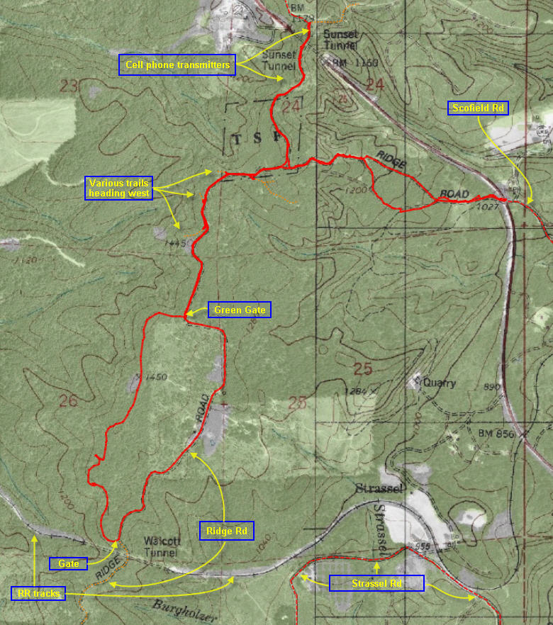
Brief summary: This trail crosses Highway 26 and follows the eastern-most ridge line that marks the eastern edge of the Coast Range. It is located atop the initial slope which Highway 26 ascends as it rises from Staley’s Junction to the tunnel under its summit. This trail is the strategic connection that joins those trails on the north side of US 26 to those stretching away to the south of this highway. The trail has two access routes, one that crosses the tunnel but requires crossing a short stretch of private property (belonging to the operators of the cellular tower), and another that abuts Highway 26 opposite Scofield Road. At the southern end of this trail the route traverses the western slope of the ridge on the outbound leg, but returns along the Ridge Road that traverses the eastern flank of the ridge.
Trail Log:
Access via Scofield Rd.:
After parking your car on Scofield Rd. carefully cross the Sunset Highway to a track that leads into the forest on the south side of the road. This is actually the extension of a road that traverses the eastern slope of this ridge and connects with Strassel road that parallels Ridge road at the base of the hill.
Just beyond the concrete barrier, the trail climbs rapidly up the slope. About a quarter of a mile up the slope the trail splits; the two routes rejoin a little more than a quarter of a mile up the slope. Either route will get you to the top, but I recommend taking the left hand option. After nearly (.9) a mile the trail intersects with another little used logging road that cuts across the top of the ridge line from the top of the tunnel.
This is the point at which both these trails join – see below section entitled “Ridge top trail” for the continuation.
Access over the Tunnel:
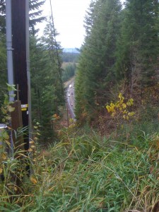 When we park at the top of the dirt road that leads up from Highway 26 we are facing an intersection with three roads branching off. The left hand trail leads north to Cape Horn Road and ultimately to the road connecting to the north with Tophill on Highway 47. The middle road leads up to a cellular phone tower located directly above the tunnel. The left hand trail leads across the tunnel and ultimately connects us to trails proceeding southwards towards Cochran Pond.
We will take the left hand option and cross over the top of the tunnel. On the far side of the tunnel we arrive at a yellow gate that is posted with no no trespassing signs.
For those not wishing to trespass the Scofield access road allows to reach this trail from below without breaching any posted areas.
But for those that are willing to brave the trespass across this private property; it’s a short transit to the far side of the property. The ownership appears to be with the cellular phone company, so it’s unlikely to be patrolled unless there’s a maintenance truck on site, and that would probably be indicated by an unlocked and open gate.
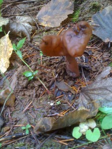
On the far side of the tunnel, the newly graveled road leads up a knoll where there is a building and radio tower. Just before the asphalt driveway veers uphill to the right, you will spot an older road disappearing into the trees – about .3 miles from the start. We will follow this overgrown trail which appears to have had little traffic in the past few years. The trees are marked with a ribbon indicating “WOEC” ownership?. After dipping down from the high point at the cellular tower, the trail climbs back to 1474 feet in height about a half mile from the start. I noted plenty of mushrooms in this area including Red Russulas, Crested (white) and Yellow Coral mushrooms, False Morels, Clustered Woodlover, the Honey mushroom, Turnip bulbed Inocybes, and the edible Delicious Milky Caps and a few Chanterelles. At .57 miles from the start, we arrive at the other yellow gate – which appears to have been effectively circumvented by numerous all terrain vehicles (ATV’s). Just beyond the gate (about .61 miles from the start) at an altitude of about 1454′ , the road splits. The left hand option heads downhill to the left and eventually reaches Scofield road – this is the alternative entry path to this trail.
This is the point at which both these trails join – see below section entitled “Ridge top trail”for the continuation.
Ridge top trail (after two access routes merge):
The trail coming up from Scofield Rd and the trail that leads over the tunnel meet on this ridge line. At the junction we will proceed soutwards along the ridge top. For those coming from the tunnel it means taking the right hand turn; for those coming up from Scofield road it means taking the left hand option.
In any event , we will proceed south along the ridge top.
Soon, (.7 miles from the start of the tunnel crossing route) we reach a wide clearing where the road splits once again. The option on the left appears to descend the eastern slope probably merging into the series of trails that all emerge opposite the entrance too Scofield Road on US 26. A bit further along (.9 miles from the start of the tunnel crossing route) we come across a path leading down off the ridge heading to Southwest. We ignore that spur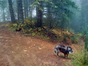 and the path continues to wend its way along the ridge line through fairly mature stands of Douglas fir trees. At almost a mile (.9) from the start above the tunnel, we pass another trail descending down onto the western slope. We ignore that side spur, too. Since it’s hunting season, I do see boot tracks, deer tracks and a long-necked Blue Grouse that thinks she call fool me by not moving…
Not much further (1.05 miles from the start of the tunnel crossing route) we emerge from the trees to gaze over a large clearcut that wraps over the top of the ridge. I see the tracks of hunters that have also recently scanned this clearcut area and in the distance I hear gunfire. Generally, I don’t worry about hunters as most of the shooting is done across clear land with a positively identified target.
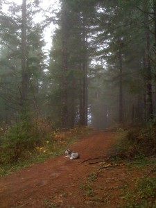
Few people will shoot through a screen of trees at vaguely moving objects – that’s more of a problem in less mountainous country. I do keep a sharp eye out for the hunters and try to announce my presence to them – usually by waving my hat vigorously. Following the European tradition, I always wear forest toned clothing (but not camouflage) and most of the hunters I’ve seen do the same.
We cross the clear cut using the gravel road that runs along the spine of the hill. At the southern end of the clear cut (1.4 miles from the start of the tunnel crossing route) we arrive at a green gate. There we turn right and follow an old road upwards towards a tall stand of timber that crowns the next high point of the ridge. As we approach the crest of this high point (1.5 miles from the start of the tunnel crossing route) we reach the highest point of the hike at about 1,470′ in elevation. The trees in this section are about 2 – 3 feet in diameter and about 120′ to 150′ high. Another tenth of a mile further along the road dips down and emerges on the clearcut that covers the southern end of this ridge all the way down to Castor Creek.
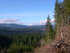
It is worth noting that Castor Creek is the first creek we’ve encountered (on the southern route) that flows into the Nehalem River and thence into the Pacific ocean – albeit through a round-about route. The water flowing off the eastern slope of this ridge – into Strassel Creek and Burgholzer Creek all flow into the Tualatin. So this ridge is a divide between inland waterways and coastal steams.
The clear cut into which we’ve entered extends from the top of this ridge with its lonely stands of mature trees – all the way down to Castor Creek which affords us a very important viewpoint across the final stretch of forests, ridges, railroad tracks and mountains that we will need to cross to get to the headwaters of the Salmonberry River – from where our descent to the Coast will begin.
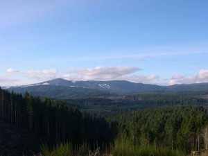 Standing on the flat “landing” near the top of this clear cut I can see down the slope to Castor Creek. A small logging road leads down the slope almost to Castor Creek. Although we will not explore this road on this trip, it is the beginning of the next segment of the coastal access route. This “cut-through” trail will connect with the Port of Tillamook railroad tracks that literally pass under your feet on this Two Rocks hike.
On the far side of the creek I can glimpse a “crease” snaking through the trees marking where the railroad tracks traverse the opposite slope. Beyond that low ridge I can see the the gradual ascent to the plateau (at 1920′ in elevation) on which Cochran Pond is situated. This is actually the watershed divide between the Upper Nehalem and the Salmonberry. And beyond the gradual slope of forest leading up to Cochran Pond, I can see the much higher lines of the mountains leading from Round Top past Larch Mountain up to Roger’s Peak.
As I stand in the shifting fog and ragged clouds, I watch colorful patches of sunshine race across the forests on the opposite slope. Around me is a grey moonscape left over from the logging operation. The fog swirls around the huge piles of forest “slash” have been piled into giant heaps for burning or decomposition. As the clouds and fog open up, I look west across the Upper Nehalem at Lousignant Ridge and my gaze rises to the crest of these hills that separate the Salmonberry watershed from Highway 26 – up there is the aptly named Coyote Corner. There ahead of me is the last stage of the southern route, before we begin our descent through the narrow Salmonberry gorge.
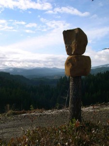 Another sight to greet your wandering gaze as you pear into the Coastal Range from this first ridge, is a curious lumberjack investment in spontaneous art. Not far down the slope, a tall stump stands silhouetted against the verdant backdrop of the Coastal Forests. But deposited on this stump are two big blocks of stone – balanced for all eternity on their wooden pedestal!
But we have tarried too long gazing at the verdant hills and mountains. We still need to complete the loop that will return us to our starting point. Following the road down through the moonscape left behind after the loggers cleared the slope, we eventually pass (on our right) the top of the trail that leads down to the base of the hill to where we can cross Castor Creek and bushwhack up the opposite slope to the Tillamook Railroad line.
But on this hike, we will not descend this western slope, but instead descend the main logging road as it follows ridge line south to where it connects with the Ridge Road. At the end of the ridge is the gate that bars vehicular access to this area from Ridge Road. As you circle around the gate that restricts access to the clearcut we’ve just traversed, you will be standing directly above the Walcott Tunnel, more recently renamed the Gordon Smith tunnel. This is the longest of the tunnels on the railroad route from Washington County to Nehalem Bay. To reach it we have to use the spur road, which we recently passed that descends the western slope of the clearcut we just passed.
If one were to descend Ridge road to the right one would soon arrive at Strassel Road. Strassel road begins at the Sunset Highway, near Staley’s Junction, and runs along the base of the hill we’ve just traversed to the Timber Road.
 An alternative walking route to Cochran Pond follows Ridge Road down to Strassel Road. Follow Strassel Road southwards to the paved Timber road. From there follow the Timber Road southeast for a quarter mile to where a logging road on the right side (Dober Road) ascends in a southwesterly direction into the hills. Dober road will eventually will lead us over the hills to the Cochran Road and Cochran Pond.
But on this hike, we will ignore all the connecting routes that will someday comprise a continuous route to Tillamook. Instead will will turn left at the gate and follow the Ridge Road along the eastern slope of this hill – passing a remote farm on our left as we proceed through the woods. Eventually we emerge from this wooded area and the road splits. The right hand option heads down the slope into taller timber. We will proceed on the left hand option traversing the slope but finally turning left to climb uphill to the green gate.
From the green gate we simply retrace our steps across the clear cut, along the ridge and depending upon our original access route, we will either continue on across the tunnel or diverge eastwards off the ridge and follow the track back down the forested slope to Scofield Road.

