Walk duration: 1 hour minutes
Travel time to trail head: 26 minutes (17.8 miles)
Take US 30 to Logie Trail and ascend to Skyline Boulevard. Head north along Skyline Boulevard. Proceed north 1.3 miles and drive past the so-called “elbow curve” which is followed by the inverse elbow curve (inhabited). 1.8 from the top of Logie Trail you will see a forest road off to the left of the road. It is gated with the usual “blue” gate that signals the accessibility by walkers or non-motorized visitors.
Elevation change:1256′ elevation at Skyline Boulevard; drops down to 983′ before reascending to Skyline Boulevard. Total elevation change is 273′
Brief summary: The short 2.5 loop explores the upper headwaters of Jackson Creek on the sunny west slope of the Tualatin range. Located in between Skyline Boulevard and NW Johnson Road it encircles the dense alder and conifer woods along the headwaters of the creek. It sports lovely views to the west across the Tualatin Plain with the coastal mountains in the distance.
Trail Log: 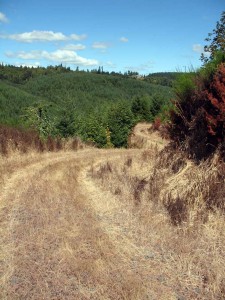 Park your car off the road near the blue gate at the top of this forest lane. Almost immediately after the gate the road splits with the left hand branch inclining upwards to a large copse of Douglas Firs astride the crest of the hill. Ignore this attractive option, because it leads directly into private property. Instead follow the right hand option and descend the graveled road through the thicket of young conifers out to the open slope of the hill. Once out on the previously cut slope you will be rewarded by a lovely view out over the Tualatin valley to the distant Coast Range spread out across the hazy green horizon. To the North, over your right shoulder, you can see the big “Toad hall” mansion with its distinctive chimneys at 23414 NW Moreland Road. For a mere $2.9 million this 40 acre estate could be yours…or we could continue our walk into the wilds. Since I forgot to bring the requisite cash, I’ll opt for the more pedestrian option and continue on around the corner following the gravel road as it traverses the hillside heading south toward NW Johnson road.
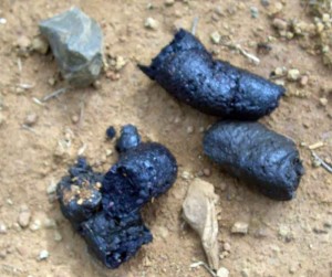
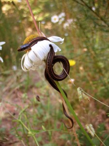 About .4 miles along we reach the summit of this trail as it rises to follow the top of the hillside, just below the edge of the private property at the crest alongside Skyline Boulevard. From here the road dips and presently it splits, with the right hand branch heading further down the hill. We will not be tempted by this scenic cul-de-sac, but will instead “hang left” following the upper branch (.6 miles) into a thicket of Scotch Broom that obscures the progress of the road. It is interrupted here by berms to prevent further access by vehicles, but as pedestrians we can by-pass these feeble restrains and plunge through the golden thickets into the path beyond. About 50 feet beyond the Scotch Broom thins out and we find ourselves on a track that winds along the hillside and enters the young alder stands at the head of the valley. Apparently, this track is used by equestrians as the signs of horses abound, but so to are signs of bear (see close by picture of bear scat sighted here).
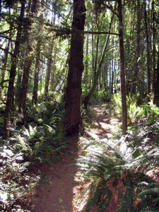
A little less than a mile into the hike (.95 miles) the trail enters the shady confines of alder groves before the trail turns west on the south slope of this valley. Here we enter the lower reaches of a Douglas Fir conifer forest as the trail weaves in and out of the contours of the hillside. At 1.38 miles we reach a woodland intersection, where a clearly used trail ascends the hillside to our left. This side spur leads up the hill for .8 miles to reach the intersection of NW Johnson and NW Beck road – a nice alternative, or even an alternative way to access the loop we’re on.
On this hike we opt to ignore the temptations of exploring unknown trails and proceed onwards following the wooded trail that continues to traverse the slope. But not more than .07 miles onwards we encounter another side spur leading downwards from the even grade upon which the current path is cut. Despite the “promising” appearance of the level track, we will take this descending trail to drop down into the basin of the ravine, crossing the nascent Jackson Creek before ascending the northern face of this valley.
Right after crossing the muddy stream at the bottom of this trough, we will see two options for proceeding.
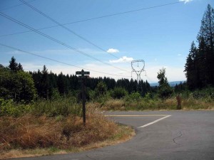
The one path leads off to the left and presumably ends up climbing another slope under the power lines.
But we will see that there is also a right hand option that begins to climb the ridge to our right, ascending out of this creek bed on a step and narrow deer/elk/equestrian track that eventually (1.6 miles) pops out at the bottom of the lower logging road cul-de-sac.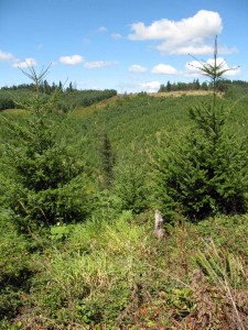
From here it’s just another tenth of a mile up the logging road until we reach the upper road with its thicket of Scotch Broom hiding the upper route. The return trip along the hillside and back up to Skyline Boulevard is about .57 miles in length, with the lovely views to entertain us as we trudge up the hillside. It’s a lovely walk and a relatively short one, too with ample opportunity to spot game and signs of wildlife all around.


