Distance: 5.8 miles (one way)
Walk duration: 2 hours 15 minutes
Travel time to trail head: 26 minutes (20.6 miles)
Elevation change: 520 ft rise in elevation from Scappoose to Spitzenberg Jct.
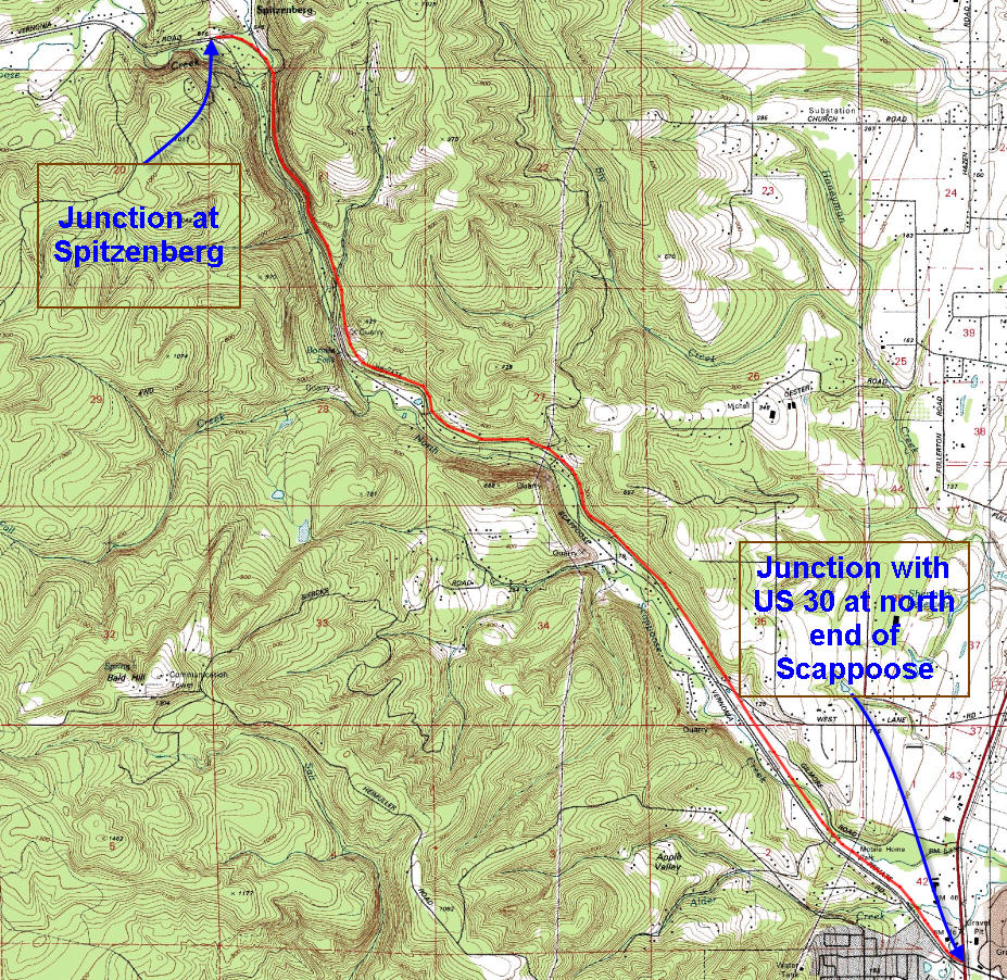
Brief summary: This once privately owned (Crown Zellerbach) logging road parallels the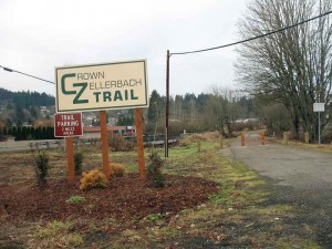 Scappoose to Vernonia road. This trail actually goes down to the banks of the Columbia at Chapman Landing about 2 miles east of US 30, but I have chosen to begin the trail description starting at the Trail’s intersection with Highway 30. Initially it runs straight through fields and next to homes before ascending slightly up the side of the eastern valley wall. From there it traverses the valley all the way to the westward turn in the Scappoose/Vernonia road at Spitzenburg about 5.8 miles distant. Most of the way is clear, with one washed out culvert that requires the hiker to descend to the creek and ascend the opposite side – not to difficult or deep.
The history of this trail begins in 1906 when Fred and Simcoe Chapman decided to construct a railroad to help them bring their timber to the banks of the Columbia River from where it could be transported to market. Consequently they constructed a rail line up the North Scappoose Creek valley, past Camp 8 – a major logging depot. In 1910 they built a 1712 foot tunnel to avoid the excessively steep grades in the upper reaches of the valley that gave them access to the “big Timber’ located in the Nehalem Valley. The tunnel is listed in the National Register of Historic Places, but it is not part of the trail and it is not open to protect the public and the tunnel. There are side trails that lead down to the tunnel and I have heard reports that some intrepid (foolhardy) types actually traversed the partially caved-in tunnel taking about 90 minutes to get through. You won’t me trying that one – too muddy, too dangerous and too spooky!
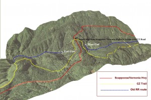 In 1943, Crown Zellerbach, a major regional logging company acquired the rail line and using the excellent railroad grade converted it into a logging road. The tunnel could not be converted for log trucks, so a road was built to cross the pass above the tunnel. The tunnel has fallen into significant disrepair since that time.
In 2004, Columbia County purchased the Crown Zellerbach Logging Road from the Hancock Timber Company with grants from the Oregon Department of Transportation and Oregon State Parks.
Trail Log:
The first two miles (west of US 30) of the CZ trail skirt fields, cross a brook and bypass occasional house At the end of this flat and relatively open landscape the valley narrows and the trail become much more scenic. 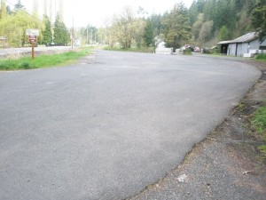 This is the location of the official CZ Trail head with lots of parking and located across from a convenience store.
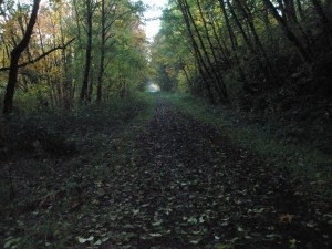
Just beyond this spacious trail head, the trail enters the woods alongside the eastern wall of the North Scappoose Creek valley. From here the trail passes through mixed forest comprised of Alder, Broadleaf maple, Douglas fir and Hemlock. As you follow this trail you will cross these listed roads at the following distances:
Road or Obstacle: From last point: From Hwy 30
Highway 30 0 miles 0 miles
Wikstrom Road 1.7 miles 1.7 miles
CZ Trail head .1 mile 1.8 miles
Deane Road 1.2 miles 3 miles
Pioneer Road .1 mile 3.1 miles
Pond Drive .6 mile 3.6 miles
Walker Road .8 miles 4.5 miles
Earth slide .4 miles 4.9 miles
Alder Creek .7 mile 5.5 miles
Spitzenberg Jct .3 miles 5.8 miles
At Pond Drive the trail bends in a northeasterly direction and skirts around the east side of Heinen Pond – a small idyllic little pond set between the road and the CZ Trail. 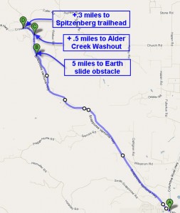
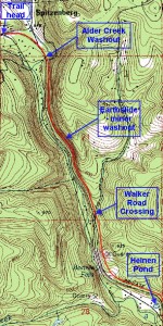 Walker Road is a paved rural route that crossed the trail as it climbs up the hill.
About .4 miles beyond Walker Road, a rock-slide has blocked the trail, forcing the walkers to scramble over a small mound of earth and rock before resuming the smooth trail.
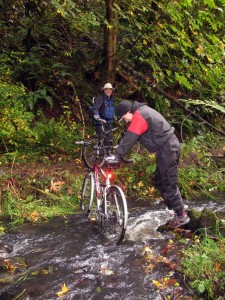
At Alder Creek the water has washed out the trail and you will have to scramble down to the bottom of the wash-out and back up the other side – one of the few places where the trail is unimproved and required a short “scramble”.
 A little bit (.3 miles) beyond the Alder Creek washout the trail turns Westwards and soon crosses the Scappoose/Vernonia Highway. The CZ Trail crosses the highway a few yards south of where Cater Road veers off to the NE and leads (via Sykes Road) into St. Helens. This marks the end of the Spitzenberg-to-Scappoose segment of this trial,
On the west side of the highway crossing is a wide open area (suitable for parking) that marks the beginning/terminus of the Summit-to-Spitzenberg segment of this trail.

Thanks for the most helpful post on this trail. I’ve always passed it and meant to check it out. I see in your below picture that people have bikes and wondered if this trail is mountain bike friendly? Can you take ride the entire trail? are there parts you cannot ride (other than the obvious areas that you have to cross streams, and go around slides and such)? Thanks in advance for your help.
The CZ Trail that runs from Scappoose to Vernonia is one of my favorite bike rides (aside from Ridge Runner’s Delight – see Saddle Mountain section). I’m not into more exertion than necessary so I typically ride down from the summit of the Scappoose to Vernonia road. I either leave a car at the Spitzenburg intersection or just out side of Scappoose across the the convenience store. When descending towards Vernonia I leave the second car at Elk Creek. The only section that still needs some work is about a quarter mile east of the Spitzenberg intersection, but it is possible (as you can see from the picture of us portaging across a spring freshet). You need to haul the bikes up a short slope, but from then on it’s ride-able, though rough in spots.
I talked to Tony Hyde, the Columbia County Commissioner that’s behind this trail and they’re planning to sort out this final piece pretty soon.
Jim Thayer
The cuts in the CZ trail are not “washouts”. In the late 1990’s, Crown Zellerbach was dealing with deteriorating culverts in their right-of-way. They simply dug out the old culverts and left the cut in the road. Since they had no plans to continue utilizing the right-of-way, there was no financial reason for them to invest in new culverts and replace the earth.
Notably when Mollenhour creek was daylighted, there was evidence of the old trestle visible. When it was converted to a logging road, it appears material was simply dumped over the old trestle and covered it up. When the county restored the culvert, this part of the old RR trestle was again covered back up.
Crown Zellerbach left several of the original culverts in place up on the Nehalem divide. These were most at-risk for a wash out, and were part of the first work the county did on the trail. Rather than dig out the road, the county employed a new technology method to sleeve the existing rusted metal culvert. It is readily evident that heavy equipment has been put to use in these areas within the past decade. Much of the foliage has been removed and is slowly reforesting.
I live near Spitzenburg and I see they are finally going to bridge Alder Creek. They have been working on both sides and there is an old rail car bed waiting there to be the bridge over the creek. Hopefully soon!
Thanks for the update on the new bridge. Tony Hyde had mentioned that they were working on it. Please keep us informed on any other changes in the area. I am now beginning to survey the forest stretching north from the Scappoose -Vernonia Highway stretching up to Camp Wilark and the lovely waterfall on Carcus Creek. I may add those trails as soon as I have completed my saturation exploration and have figured out good circular routes.
Jim
I noticed that there has been a road graded from Walker to the Alder creek crossing and that the bridge concrete forms have been poured on both sides of the creek as well as a bridge section waiting to be set in place. Are there plans to develop this section of the CZ trail, thus all of the improvements or will it remain a ‘trail’ and not a paved road? I tried to contact Tony Hyde but my call was not returned. I am hoping that the trail stays dirt and doesn’t become a paved road with housing developed in the area. Any idea what the county’s plan is for future CZ changes? The funding has to be coming from some outside source perhaps?
Peggy:
I honestly don’t know but will contact Tony to find out what the plans are. Bill Swenson sent me a picture of the footing for the bridge over Alder Creek. Looks like we’re making progress. I’d hate to see the entire road paved, because that somehow takes the fun out of the ride. Frankly I find the Banks to Vernonia portion boring, but then again I’m not happy until I’m completely off trail and waist-deep in Oregon Grape and Salal.
I was on the citizens advisory council when this was planned out a few years ago. The trail is going to be maintained in its present condition. There are no intentions to pave it.
Thanks for the update. Jim
I found and went all the way through the tunnel. I do not recommend it!