
Brief Description: This higher altitude hike is about 7.15 miles in length and took about 3 1/2 hours to complete. It has absolutely stellar views, rugged terrain, exposure to coastal weather – but is well worth the effort. The approach road is daunting and required a car with sufficient clearance and power to navigate the steeper slopes. Having said that, I have completed the climb several times in my Honda Odyssey.
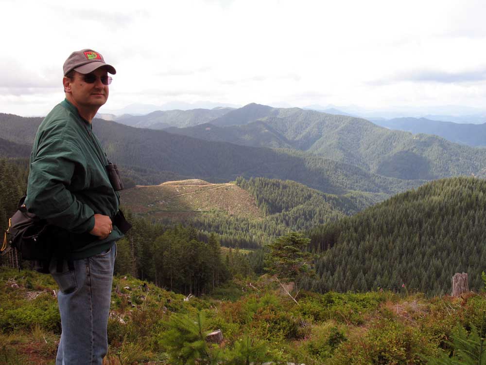
View westwards from Roger’s Peak
Distance/Duration: 7.15 miles. Three and a half hours will take you around and over Roger’s peak and back to the gate on Gilmore road.
Travel time to Trailhead: 52 minutes from the Sylvan interchange on US 26, via Highway 6 to Jones Creek Camp.
Elevation Change: The biggest elevation change on this hike occurs during the approach. From the Jones Creek campground to the crest of the Gilmore Road (2740 ft.) the elevation gain is 2,200 ft. But that’s all accomplished in the comfort of your car! The hike itself as it ascends Rogers Peak and returns to the gate on Gilmore Road is only 828 ft. in elevation gain.
Trail condition: Mostly logging roads; some are rutted, but most are smooth cycling. Once over the crest the roads are fairly level, typically nothing more than a 4% grade. The actual ascent of Roger’s Peak is a bit steeper, and the road conditions are rougher.
Special Attributes: This trail has one of the greatest advantages, in my view. It is a remote, rugged and beautiful landscape with vistas across the entire North Coast Range! Because it runs parallel to the Salmonberry River to the north and the Wilson Rive to the south, it is a splendid alternative for descending the Salmonberry gorge – especially as official efforts to rebuild a trail will entail closures. This route gives you the eagles’ eye equivalent to the Salmonberry Trail, and the Wilson River, all in one.
Directions to Trailhead: From Portland travel west on US 26. Take the turnoff (Highway 6) for Tillamook cruising past the towns of Banks, and Gales Creek before crossing over the summit. About 46 miles from Portland (from the Sylvan Height interchange on US 26) you will approach a side road leading to the Jones Creek Campground. It follows just beyond the general store at Lee’s camp. Exit the highway to the right and cross the bridge into the campground. Continue straight for about 2,000 ft. on North Fork Road, and then take the first major right hand turn. This will put you on the North Fork of the Wilson River road heading northwards. About 1.6 miles onwards you will reach the turnoff (on your right) to the Diamond Mill Park, but you will veer left and bypass the park.
Continue on up the North Fork of the Wilson River. At 2.3 miles from the highway you will cross a small stream flowing down from the left. Continue on up the North Fork, even as the road gets rougher. A mile further you will cross the “West Fork North Fork of the Wilson River”. Turn left here and follow the aforementioned tributary up this valley for 1 mile, whereupon you will encounter a small concrete bridge leading off to the right. Cross that bridge and follow the road steeply uphill for the final 3.6 miles. This leg of the labyrinth will take you into the watershed of Morris Creek. The final stretch is on Gilmore Road that leads up the ridge and is quite steep. I managed the steep grade in my Honda Odyssey, but this “flying toaster” as my wife refers to it, has climbed grades in excess of 30%! Nonetheless, my sense of automotive machismo was a bit dented when I found a Vespa parked at the final gate.
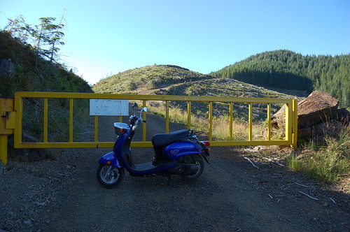
A Vespa made it up the challenging approach road?
If these instructions seem complicated, it’s because they are. I urge anyone interested in this kind of back country exploration to invest in detailed maps that show the logging roads and permit you to trace your route up this maze of rocky roads. Better yet use mapping software, like Topofusion (PC) or Base Camp (Apple OS) to map the route. Then you can transform it into a digital file and transfer it to your GPS device. In this manner you will have a clear route to follow. In a pinch these roads are even marked on Google Maps.
Trailhead: The trailhead on Gilmore Road is a narrow road that slants up along a recently clearcut slope. At the top you will see the yellow gate. There is a small space to turn around next to the gate and another smaller widening of the road about 200 ft. before the gate. Turn and park off the main track so as not to impede others on this narrow stretch of road.
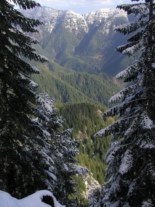
The crest of the ridge is located about 600 ft. above the gate. When you arrive at the crest take a few moments to absorb the panoramic view of the North Coast Range. The Wilson River is 2,200 ft. down behind you. Dwindling into obscurity in front of you is the Salmonberry River – way down below! To your right is a rocky hillock: Roger’s Peak. The slope from the top of Roger’s Peak down to the Salmonberry River is 10 times steeper than the slope between Sandy, Oregon and Government Camp.
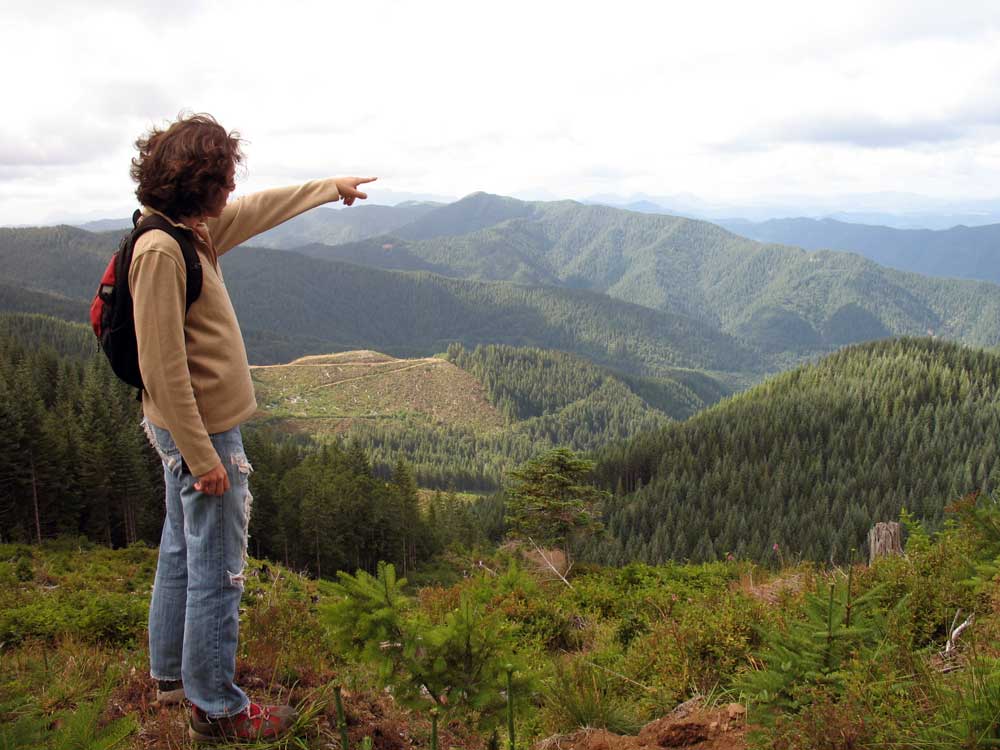
Diana pointing to Nehalem Bay.
Trail Log: Immediately after crossing the summit veer to the right and take Gilmore road that traverses the northern slope at a pretty level grade. Two and a quarter miles from the gate you will encounter a 5 -way road crossing. Aside from the Gilmore road we used to reach this point, we will observe 4 other roads coming together on this point. Starting from the Gilmore road, in a clockwise fashion, we will see:
- To the west: the extension of Gilmore Road heading towards Cook Creek and the Coast.
- To the northwest: a minor logging road that dead-ends further on.
- To the east: the Belding Road heading downhill to the Salmonberry River
- To the east: the Standard Grade heading East to Cochran Pond and Storey Burn Road.
Our route will lead us along the Standard Grade – the most level of all the ridges angling through the mountains eastwards facing roads. Less than a mile further we will reach a fork in the road. The Standard Grade turns left at this point, but we will continue onwards heading in a northeasterly direction. Two-tenth of a mile beyond this split, we will encounter another split, with a road leading down to Blue Lake. Again, we will bypass this option and continue to take the right hand option that continues around the base of Roger’s Peak.
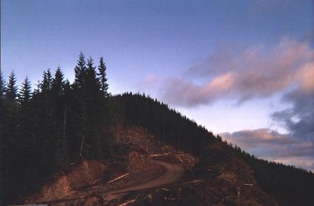
Rogers Peak at sunset
As we begin to round the corner at the northern side of the mountain, we will leave the main trail that encircles the peak, and we will take a steeper road that climbs up the shoulder of the north face. These slopes are mostly dirt and rock, but are not precipitous. This steeper road splits a few hundred feet onwards. Take the left hand option that traverses the northern face. This road eventually circles around until it’s facing south. Further on it splits again – take the right option and climb upwards. As you climb the grade gets progressively steeper and the rock underfoot chunkier. Along this route we encountered several vantage points that provided a spectacular view of the North Coast range all the way to Saddle Mountain. Spread out before us were the wide basins that emptied into Ripple Creek and Bathtub Creek – both tributaries of the Salmonberry River. Far down, the deep Salmonberry River gorge with its massive escarpments was glowing orange in the late afternoon sun.
The track we used exhibited much elk and deer traffic, but no evidence of bears – although the berry bushes had certainly been stripped bare.
From the first vantage point at 3415 ft. in elevation, we continued to climb another half mile eventually reaching a narrow ridge that separates the southern flank from the northern flank at an altitude of 3568 ft. Moving along the top of this mountain the road dips a bit (3517 ft.), but quickly ascends again to about 3553 ft. – before finally slipping down a southwards facing ridge. Off the edge of the track the slope is very steep and falls away to
Looking down the north slope into the Salmonberry River Canyon.
Morris Creek about 1000 feet below.
The descent continues over an overgrown route eventually intersecting with a well-maintained road that traverses the southern slope. We turned right on this road and followed it back to the gate. The culmination of this hike is dramatic. It quickly transitions from a primitive scramble to a well-designed roadbed, and then you see the yellow gate and beyond that the car… Re-entry is a jolt.

