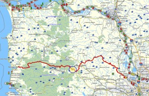
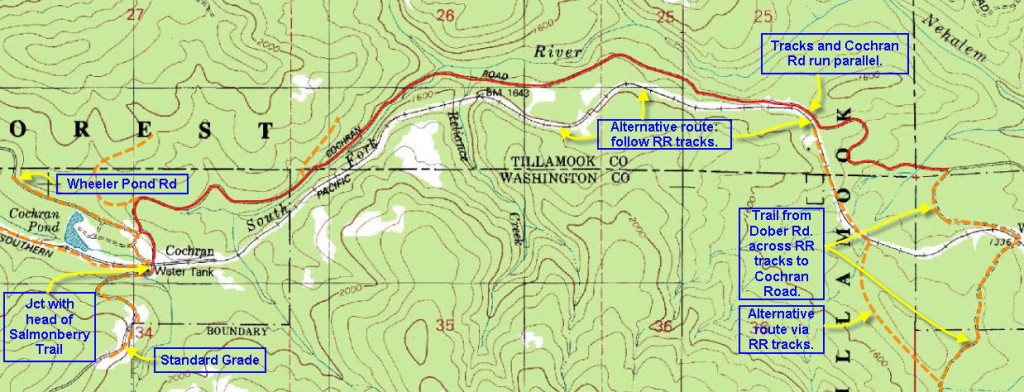
 Brief Description: This segment follows the dirt road leading from Timber to Cochran Pond, which can easily be navigated by car (my recommendation). Save your shoe leather for the Salmonberry corridor – one of the most impressive hikes in the Coast range! But if you insist, budget about one hour and 40 minutes to reach this remote pond.
Distance: 3.3 miles
Elevation Change: The trail segments begins at an elevation of 1360 ft. where the Round Top logging road debouches on to the Cochran Rd. And the segment ends at an elevation of 1775 ft. where the road crossed the RR tracks just to the east of Cochran Pond.
Walk duration: 1 hour 40 minutes
Travel time to trail head: 40.4 miles 56 minutes
Trail Log: Arriving at the Cochran road, turn left and follow the road south towards Cochran Pond. The road rises to 1612 where the RR comes alongside the road. The road gradually rises over the 3.3 miles to 1922 just above the Cochran Pond. This segment ends where it crosses the RR tracks at an elevation of 1862. The first Salmonberry segment begins here and follows the railroad west down into the Salmonberry gorge.


Hi there!
Love your website. Me and a friend are looking to ride our two horses to the coast from the valley. I have read many things about your travels and am looking for a trail (or route) to do the ride by fall of next year. Starting from around the PDX metro and landing anywhere along the coast is our desired start and stop. Any recommendations?
Ellen
Dear Jim,
Thank you for this great site and all the information. I grew up with my uncle taking us all around Cochran, the Salmonberry, the Beaver Slide road, Camp 9, etc. He passed recently and I would love to visit his favorite place: the mill ruins at Doty pond. Are you familiar with this area and best way to access? It’s been years and I’m across the country now, so I’m trying to gather as much intel as possible before heading back. One site traced a creek running down to the Cochran Rd. My only thought was to take a pack, follow the creek up to see. Any thoughts, intel, suggestions would be welcome.
Thanks again!
I was looking for information online regarding Doty Pond mill and came across this comment..
The mill remnants are still there.. Definitely hidden very well in the forest, but pretty easy hike
Anyway, I know this comment was from 7 years ago, but if you’d like a picture of the building and pond area let me know