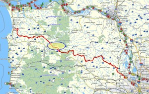
 Brief description:This trail is about two-thirds of the way to the coast, and is most easily accessed via the hamlet of Vinemaple located on Highway 103 (exit Hwy 26 at the Jewell Junction). This segment of the Northern Route brings us down to the lower Nehalem and is the final trail in the “Nehalem Valley” grouping.
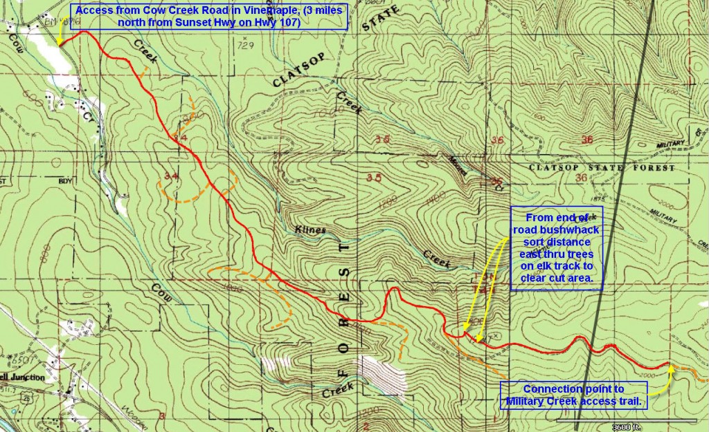
Travel time to trail head: 1 hour and two minutes from the Sylvan interchange on Highway 26, or 52.5 miles.
Elevation change: 1530 ft.
Trail Log:
This hike begins at the yellow gate on an unnamed logging road located near the top of Cow Creek road. Cow Creek road ascends eastwards into the hills from the small community of Vinemaple, which is located a couple of miles north of US 26 at the Elsie junction, about 40 miles from Portland.
This hike will connect with the trail described as the “Military Creek hike” that originates just a few miles west of the rest area on US 26. That trail skirted the side of Dog Thief Mountain and traversed the hills above the Quartz Creek watershed. Once it crested the shoulder of the heights, the route crossed the top of the Cow Creek and then began to traverse the northern flank of Cow Creek heading west towards Vinemaple. It ended abruptly just short of 5 miles into the hike as we had reached the limit of our range for a day-hike. This hike will connect with that trail to complete this portion of the “Northern Route” leading all the way to the banks of the Nehalem River, located a mile west of Vinemaple.
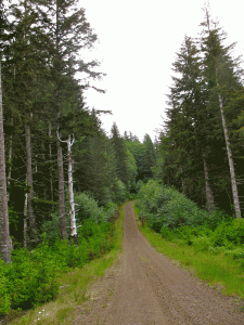
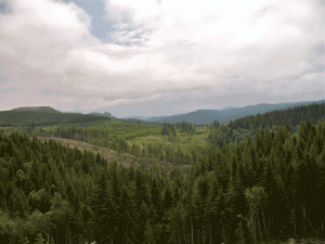
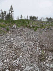
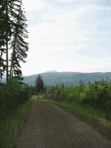
From the gate, the road heads in a northerly direction, but soon turns east as it begins a long and gradual climb up the Cow Creek Ridge (the northern flank of the Cow Creek watershed). Initially you pass through a series of clear cut and recently reforested areas. After 1.14 miles the trail passes out of the recently forested area into a stand of timber probably about 40 years old.
The area is rife with berries including the native trailing black berries, foxglove, thimble berries, and the occasional patch of salmonberries. There is evidence of much elk and deer traffic throughout this area. After a while, I realize that I am also looking at the dusty tracks of a bear ascending the road ahead of me.
Two and a half miles into the hike, at an elevation of 1600 ft., the road splits. The main road turns abruptly left and proceeds in a northerly direction and then continues the upward climb along the ridge. The other option continues straight and level, but eventually this branch ends further along the slope, as the ridge rises behind it.
At about 3.16 miles (elevation 1800 ft.) into the hike the road splits again. The left hand option appears to go continue climbing the ridge, while the right hand option begins to descend the northern flank of Cow Creek. This lower road eventually slips down the hillside and terminates just above the deep ravine down which Cow Creek runs. At that point you can see across to the hillside to the slope located below the Military Creek road. From the staging area at the end of this road you can look down into the uncut riparian area and hear Cow Creek, but the ravine is both deep and fully forested and thus impractical to cross.
So, it is advisable to take the left hand fork in this road and proceed upwards along the spine of the ridge. This somewhat older logging road proceeds up through a stand of timber and eventually curls northward to terminate almost exactly 3 miles into the hike. What now, you wonder? Well, this is the fun part where we bushwhack from one logging contract area to the next. This is an example of how logging roads are not designed to connect two distant locations; instead they are designed to provide access to a particular area, but they do not connect different area. We have arrived at the edge of a contractually distinct logging area and to reach the next logging are we will have to penetrate the woods to reach the furthest extent of the logging road network that serves the neighboring tract.
OK, so let’s orient ourselves. Follow the road east as far (uphill) as you can – the next tract is due east of our present location. Peer through the trees and try to discern the tree line at the other side of the uncut portion of trees. And look around you at the verge of the forest and find where the elk have been traversing this uncut area. I had no trouble spotting a well used elk “freeway” that cut into the underbrush heading east along the ridge. Follow that, or simply push directly into the undergrowth and walk about 50 yards east. At that point you will emerge onto a large clear cut area, and directly ahead of you will be a logging road that makes a curling switch-back loop about 50 yards further into the clear cut. Hurray, you’ve just made the jump from one logging tract to another – by bushwhacking through a small sliver of forest.
The road that you’re now facing was designed to serve the harvesting operation that clear the timber of this slope. Since you are approaching the road at the “elbow” of the switch-back you can either proceed lower across the slope, or higher across the slope. Choose the upper road (the lower road dead-ends further down the slope) and head further east traversing the clear cut.
At the east end of the clear cut, you will encounter a spur road on your left that proceeds up the slope – ignore that upper route (it dead ends near the top of the clear cut), but proceed straight ahead along the older road that passes through the stand of trees that separate this clear cut from the next clear cut further to the East on the flank of this hillside.
This road leads on traversing this long flank of the Cow Creek watershed until it eventually connects with Military Creek road at the head of Cow Creek. But on this walk we reached a point about five and a half miles from the start – an arbitrary location along this long road. Loki was exhausted and we’d been walking for three hours – just outward bound. So we faced a tiring return trip…
A week later I reached that same point by climbing the Military Creek road and walking the final portion of the northern flank of Cow Creek back to the turn-around point achieve on this day.
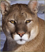 It was on my way down this long trek along Cow Creek, that I had one of my most intimate encounters with a mountain lion. Coming around the bend about two miles above the car, I spotted a large creature hovering around the edges of a large salmonberry patch – apparently nibbling on the ripe fruits. Loki was too tired to notice as he huffed and puffed exhaustedly. No more than 50 feet ahead of me was a large dark shape about the size of a calf, moving about at the side of the road. I was unsure at this distance whether it was a deer, a bear or an elk calf. But suddenly it dawned on me that it sported a long tail… I was looking at a mountain lion!
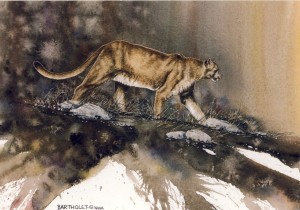 Seconds later the lion saw me standing in the distance and in one graceful leap he dove into the underbrush and vanished. This was indeed a special occasion since decades can pass without ever seeing a cat in the woods – and I haven’t seen one since!
At 4 PM I finally arrived back at the car – the entire hike, including the various side explorations down several dead-ends amounted to nearly 10 miles of walking. Without the diversions the hike was approximately 8.4 miles in length – and the upper portion was particularly beautiful and apparently replete with sufficient wild game to make the trip especially memorable!
Connecting to the next trail segment:
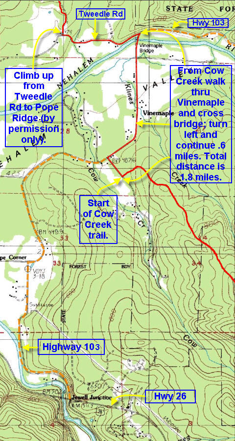
Explanation: To reach the next segment of the Northern Route you should walk/drive 1.8 miles from the base of the Cow Creek road, through Vinemaple and across the Vinemaple bridge. On the west side of the Nehalem River, turn left on to Tweedle Road and continue south for .6 miles.

I know this if off topic but I’m looking into starting my own blog
and was wondering what all is required to get setup?
I’m assuming having a blog like yours would cost
a pretty penny? I’m not very internet smart so I’m not 100% sure.
Any recommendations or advice would be greatly appreciated.
Kudos