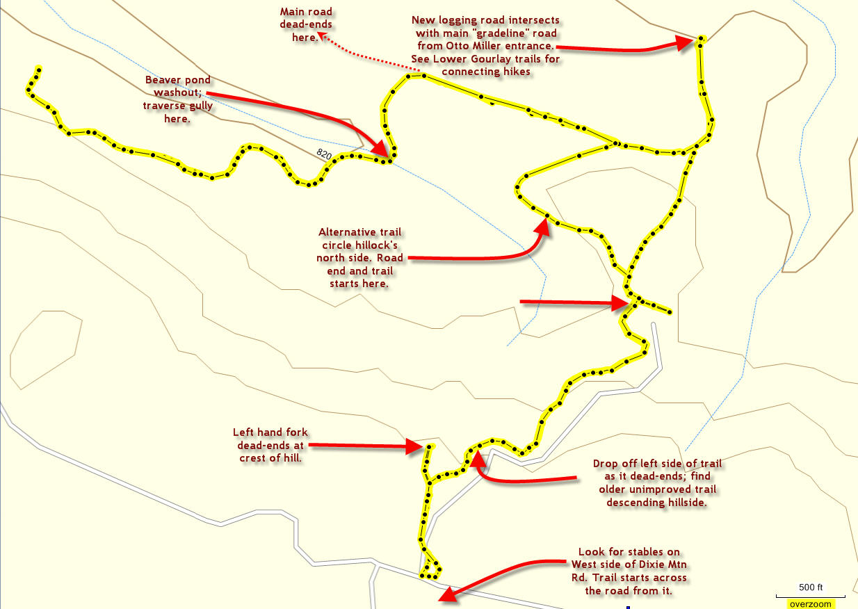
Distance: 4.5 miles
Walk duration: 2 hours 15 minutes
Travel time to trailhead: 40 minutes
Driving directions to the trailhead: Driving directions to the trailhead: From downtown Portland drive north on US 30 past Linnton, Burlington, the Cornelius Pass intersection, Logie Trail. Continue past the Wildwood Golf Course, and exit Highway 30 at Rocky Point Road. Drive up Rocky Point road to the intersection with Skyline Boulevard, and continue straight onto Dixie Road. This road will take you north around the low summit of Dixie Mountain. At 1.4 miles the paved road ends and splits. The left hand option is Dixie Mountain Road that heads into Washington County. Take the right hand option which confusingly is also called Dixie Mountain Road and proceed another .9 miles. At this point you will pass a stable on the left hand side of the road, immediately opposite is a newly built gravel road. Park close to this gravel road.
This is the trail head for the Bridle Trail.
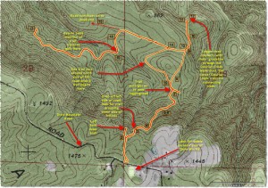 Includes key to numbered instructions below Elevation change: 533 feet
Conditions: older footpath descending hillside connects with graveled logging roads, includes some less traveled and intermittently washed out side roads traversing the hillside.
______________________________________________________
Bridle Trail description:
1. Park 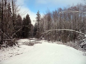 on Otto Miller Road just beyond the stable and before a driveway (on the west side of the road) and walk back to the gravel road heading eastward from the right side of the road. Prior to 2009, this trail had just been a muddy bridle trial heading off into trees and not easily spotted. But since 2009 the upper stretches of this property have been developed with a large gravel road that goes in about 1/8 of a mile to the crest of the hill. on Otto Miller Road just beyond the stable and before a driveway (on the west side of the road) and walk back to the gravel road heading eastward from the right side of the road. Prior to 2009, this trail had just been a muddy bridle trial heading off into trees and not easily spotted. But since 2009 the upper stretches of this property have been developed with a large gravel road that goes in about 1/8 of a mile to the crest of the hill.
2. At this point the road splits into two. The left hand branch goes straight out onto a point and ends abruptly. The right hand fork goes heads south around the bend until it dead-ends about 500 yards further along. It is possible that these roads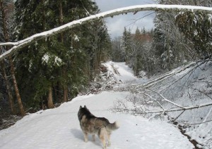 are the precursor for the logging roads that will soon contribute to the harvesting of the timber on this slope. are the precursor for the logging roads that will soon contribute to the harvesting of the timber on this slope.
3. For our purposes we will take the right hand fork of the split. As you approach the end of the right hand fork, drop of the road on the left hand side (eastern side) and you will see that there’s an old clearing right below the gravel road as it enters its final 100 feet. In the picture (on the left side of this page) note the position of the dog. From where he is standing turn left and drop off the road and circle behind the pile of debris. 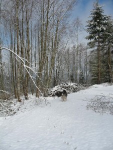 Emerge into a small clearing below the gravel road. On the left side of that clearing and near the crest of the hill you will see that there’s an old trail dropping down the side of the hill. You may note evidence of ATV use giving the track a double rutted appearance. Follow that little trail down the hill. This trail traverses the hillside on its way downwards, heading south. It’s a bit overgrown with alders but still clearly visible. It’s not used much so the track is littered with natural debris. This trail was used by the stable, but I’m not sure it is still in use since the road was built. It is not clear whether these new changes will impact access to this area, but for the time being it’s still accessible. Emerge into a small clearing below the gravel road. On the left side of that clearing and near the crest of the hill you will see that there’s an old trail dropping down the side of the hill. You may note evidence of ATV use giving the track a double rutted appearance. Follow that little trail down the hill. This trail traverses the hillside on its way downwards, heading south. It’s a bit overgrown with alders but still clearly visible. It’s not used much so the track is littered with natural debris. This trail was used by the stable, but I’m not sure it is still in use since the road was built. It is not clear whether these new changes will impact access to this area, but for the time being it’s still accessible.
4. The road continues on down. 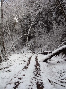 Along the way there are blue and orange tags on the trees which probably mark the bottom of the farm property situated on the crest of the hill. There appears to have been some traffic since branches have been broken off from time to time. It appears that there may still be some horses moving up and down this track. During hunting season and in the summer I’ve observed ATV tracks on this stretch as well. Along the way there are blue and orange tags on the trees which probably mark the bottom of the farm property situated on the crest of the hill. There appears to have been some traffic since branches have been broken off from time to time. It appears that there may still be some horses moving up and down this track. During hunting season and in the summer I’ve observed ATV tracks on this stretch as well.
5. At about .45 miles we have now dropped down to an elevation of 1095 and are passing between a series of logs that fell some time ago and into which a passage has been cut that will just just accommodate an ATV vehicle.
6. The vegetation in this area is mainly sword ferns, alders, broad leaf maple and a fair amount of cedar and vine maple. There are also some 30 year old hemlock trees. This area was probably a private wood lot area and was not reforested when it was cut resulting in a scarcity of conifers. Those that I do see here look like volunteers.
7. At .95 miles we’re at 1000 feet. The road turns here to the northeast. We enter into more of a conifer forest, passing through a glade that has become overgrown with alders and sword ferns. To the south of the trial there are more hemlock trees and broadleaf maples amidst a carpet of sword ferns. Originally the trail passed through a large grove of alders that straddled the crest of this ridge, but now a logging access road has been built along this saddle and the alder grove is partially obliterated by the big gravel road. The logging road dead-ends near 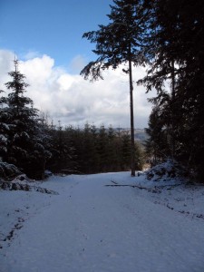 where our trail emerges from the alder grove. The end of the logging road (100 feet to our right upon exiting the alders) overlooks a steep ravine to the south with lots of cedars in sight. Immediately at the end of the trail is a tree with very visible marks of a pileated woodpecker. where our trail emerges from the alder grove. The end of the logging road (100 feet to our right upon exiting the alders) overlooks a steep ravine to the south with lots of cedars in sight. Immediately at the end of the trail is a tree with very visible marks of a pileated woodpecker.
8. If you look carefully on the north side of the new logging road about 50 feet east (left) of where the alder trail debouched onto this new logging road, you may see the remnant of the original trail through this alder grove. It strikes off to the north of the new road to circle the north side of s a small knoll before connecting with another existing logging road. But we will return by this route, so if you cannot espy the trail, don’t worry. It’s much easier to find from the other end.
9. Following the new logging road you will find that it ascends around the south side of a knoll. A side spur heads directly south ending about 500 yards around the bend. Following the main track around the knoll you’ll find that (at 1.1 mile measured from trailhead) the road intersects with another older logging road heading west southwest (it comes in from the left). This is the original trail into this area and terminates on the north side of the aforementioned knoll, from which a small trail connect back to the alder grove which has now been cleared for the new road.
10. Now the road leads out to the main line road that serves all the logging on Gourlay Creek. As one approaches this main road one can see the new timber harvesting that has occurred. 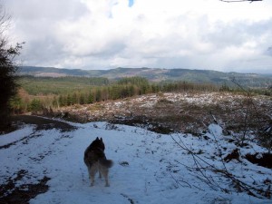 As I pass through this area, I can observe at least 20 to 40 downed Western Hemlock and Douglas fir trees; most are about 120 feet tall and 40 to 50 years old. As I pass through this area, I can observe at least 20 to 40 downed Western Hemlock and Douglas fir trees; most are about 120 feet tall and 40 to 50 years old.
11. At the “grade line”, as the central ingress and egress routes are frequently referred, a sign proclaims that there is active logging ahead. As I am walking along this route on a Sunday, and I can hear no sounds of trucks or buzz saws, I feel reasonable safe. But if there were indeed active logging going on I would strongly advise the walker to retreat from the area, as timber harvesting is not a spectator sport that can be practiced without incurring some danger of being hit by falling trees, limbs, or being struck by very fast moving and fully loaded log trucks. Anyone familiar with the way log truck driver drive on these roads knows to give them a wide berth. They drive like they own the road – which indeed they do!
12. The point of intersection with the “grade line” is what I have referred to as the “green box gate”, because at this point there is a green gate whose lock is housed in a large metal box, also painted a vivid pea green color. This gate is 2.75 miles from the entrance to the lower Gourlay road on lower Otto Miller Road. If you follow this road to the right (past the green lock box) you will be able to explore the southernmost reaches of this Gourlay Creek and Raymond Creek watershed area.
  I recommend, if you have time and are inclined, following this road about two miles further to a point where you can get a fabulous view of the upper Raymond Creek watershed and the eastern slope of Dixie Mountain. This is a very remote area inaccessible from most other directions. I’ve bushwhacked through from the Vedanta Ridge to the South, and climbed up from the bottom of Raymond Creek to the East, and descended from Dixie Mountain in the West and they’re all gnarly scrambles! I recommend, if you have time and are inclined, following this road about two miles further to a point where you can get a fabulous view of the upper Raymond Creek watershed and the eastern slope of Dixie Mountain. This is a very remote area inaccessible from most other directions. I’ve bushwhacked through from the Vedanta Ridge to the South, and climbed up from the bottom of Raymond Creek to the East, and descended from Dixie Mountain in the West and they’re all gnarly scrambles!
 At this ridge line, the road splits. To the right the route turns uphill; to the left it follows the ridge line and eventually curves back and also heads southwards along a tributary of Raymond creek. This is the route to follow if you want to get to the end of the road on a logged off hill overlooking Raymond Creek – and right across from the Vedanta ridge described in the Jackson Creek hike. It is also possible to bushwhack from the end of the road westwards into a privately held forest on the eastern slope of Dixie Mountain. A road down this slope will eventually get you back up to Otto Miller road at the point where it crosses the county line. But it is suggested that you get permission before traversing this private land. At this ridge line, the road splits. To the right the route turns uphill; to the left it follows the ridge line and eventually curves back and also heads southwards along a tributary of Raymond creek. This is the route to follow if you want to get to the end of the road on a logged off hill overlooking Raymond Creek – and right across from the Vedanta ridge described in the Jackson Creek hike. It is also possible to bushwhack from the end of the road westwards into a privately held forest on the eastern slope of Dixie Mountain. A road down this slope will eventually get you back up to Otto Miller road at the point where it crosses the county line. But it is suggested that you get permission before traversing this private land.
Rather than going the extra two miles to the end of the road, you may instead opt for the right hand road that ascends the slope. If you follow this road upwards for about a quarter mile, you’ll come out on to the upper reaches of the Raymond Creek watershed. The road continues up the slope further before petering out altogether, but I suggest taking the first left hand spur which leads out onto a ridge. Here you can get a spectacular view of this remote area. Across from you is the recently logged-off hill top that marks the end of the grade line road. 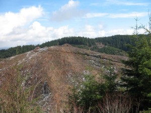 Beyond it is the ridge where the Vedanta Society has built its retreat with its many quaint shrines. Above you to the southwest is the slope of Dixie Mountain. And to the north of you stretches a panoramic view up the South Scappoose Valley culminating in Dutch canyon and above it: Buck Mountain. Away to the north you can see the Columbia and the soda ash loading facilities in Kalama, Washington. It’s a pretty remote spot and beautiful as well. Had you walked in from Otto Miller road it would have Beyond it is the ridge where the Vedanta Society has built its retreat with its many quaint shrines. Above you to the southwest is the slope of Dixie Mountain. And to the north of you stretches a panoramic view up the South Scappoose Valley culminating in Dutch canyon and above it: Buck Mountain. Away to the north you can see the Columbia and the soda ash loading facilities in Kalama, Washington. It’s a pretty remote spot and beautiful as well. Had you walked in from Otto Miller road it would have 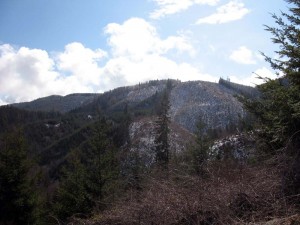 been about six miles just to get there, but this route provides much easier access. When you’re ready let’s retrace our steps down to the grade line that we left at the ridge line intersection. Turn left to circle through the “finch dell” and return to the green box. Now we’re back to the road that came down from the alder grove. been about six miles just to get there, but this route provides much easier access. When you’re ready let’s retrace our steps down to the grade line that we left at the ridge line intersection. Turn left to circle through the “finch dell” and return to the green box. Now we’re back to the road that came down from the alder grove.
13. On returning up this side  road that eventually passes through the alder grove, I have detoured on to the trail that connects with it from the north. This older trail is less used and its surface is covered in moss. On either side is new dense spruce growth about 15 to 20 years old. It is very remote and beautiful. The roadside is abundant with mushrooms, including black headed and convoluted elfin saddle, and lttle funnel shaped rufus fuzzyfoot (Xeromphalia Fraxinophila), puffballs, and clustered Psathyrella growing on wood remains. Another common variety spotted in this region is the Hebeloma Crustuliniforme, or “Poison Pie” in the vernacular. It looks substantial and blondley attractive, but make no mistake this shapely shroom will do you in! See the picture below. road that eventually passes through the alder grove, I have detoured on to the trail that connects with it from the north. This older trail is less used and its surface is covered in moss. On either side is new dense spruce growth about 15 to 20 years old. It is very remote and beautiful. The roadside is abundant with mushrooms, including black headed and convoluted elfin saddle, and lttle funnel shaped rufus fuzzyfoot (Xeromphalia Fraxinophila), puffballs, and clustered Psathyrella growing on wood remains. Another common variety spotted in this region is the Hebeloma Crustuliniforme, or “Poison Pie” in the vernacular. It looks substantial and blondley attractive, but make no mistake this shapely shroom will do you in! See the picture below.
14. Some distance up this road, it splits with the left hand track 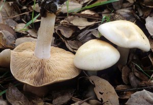 continuing on around the knoll. I suggest you follow the right hand track which heads gently downwards through a young spruce forest. If you follow this route for another mile you will encounter another side trail on the left side, which we will take. continuing on around the knoll. I suggest you follow the right hand track which heads gently downwards through a young spruce forest. If you follow this route for another mile you will encounter another side trail on the left side, which we will take.
15. The main track going directly forward ends a short distance further among a dense stand of young trees.
16. The side track we’ve chosen heads northwards following the side of the slope until it eventually comes to a break in the road over looking an idyllic beaver pond with some tall timber on the uphill side of it. Here the road was apparently swept away as a consequence of the beaver pond built upstream of the road. Now you may begin to understand why foresters try to control the activities of these creatures since they cause great damage to the logging roads and require very expensive repairs. The washout will require you to clamber down to the stream before scaling the far side of the ravine to reach the farther remnant of the road.
17. That road continues along the side of the hill for another 2 miles before coming to a dead-end at the northern edge of the property. In places the old track has almost washed away, 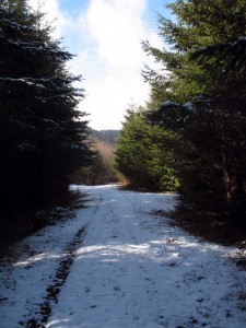 but it’s still possible to follow it to the end. The promontory upon which this trail ends probably abuts the property belonging to the Dixie Mountain Ranch which is located above this portion of the hillside, but no connection exists to any of the access roads from the Dixie Mountain Ranch. The slope is very steep all around the end of this road and covered in very dense vegetation. Believe me, I tried to penetrate further but gave up within 100 yards of the promontory upon which this trail ends. but it’s still possible to follow it to the end. The promontory upon which this trail ends probably abuts the property belonging to the Dixie Mountain Ranch which is located above this portion of the hillside, but no connection exists to any of the access roads from the Dixie Mountain Ranch. The slope is very steep all around the end of this road and covered in very dense vegetation. Believe me, I tried to penetrate further but gave up within 100 yards of the promontory upon which this trail ends.
18. Heading back we continue past the beaver pond wash-out and turn right when we reach the road through the young spruce forest. Following this back we eventually reach the older moss-covered road that we traversed on our way in. At this intersection with the moss-covered road we will turn right instead of taking a left turn which would lead us back to the new logging 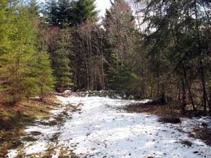 road we used on the way in. This infrequently used road threads through the young forest and circles the north side of a small hillock. After a tenth of a mile, the road curves southwards around the western face of the hill. The road ends anther tenth of a mile beyond this turn. But don’t despair! A trail leads past the end of the road and cutting along the western face of the hill it emerges on to the logging road we originally encountered on our way into this area. road we used on the way in. This infrequently used road threads through the young forest and circles the north side of a small hillock. After a tenth of a mile, the road curves southwards around the western face of the hill. The road ends anther tenth of a mile beyond this turn. But don’t despair! A trail leads past the end of the road and cutting along the western face of the hill it emerges on to the logging road we originally encountered on our way into this area.
19. As you emerge on to the great gravel and rock foundation of this logging road, you will be mere yards from the point where our original trail (coming down the hill) debouched from the trees. Find this trail again and continue to backtrack , eventually ascending the hillside all the way to Dixie Mountain Rd. |
 Brief summary: This trail is a strategic access route for the southern end of the Gourlay Creek watershed. The trail itself is an infrequently used track descending the hillside and connecting with a new network of logging roads on the plateau’s below. Mostly the scenery is mixed medium aged timber, but quite remote because access from any other direction is at least 2.5 miles away. This route can be used to reach the base of Dixie Mountain or the point on the headwaters of Raymond Creek where the bushwhack route from Vedanta Ridge emerges.


 At this ridge line, the road splits. To the right the route turns uphill; to the left it follows the ridge line and eventually curves back and also heads southwards along a tributary of Raymond creek. This is the route to follow if you want to get to the end of the road on a logged off hill overlooking Raymond Creek – and right across from the Vedanta ridge described in the Jackson Creek hike. It is also possible to bushwhack from the end of the road westwards into a privately held forest on the eastern slope of Dixie Mountain. A road down this slope will eventually get you back up to Otto Miller road at the point where it crosses the county line. But it is suggested that you get permission before traversing this private land.

 road that eventually passes through the alder grove, I have detoured on to the trail that connects with it from the north. This older trail is less used and its surface is covered in moss. On either side is new dense spruce growth about 15 to 20 years old. It is very remote and beautiful. The roadside is abundant with mushrooms, including black headed and convoluted elfin saddle, and lttle funnel shaped rufus fuzzyfoot (Xeromphalia Fraxinophila), puffballs, and clustered Psathyrella growing on wood remains. Another common variety spotted in this region is the Hebeloma Crustuliniforme, or “Poison Pie” in the vernacular. It looks substantial and blondley attractive, but make no mistake this shapely shroom will do you in! See the picture below.


We lost our dog today off of Dixie Mountain Road. Any possibility of getting help trying to figure out which way he might have gone? He is a husky with Id and reward. Thank you
Chris, I own (and have previously owned several) a husky. I typically will leash her when we get into areas with deer and elk, because they just go nuts and bolt until they can’t find their way back. I typically will not let mine off the leash until they’re already tired and/or the slope is so steep they get exhausted trying to get through the understory.
When mine bolts (occasionally), I just hunker down in the place where I last saw them. I call “come” occasionally, but not incessantly. Sometimes i just sit without making noise so I can hear the dog going through the brush in the distance. If they can hear you they may just continue onwards knowing that you’re going to be where you voice is coming from. If you reduce the number of calls to one or two every few minutes, they’ll pause and return because they not sure where you are anymore. Constant calling is a license to keep running from their perspective.
I would post signs along Dixie Mountain Road. If he went west from Dixie Mtn road I might also post a sign on Ridge Rd (accessible by driving up Pumpkin Ridge in Washington County). Otherwise also post signs at the three blue gates that provide access to the Gourlay Creek hikes (entrances on Otto Miller road) that traverse the slope further down on the eastern flank. If the dog went missing where the road is still paved consider knocking on a few doors, and/or posting a note at the top of Gilkison Rd (above Scappoose). Also call the Columbia County Pound.
I also recommend training your dog with an electric collar. yea, I know it sounds cruel, but it works. Once you get them convinced that you have such bad ju-ju that it can zap them from a distance they will think twice about ignoring your frantic calls. If you train them properly with the collar you can reduce the stimulus down to a gently vibration, and only reinforce the training with a once-a-month reminder session. It worked for my dog. I haven’t reinforced this in some time, so if she does bolt these days I just sit down near where she disappeared. I eat a snack, read a book and occasionally call. inevitably she reappears – you can call again when you hear the dog approaching through the underbrush. If you’re not yelling yourself, it’s amazing how far you can hear an animal pushing through the brush. Jim