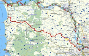
 Brief summary: This trail joins two idyllic forest roads by means of a bushwhack that climbs a scenic ridge. As the name of this trail suggests there is much wildlife in this area of the Gourlay Creek watershed, due to the abundance of streams and the thick forest that shield the animals. While the hike is only a little more than 3 miles the bushwhack climbs 170 feet in .15 miles and the last portion of that bushwhack is pretty much straight up the side of the slope. Really, it isn’t that difficult, especially since the length of the bushwhack is so short.
Walk duration: 2 hours 30 minutes
Travel time to trail head: 45 minutes
Driving directions to the trail head: From downtown Portland drive north on US 30 to Scappoose. Turn left opposite the gas station on Bonneville Drive and then an immediate right on to Old Portland Road that parallels US 30 passing behind Scappoose. Turn left on Dutch Canyon Road, and follow this gradually west entering into the South Scappoose Creek valley. Follow this road all the way back to the bridge near the very end of the Dutch Canyon Road. Cross the bridge and immediately after the pavement ends. Follow this dirt road upwards for .43 miles and pull off and park at the blue gate on the left hand side of the road.
Elevation change: 415 ft elevation at the intersection with Otto Miller Road. 983 ft elevation at the top of the bushwhack; total of 702 ft climb.
Conditions: Mostly graveled logging roads, some older forest roads with possible muddy patches. One steep but short bushwhack up a ridge line.
Brief summary: This trail joins two idyllic forest roads by means of a bushwhack that climbs a scenic ridge. As the name of this trail suggests there is much wildlife in this area of the Gourlay Creek watershed, due to the abundance of streams and the thick forest that shield the animals. While the hike is only a little more than 3 miles the bushwhack climbs 170 feet in .15 miles and the last portion of that bushwhack is pretty much straight up the side of the slope. Really, it isn’t that difficult, especially since the length of the bushwhack is so short.
Trail Description: This is a short but challenging hike that joins two lovely forest roads that penetrate into 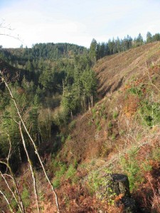 some of the deepest folds in the Gourlay Creek watershed. The are is full of game as the roads are surrounded by dense forest. Below you Gourlay Creek carves out a deep ravine that splits into separate creeks which carve up the slopes into a confluence of ridges and narrow ravines.
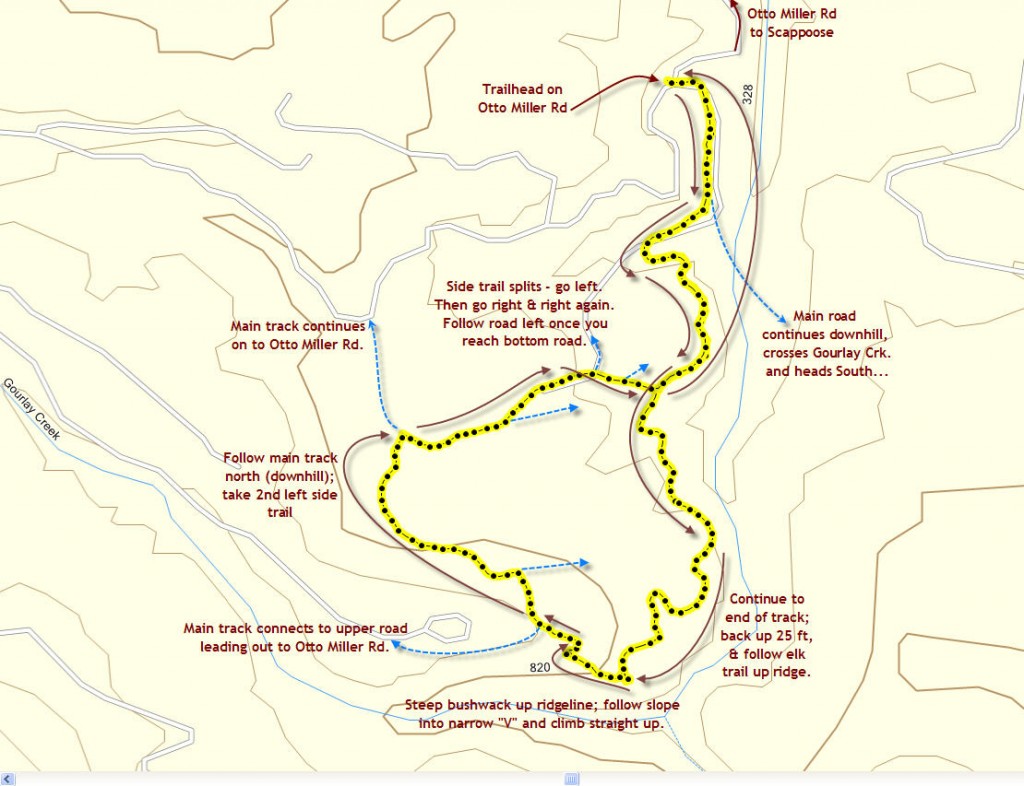
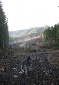 We start at the blue gate that leads into the Grade-line road that serves the Gourlay Watershed area. this is the same entrance for the Gourlay Creek Main Trail and for the Gourlay Creek Lower Trail. The elevation of the gate is at about 434 ft in elevation. The trail descends from the gate and we follow this road for .2 miles to where the main road descends down to the creek. Instead of following the main route down to the bridge we turn right and follow the winding road uphill paralleling the creek. This uphill stretch winds along the slope for 1.2 miles where the road ends on a point overlooking the confluence of three narrow creeks. About half way to this point, you will pass a side trail that descends to meet the road your on from the hillside above your right side. This is where you will rejoin the road upon your eventual return.
If your hound is inclined to harass the game, I would recommend keeping them on the leash. My Siberian Husky, Loki, sustained a serious injury when he was kicked by an elk whom he tried to molest in the woods above t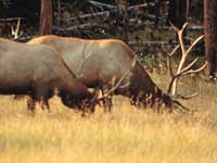 his track. To this day, Loki carries a substantial divot in his left haunch and he no longer chases large quadrupeds!
The view from the end of this road is lovely to my eyes as it spreads out over an expanse of wild and nearly impenetrable ravines and steep ridges that tumble down the slope below your feet.
The photograph of the steep slope with the stump in the foreground shows the ridge that you will ascend during the bushwhack. At the end of that ascent you will be located at the top right corner of the photo where the trees crown the ridge line – about 170 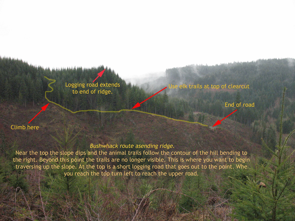 feet above your current position.
To begin this ascent retrace your steps back from the point to a place where the uphill side of the road shows traces of animal trails that mount the embankment. Find the largest or easiest to climb and clamber up the embankment into the thick Salal and Oregon grape bushes that grace the hillside. Take a moment to take in your surroundings. As you look uphill you will not that you are standing astride a ridge line. To your left the clear cut slope drops off (see picture above), while the hillside to your right is forested. You will want to climb straight up staying just inside the clear cut area, but at the top of the lateral slope on your left. Hug the tree line as you climb upwards. Most of the way you will be able to benefit from many crisscrossing elk trails demonstrating that these huge beasts also appreciate this ridge as a convenient ascent.
The entire bushwhack is no longer than about 200 yards. The first 100 yards you can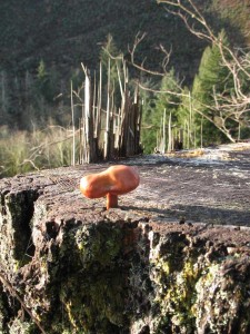 follow elk trails along the top of the slope. Then the slope curves inward and the trails enter into the tree cover. Follow these trails in to the back of the slight fold in the side of the hill – not quite 75 yards. From there it’s only 25 yards of climbing to reach the logging road at the top of the ridge.
The last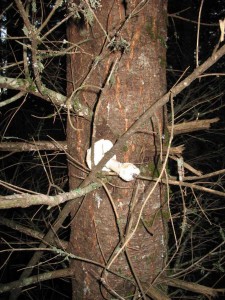 piece is a scramble up between the conifer trees and suddenly you pop out on a short logging spur that terminates at the end of the ridge you’ve just climbed. This is the highest point on the hike – at 983 ft in elevation. And you’ve walked about 1.5 miles.
As you have by now figured out, I’m a bit of mushroom enthusiast. Actually, I enjoy identifying the myriad species as much as I like eating them. Actually, I’m quite persnickety about what I pick – mostly Chanterelles and Matsutake and occasionally some Slippery Jacks or other Boletes.
The mushroom growing directly out of the stump is a Gymnopilus Liquiritiae. This is a typical lignicolous mushroom, or a wood rooting mushroom. This species is said to be bitter tasting. Others in this family contain psilocybin and psylocin both toxic substances; the former also being hallucinogenic. I generally stay away from all ligniculous mushrooms, with the exception of the Honey mushroom (Armillaria mellea).
During my latest visit to the Elk Kick loop, during the fall of 2008, I was surprised to find numerous mushrooms stashed in the tree branches of the young conifers growing at the top of this ridge (see picture above). At first I was utterly mystified as to why anyone would pick these mushrooms (mostly Russulas) and then leave them tucked into the tree branches? But then I recalled recently seeing a squirrel scampering up a tree with a mushroom not far from my home in Portland. So apparently this was a mushroom loving squirrel that was stashing his treats to dry among the branches. I have observed this behavior in several locations. So I guess I’m not the only one who’s nuts about his shrooms!
Once having reached the trail at the top of the 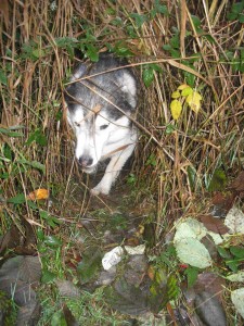 ridge, we turn left and follow this short spur out to where it joins the main access road for this area – the middle road leading into the Gourlay Creek watershed. This logging road road sweeps past this short spur as it descends the slope and heads northward to Otto Miller rd.
It is possible to follow the road uphill; eventually the road will lead you out to Otto Miller road in the sharp curve between the two house that sit on the top of the ridge. On this walk however, we will walk downhill following the road to the right. Another .10 of a mile brings us to the next intersection that has two roads leading out to the right. This spur road leads out to a ridge end that once supported the equipment to extract the timber. Today, it’s just a quiet dead-end situated at the end of point.
Another quarter of a mile descending to an elevation of 814 feet will bring you to an upland pond with some evidence of beavers. The beavers had taken note of our arrival and had departed, but Loki, burly though he is, loves dashing down the narrow trails that the beavers maintain all around the pond.
Another .10 of a mile brings us to the next intersection at an elevation of 833 feet. Here we will depart from the main road and turn right.
It is possible to continue on this road to Otto Miller road and then descend to the car that was left at the entrance of the main Gourlay trail, but in this hike, we will descend down a parallel route that returns us to the main Gourlay Creek road (grade-line) so that we don’t have to cope with the minimal traffic that uses Otto Miller road.
Turning right at this intersection (2.07 miles into our hike) we proceed down a wide ridge top road that had been cleared of trees on either side. All around the slope is heavily forested. We follow the ridge top road for a short distance  (.07 miles) and choose the left hand fork as the trail splits. This more recently built road descends the north side of the ridge we were straddling. Exactly a quarter of a mile down this track we will encounter the next intersection. To the right a road will veer northwards, but it quickly dead-ends, although older maps indicate that this route will also penetrate down to the Main Gourlay access road.
We will stay left and follow the road as it descends more steeply. Shortly thereafter another short spur road diverges from the left, but again we stay right. Minutes later we will emerge on the side trail that we took to ascend above Gourlay creek to the point where we began our bushwhack. We have now returned to an elevation of 547, and we’ve completed 2.5 miles of the hike.
From here we simply follow the road to the left and descend to the “grade-line” road that drops to 407 feet in elevation before climbing up to the blue gate at 434 feet in elevation , and 3.17 miles in the round trip hike.

Hey, I checked this hike out this last weekend and enjoyed it. I appreciate your project and all the work you have put into it!
Well, I pleased you found the bushwhack up the hillside to the upper trail, and that neither you nor any of your four footed companions (?) got into a fracas with the elk or deer, as mine did. My dog Loki, went to the rescue of his younger, and somewhat dimwitted friend, Buddy the lab, and got kicked by an elk for his efforts. He never really recovered from that battle, though he did live to the age of 12, which is respectable for a Siberian Husky. He never tried to tangle with big quadrupeds after that.
Jim
Hey there, You have done an excellent job. I will certainly digg it and for my part suggest to my friends. I’m sure they will be benefited from this web site.