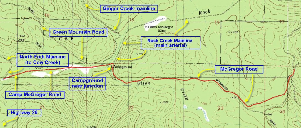
This short trail serves to connect the western end of the East-side Gradeline with the Rock Creek Mainline – an important watershed that provides access into these mountains along the “northern route”.
Walk duration: about 1 hour climbing up the western end of McGregor Road (aka Olson Cut-off road) and then via the lower (less traveled) Olson Road to the intersection with Nofo Road and the East-side Grade. There is one short bush-whack as you have to bypass a giant pile of wood blocking the Olson Road near its terminus at the Rock Creek Mainline.
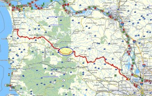
Travel time to trail head: This hike can be approached from both ends. The eastern terminus is at the intersection of McGregor Road and Nofo Road, high on a ridge above US 26. The western end is on the Rock Creek Mainline road. Since the Rock Creek Mainline is often closed I have provided information on getting to either end of this trek.
Eastern terminus: Travel 36.2 miles on the Sunset Highway (from the Sylvan exit) to the entrance of the N. Wolf Creek Road. Travel up that dirt road for 2.9 miles being careful to stay on the main track (use a map) until you reach the intersection with Nofo Road – heading up on your right hand side. Follow Nofo Road for 3.4 miles – over a ridge summit and follow it down to the intersection with McGregor Road and the lower Olson cut-off road.
Western Terminus: Travel 42.7 miles on the Sunset Highway (from the Sylvan exit) to the entrance of the Rock Creek Mainline (immediately past the Sunset Rest area). If the gate is open proceed up that road for 3.9 miles to the intersection with Olson Rd. Park there and walk up Olson Road.
Elevation change: 300 ft elevation gain/drop – from 1200 ft at the Rock Creek Mainline to 1500 ft at the intersection with Nofo Road.
Trail Log: (starting at the Nofo Road/Olson Rd/McGregor Rd (aka Eastside Grade) junction and descending to the Rock Creek Mainline road). Looking south at this ridge line clearing, we see three roads diverge. The left option (Nofo Road – presumably a contraction of “North Fork Wolf Creek”) heads up the side of the ridge in a southerly direction. The middle road (McGregor Road) heads in a southwesterly direction and traverses the northern face of the ridge ahead of us. The right hand fork dips slightly and follow the same direction as the McGregor Road – only about 100 feet lower down the slope.
We will take the Olson road since it’s less traveled and links into the Olson Road Cut-off that we want to descend. This initial section of the Olson Road is about .7 miles long. If you’re making this passage in the winter and you find the lower trail snowed in, you can easily use the upper (McGregor Road) road as it also intersects with the Olson Cut-off road.
At the intersection with the Olson Cut-off road (regardless of whether you took the upper or lower route) turn right and follow the Olson Cut-off Road along a pleasant and fairly flat ridge line as it heads gradually down towards the Rock Creek basin. There is much wildlife in this area and I almost always spot some game in these woods. The road continues down the ridge line for 1.7 miles. Through the “commercially thinned” forest on your left you can spot a series of small ponds that cascade down Olson Creek – which might account for the prevalence of deer in the area. About 1.6 miles down the road, fallen timber prevents further vehicular progress, but on foot it’s no problem. But you will presently be blocked by a huge pile of wood detritus – about 20 feet tall.
But fear not intrepid hiker for there is a perfectly serviceable elk detour that climbs up the slope on your right and crosses over the obstacle. The road on the other side is flat and walkable, only partially obstructed by Scotch Broom. A tenth of mile further along this road connects with the Rock Creek mainline. If you have to walk out to US 26 from this point – it’s only 3.9 miles. The connection to the start of the next leg of the “northern route” is even shorter – only 1.2 miles west down the Rock Creek Mainline to the beginning of the North Fork Mainline that ascends Dogthief Mountain.


