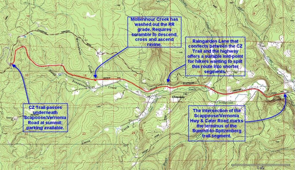
 Distance: 5.36 miles (one way)
Walk duration: 2 hours 30 minutes (Riding bikes from the Summit to Spitzenberg Jct. is highly recommended!)
Travel time to trail head: 50 minutes (32 miles)
Elevation change: Drops from 1220 ft in elevation at the summit to 540 feet in elevation at the Spitzenberg jct. Total drop is 680 ft in elevation.
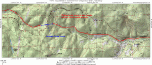
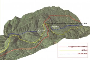
Brief summary:This trail descends from the summit of the Scappoose/Vernonia highway to Spitzenberg junction. The “Crown Zellerbach Trail” parallels the route but away from the main highway traveling through coniferous woods with views of thickly forested hills and some bucolic farmlands lower down.
Trail Log:
The best way to cover this trail is to start at the Summit and walk (ride) back towards the Spitzenberg Junction (5.36 miles), or to Raingarden Lane (3.3 miles) 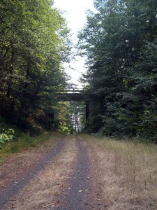 if you want to do a shorter version.
To get to the summit follow the Scappoose to Vernonia Highway from Highway 30 for 11.4 miles (about 20 minutes) to where it starts to drop down into the Nehalem Valley. You can recognize the junction, because you will pass over a short wooden bridge before coming to a wide junction with a dirt road that heads straight south and up towards Tater Mountain. The main road bends to the right and then starts to descend. Park anywhere along the verge of this big clearing. To the north side of the junction, you’ll see a big pile of rocks designed to prevent ATV’s from entering the CZ Trail.
 When you’re all laced up or saddled up on whatever steed you’ve chosen – head around the big pile of rocks and follow the short ramp down to the CZ Trail, which actually passes under the wooden bridge you just crossed (see nearby picture). If you want to head towards Vernonia turn left, otherwise we’ll be going right and eastwards on this hike. My favorite way to do this trail is to ride my bike down this segment – all the way to the Spitzenberg junction, and beyond to Scappoose if you desire.
Originally, this route was developed to haul lumber out of the North Scappoose Creek valley and the Nehalem Valley just on the far side of the summit.
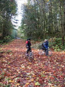
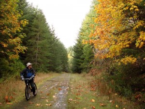 The initial few miles pass through a nearly mature forest of Western hemlock, Douglas fir and Big-Leaf maples. Riding this trail in late October is a real treat as the brilliant yellow of the Big-Leaf maples is utterly stunning – especially in the crisp fall air!
About 1.9 miles down the slope the trail crosses Mollenhour Creek. I am delighted to report that the county has replaced the culvert that was previously washed out and necessitated carrying one’s bike down to the creek and up the other size. Now there is a gentle dip in the road that carries one right over the creek and up to the original grade on the downhill side.
Another .7 miles beyond Moellenhour Creek, we will encounter a farm to our left that borders the trail on its uphill side. This farm has Llamas guarding the goats and other beasts that stroll along this hillside pasture.
The road now parallels a narrow valley that has homes and farms situated along the way for the next .5 miles where we circumnavigate a yellow gate and emerge on Raingarden Road that serves a cluster of homes 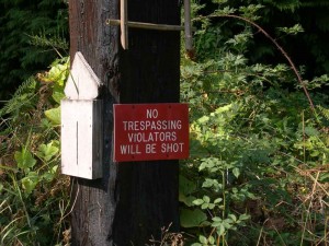 – not all of whom are enthused by the prospect of hikers and bikers invading their rural bliss. This location is also another pick-up/ drop-off point for those wanting to just walk the upper 3.3 mils of the trail.
Some of the automotive detritus in the underbrush is worth noting – such as the home delivery milk truck slowly melting away in the scotch broom thickets.
At this point in the trail the main gravel road is blocked by two gates and a sign that conspicuously notifies you not to trespass. 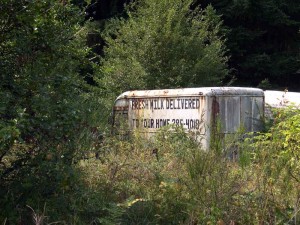 When on foot I have walked along the north side of the road to bypass this seemingly private stretch of road (about 500 feet in length), but on bicycle it’s hard to avoid the road and I have simply hauled my bike over the low gate and proceeded onwards whilst casting furtive glances at the homes situated nearby. But fortunately this interruption is short as the second gate marks the further boundary of the disputed trail section.
Beyond this short stretch of unresolved trail development the track continues onwards for about .7 miles to where it reaches the intersection with the Chapman road that leads to the original logging community in this valley. In this stretch, two creeks flow down off the slopes of Tater Hill and Pisgah peak into the North Scappoose Creek: Lizzie Creek and Brush creek. From the north Cedar Creek flows under the main road and the CZ Trail. 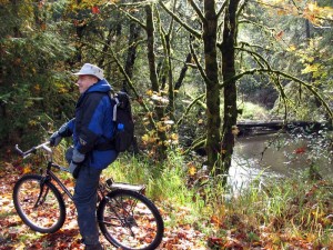 This spot is graced with a newly installed bench overlooking this bucolic stream flowing under a huge downed cedar trunk – looking like the temperate jungle that these forests really are. Another 1/10th of a mile further we cross the Pisgah Home Road that heads south and up towards bald Mountain and the ridge bordering the north side of Dutch Canyon.
At this point the trail runs parallel to the main road at a distance of 25 to 100 feet. The route now passes through pastures with herds of lounging cattle clustered under the clusters of shade trees. 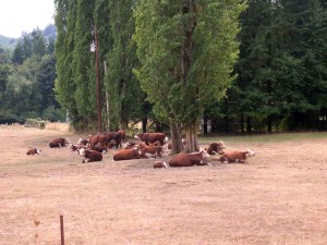 In this stretch the CZ Trail is cross-crossed with various roads that serve the farms to the south of the highway. On the north side of the road older homes stand dating back to the days of the original logging camps established by the Chapman brothers in the early 1900’s. Beyond this straight stretch the road takes a sharp swing to the south before resuming its eastward direction, and very shortly thereafter we arrive at the junction in Spitzenberg.
From here one can cross the road to follow the CZ Trail to Scappoose, or one can position the pick-up car just off the main highway where the trail emerges from the woods. This is a lovely trail on foot or on a bicycle!
Travel in the North Scappoose Valley in the 1890’s:
Historical records describe how Elmer Everett Nickerson, one of the early settlers in the Nehalem valley, took 2 days to go from St. Helens to Vernonia, probably with a loaded wagon. The November 1891 note records Nickerson complaining that the rains had made the trail “almost impassable” – an expression used liberally in the wet season to describe rural roads in these mountains. For example, a month later another report described the mud and water as being “nearly boot deep between Vernonia and St. Helens” .
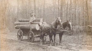 In February the following year an anonymous horseback rider passing through on his way from St. Helens to Clatskanie wrote about the conditions and the communities that he found along the way. It was published in the St. Helens newspaper, Oregon Mist on February 26, 1892.
“St. Helens is the only place on the route that had the appearance of a city. You have excellent services and sidewalks clear through the city.In Columbia City the road was recently slashed of brush,. Here too was an excellent schoolhouse, an old sawmill, a wood dock, a two-story hotel, some moss-covered tumble down houses and some very neat cottages”.
The Nehalem Divide Tunnel
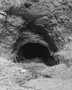 Much of the Crown Zellerbach road rests upon a railroad grade that was originally built by the Chapman brothers to extract their timber from this valley. The “Portland & Southwestern” in time became one of the major timber producing railroads operating on the North Coast. Started in 1905, the first train ran in 1906 and it continued to be built in a “log as you go” fashion, reaching Chapman, their main base of operation, around 1910. The Chapman brothers had high hopes to extend the P&SW all the way to Nehalem bay, but the costs to extend the line up to the head of the North Scappoose Valley exhausted their finances and they sold out to Henry Turrish who took on the task of extending the line into the Nehalem Valley by whatever means they could.
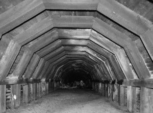 Switchbacks up the eastern slope of the valley were considered, but eventually it was decided to reach the Nehalem valley by tunneling through the summit. Plans were drawn up in 1918, and the tunnel was bored in 1919. The following year the internal support construction was completed to help shore up the walls and ceiling. The tunnel was quite long at 1712 feet in length and it stood 22.5 feet tall and 16 feet wide.
 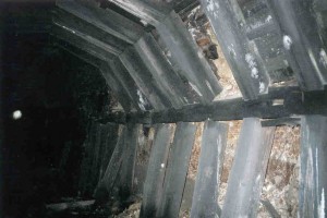 The beams that supported the ceiling and walls were 12″ by 12″, while the “lagging” boards between the beams were 4″ by 6″ pieces. The space above the curved arch of the beams was filled with scrap wood to hold the ceiling rock in place. Since the material through which the tunnel was bored was not solid rock, but mostly sandstone and fossil materials the entire length of the tunnel had to be lined.
 By August of 1919 the tunnel was completed but it took another year to extend the western side to the distance hamlet of Pittsburg. About 2.3 miles from the western portal a 100 foot high trestle had to be built to cross an unknown creek. Records indicate that this formidable structure survived into the 1970’s, but was removed soon after the establishment of the nearby Scaponia Park.
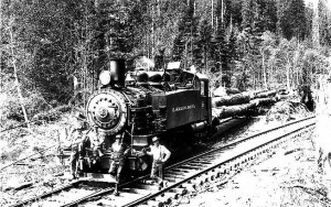 In 1926 the rail line was purchased by the Clark& Wilson Lumber Company that operated logging franchises all over the North Coast. But by 1944 the railroad ceased to operate and the line was sold to the Crown Zellerbach Corporation who converted the grade to accommodate log trucks. This change enabled CZ to cross the summit by means of a switchback road, since the renovation and maintenance of the tunnel was deemed too costly.
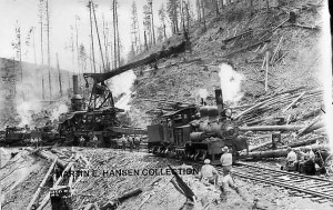 In 1945 the railroad was officially abandoned and replaced by the new CZ road. The new road generally followed the old railroad line, but it did bypass some sections that had relied on extensive trestles to cross the ravines. In the mid-1970’s the Bureau of Land Management came to own the land upon which the tunnel was located and they considered whether to restore the tunnel, but the enormity of the task proved too costly. Thus in 1981 the tunnel was extensively photographed and subsequently placed on the National Register of Historic Places (as site # 81000481), but its location was carefully suppressed.
  For years the location was lost and most of the old-timers who still knew about it assumed that it had long since collapsed. But in fact it had survived and was rediscovered in 2005. Although it was in bad shape it was still navigable through its entire length.
Though accessible by side trails that descend from the CZ road, it is not recommended that one ventures into this tunnel as it is in extremely poor condition an on the verge of collapsing.
