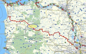
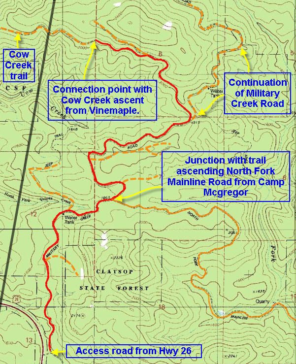
Brief description:This trail is more than half way to the coast and is accessed by a turn off about a mile west of the rest area. This trail connects to the route designated as the Northern Route. This route permits the hiker to approach a remote portion of the Northern Route directly from US 26 and complete the connection between the Dog Thief Mountain ascent (from Camp McGregor) with the eastern end of the Cow Creek ascent from Vinemaple.
Distance: This trail was clocked as being 4.67 miles long – however that may be a somewhat arbitrary stopping point as it represents the furthest proint reached during the prior ascent from Vinemaple. Theoretically this route could take you all the way to Vinemaple.
Walk duration: This hike took me about 2 hours and 40 minutes to reach the turn-back point. This might be considered slow, but the climb involved and the fact that my dog was having issues with the graveled road probably contributed to the pace of approximately 1.75 miles per hour.
Travel time to trail head: 52 minutes (45 miles) from the Sylvan interchange on Highway 26 to turn-off from Highway 26 – about 2.5 miles past the rest area.
Elevation change: 660 ft. in elevation gain
Trail Log: The trail begins a mile west of the Sunset Highway rest area. On the right you will spot a short dirt road that splits about 50 feet from the main highway. At this point take the left hand option and park somewhere before the yellow gate that marks the beginning of the privately owned timber lands.
The hike begins at an elevation of about 1495 feet as you pass the yellow gate. The road winds up a slope – above an area of recent clear cutting. You will see several short logging spurs that extended off to the left and dead-end on the ridges below the road you’re on.
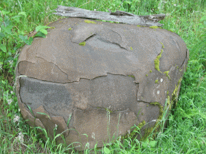 You will continue to traverse this slope traveling in a westward direction. At .8 miles up the road you will encounter the first spur road heading off to the right. This side spur road doubles back to serve the logging of the slope above the road. Follow the main road. From here on the road flattens out, and (as of 2010) it passes through a section of uncut timber. Note to the left side of the road the large round boulder lying by the side of the road. Just beyond it, the road splits again. The lower road goes straight ahead and eventually, this road will cross above the headwaters of Quartz Creek – this creek is surmounted by a long narrow bridge familiar to travelers along US 26.
But instead on continuing on at this lower elevation, you will take the right hand option and ascend the steep slope. At 1.8 miles (elevation: 1957 ft.)you will encounter the next spur road on the right side. This is the connection to the Dog Thief Mountain ascent – the prior segment of the “Northern Route” that climbs the North Fork Mainline Road from the camp McGregor Road. But rather than back eastwards towards Dog Thief Mountain on the North Fork Fork Mainline road, we will stay left and continue up the main road. Thankfully it flattens out a bit at this point, but at 2 miles (only 2/10ths of a miles further) we encounter another right hand turn – this time blocked by a yellow gate. Again , we ignore this side road (that dead ends further up the slope) and proceed up the main road.
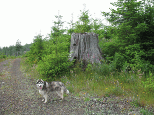 Here the road begins to bend to the left and it crossed across the base of a large clear cut, then it curves to the right and ascends the slope arriving at the shoulder of the ridge (elevation: 1978 ft.) at 2.45 miles into the hike. Once it arrives at the shoulder, the road splits. The right hand option proceeds along the southeastern edge of the shoulder (above the clear cut you just walked around as you ascended), but ends just a bit further along – in the good tradition of misleading logging roads!
Instead we will proceed up the main road that also swings to the right soon after the prior intersection. Several less well traveled forest roads/skidder roads do extend down off the shoulder on your left, but ignore these unless you’re trying to get down into the Quartz Creek watershed connecting with the lower road that we discussed in the vicinity of the “round boulder”. So…staying on the curved and gravelly main logging road we now proceed to cross the shoulder and walking along a relatively flat patch that passes through some younger trees (20 years old?) to arrive near the top of a slope that drains into Cow Creek – a small stream that flows in a westerly direction and empties into the Nehalem near the small town of Vinemaple located on Highway 202.This is a great spot to take a rest and eat your lunch – if you’re so inclined.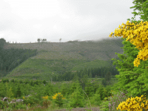
As you proceed you will soon be treated to a view across Cow creek of a long ridge that slopes down towards the left or westwards. This is the slope along which the route will eventually carry you in the direction of Vinemaple. Above you, at the top of the clear cut slope is the upper road that you just bypassed back at the brink of the shoulder. This stretch is relatively flat, and eventually it descends into a low point near the head of the Cow Creek valley. This natural “saddle” marks the transition between the hill top you just circled and the next high point that crowns the long ridge to the north of Cow Creek.
This saddle is about 3.5 miles into the hike and lies at an elevation of 1915 ft. At the north end of this saddle the road splits again. The main road, the so-called Military Creek Road which we have been ascending all day continues in a northerly direction in the general direction of Green Mountain – a peak that dominates the hills to the north of Dog Thief Mountain. You can see into this vast checkerboard of forest and clear cuts that extends northwards from the saddle. But our route will now depart from the Military Creek road and ascend a less traveled road that branches off to the left from the main road at the north end of the saddle. This nameless road traverses the slope that parallels the north side of Cow Creek as it descends westwards towards the Nehalem River.
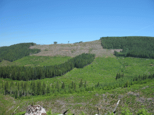 The picture alongside this text shows rthe slope that you just traversed, with the main road running along the bottom of the clear cut and the upper road running along the middle of that brown cleared area.
Beyond the saddle we will take the road that branches off to the left. This road now ascends the slope eventually climbing to an elevation of 2160 ft. at 4.25 miles into the hike (3/4 mile beyond the saddle). At this point you will see an older less well used road that turns off the main track. While the main track continues to gradually ascend the slope, the left hand option that we will chose traverses the slope at more or less the same elevation. This lovely route affords us breathtaking views of the peak we recently encircled and the numerous other peaks to the south of these heights. Running along the flank of the ridge that marks the northern lip of the Cow Creek valley, this road will eventually connect with a newer network of logging roads that were used to harvest timber further to the west on this slope. But our trip ends here at an arbitrary distance of 4.78 miles from the gate that marked the beginning of this trek. The reason for this abrupt end is simply that this is the furthest point that we will reach when we ascend the Cow Creek valley form Vinemaple on our next leg of the “Nothern Route”. And Loki was too tired to go on!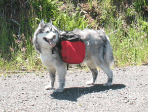
Tired dog!
If you were to continue down this road and you will eventually get to the end of this logging road. Just before the end of this road system, several right hand spurs lead up the slope, but the main track will continue along the slope finally looping around to the left to accommodate the logging of the lower slopes.
Here’s the tricky part! Where the road makes its final loop, you will have to bushwhack straight ahead through a copse of trees to reach the end of the logging road system that serves the logging area directly to the west of your current position. here is no direct road connection between these two distinct contract logging areas.
So here’s the exact directions on how to make that leap from one logging road system to the next: where the road begins to bend to the left (and curls back around on itself) you must continue OFF THE ROAD straight ahead. Imagine the route of a car careening off the road as it tries to navigate the curve at too high a velocity. Walk up and out of the road as it curves to the left. Look around you for the telltale marks of where the elk have carved their own trail the short distance acropss the clear cut slope to the distant tree line (to the west of that final loop in the road). Follow the elk trails towards the trees and use them to guide you through the 50 feet or so of forest until you reach the terminus of another logging road that leads into these trees from the west. Even if you miss the elk trails, just walk straight ahead through the trees – you can’t miss the logging road located on the other side of the trees. This road is the top of the logging road network that originates in Vinemaple. Following this road downwards along the flank of the Cow Creek Valley will eventually deliver you to Vinemaple on Highway 202 situated near the Elsie junction with US 26.

Vinemapile is located on highway 103.
I stand corrected. Thanks for the correction.