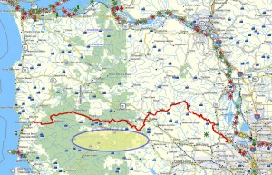
 Brief summary: This nice wooded trail follows Elliott Creek along the slope of these hills. University Falls is worth the 500 foot detour, but the lack of places to sit and enjoy the view of the small waterfall makes it a short-lived wonder…I like the waterfall on the Storey Burn Trail better. This is part of the Tillamook State Forest and just south of the Southern Route.
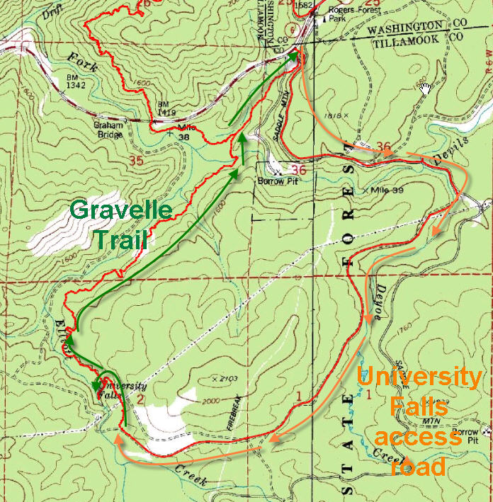 Distance: 3.3 miles round trip
Walk duration: 2 hours at a steady amble.
Travel time to trail head: 42 minutes from the Sylvan interchange on US 26 to Browns Camp. 10 minutes to the University falls trail head.
Driving directions to the trail head: Drive west from Portland on US 26 (Sunset Highway) for 36 miles (measured from the Sylvan exit at the summit of the West Hills) to Browns Camp. Turn left into Brown’s camp and take a right at the “T” intersection where the road turns into gravel and follow signs to University Falls Trail head – about 3 miles.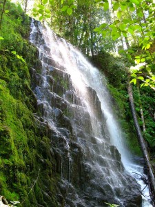
Elevation change: 287 ft over 2.7 miles – mostly level walking.
Conditions: nicely maintained trails, but also used by mountain bikers. Be careful of speeding cyclists.
Trail log: The best way to reach University Falls and the Gravelle Brothers Trail is to drive in to the trial head on the forestry road accessible from the Roger’s Camp exit off US 6. Follow the signs from Roger’s camp to the University Falls trail 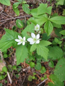 head. The trail begins with a short climb over a rocky ridge and crosses two ATV trails. Given the noise these beasts make it’s hard to be surprised by them. Another 0.4 mile descent brings you to a wooded ridge with an open space sufficient to hitch horses to the hitching post that is located in the glen. To reach the falls, look the sign marking the way and continue down this trail 500 feet to the falls. University Falls is a lovely cascade, but the terrain at the base of it doesn’t provide much space to stretch out for a more contemplative stay.
To continue on the loop back to Roger’s Camp Trail head retrace your steps back about 500 feet from the waterfall to the open area with the hitching post for horses. Another short trail also extends down to the stream – presumably where riders have led their horses down for a drink. But the Gravelle Brothers trail strikes out in a northerly direction from this ridge. diverges northward near to where the trail descending 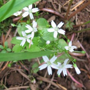 from the trailhead entered to the clearing.This trail is named for the Gravelle twins, Elroy and Edmund, who spent countless hours helping to develop and maintain the Tillamook State Forest trail system. Note the many scorched stumps along the way; they are the legacy of the great Tillamook fire. One of the prevalent wild flowers in this region is the Anemone (Anemone Oregana). This white petaled plant is to be found in early summer in the deep woods shade. It is sometimes called the wind flower and is pictured to the left.
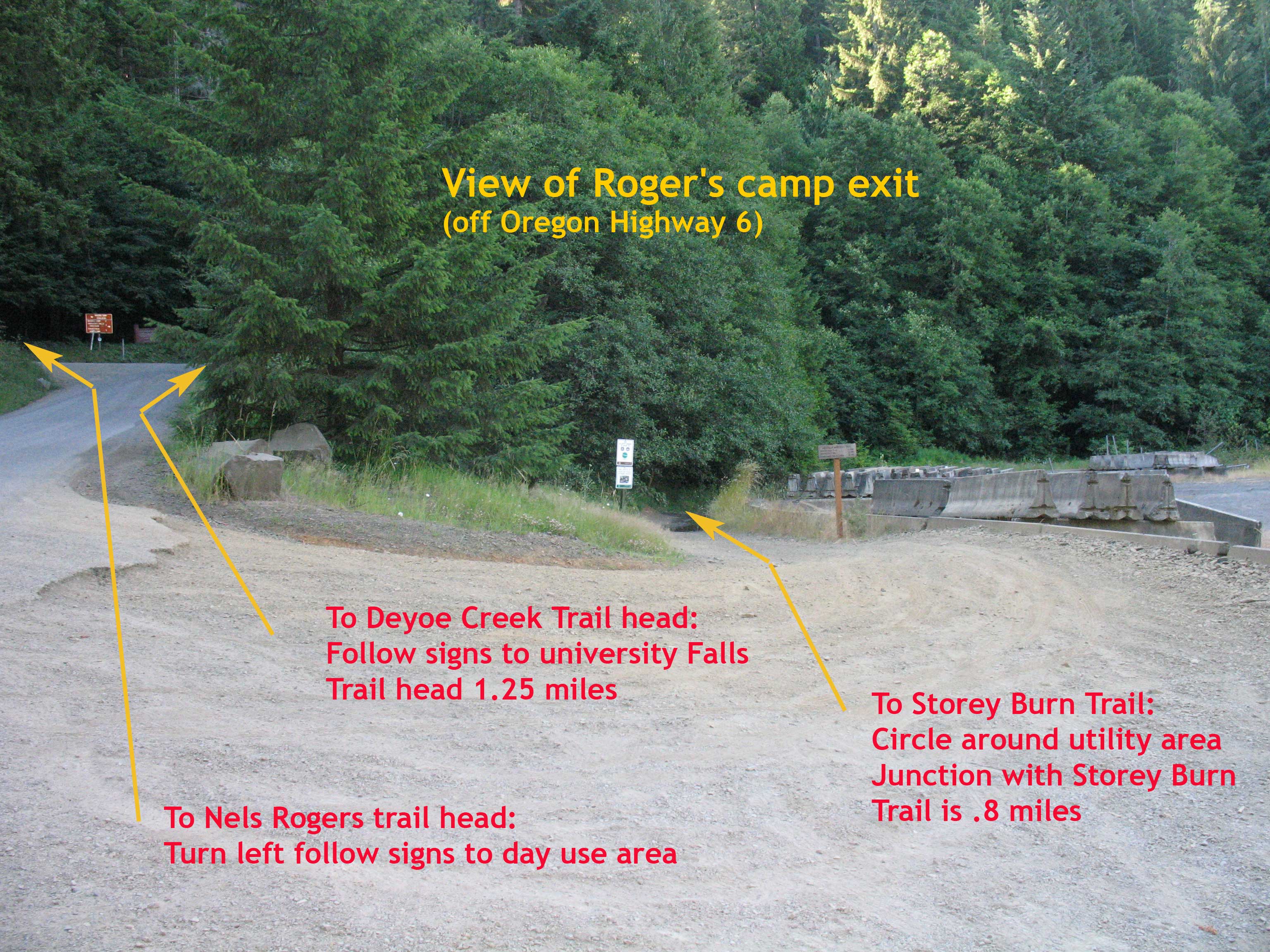
Another noteworthy plant that can be found in the deep shade of the forest is the Montia Sibirica, or Candy flower. In the West this lovely little ground flower is commonly referred to as Miner’s Lettuce. It is one of the few annuals that seed sprout grow and die in a single season. To try this delicate plant in a “miner’s salad” 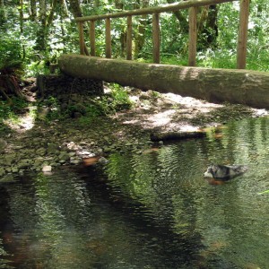 pick the youngest, and yet-to-blossom specimens. Eventually after 1.8 miles you will intersect with the Storey Burn Trail. Just before you reach the intersection with the Storey Burn Trail, the trail crosses Elliott Creek on a log bridge. A bench offers a great spot to stop for lunch, and the pools in the creek will give you four legged friends an opportunity to cool off. Another .8 miles after the intersection with the Storey Burn trail will bring you to the old road grade to Rogers Camp. A right turn here leads quickly up to a gravel road. According to the Tillamook Forest guide you should “follow the road to the top of the hill to the ODOT maintenance shed and proceed behind the cement barriers on this shared-use segment of the Elliott Creek OHV Trail”. The above picture shows where this trail emerges.

Pingback: University Falls Hike | Evergreen Hiker
The hike itself was great except that we were serenaded by Quads, motorcycles and gunfire the entire hike including one genius that was firing his gun out of site but just yards off the trail leaving us wondering which direction he was firing. THIS IS NOT A HIKE FOR PEOPLE WANTING TO ENJOY THE SERENITY OF THE FOREST! But the hike is a great workout and I enjoyed it anyway.
You’re right this area is a bit noisy since it’s near one of the premier locations for ATVers. I try to stay at least one ridge away from Brown’s Camp. The Storey Burn trail is as close as I go, unless it’s in the winter when most of the noisy folks are at home. The last time I was out in that neck of the woods they were filming an “explosive scene” in the vicinity and the tranquility (such as it was) was shattered by a massive blast that rocked the entire area – but that, thank goodness, was out of the ordinary. The ATVers, though, are a near constant presence near Brown’s camp.
Pingback: University Falls, Tillamook National Forest - Oregon « Pacific Northwest Photoblog Pacific Northwest Photoblog
Thanks for finally talking about > University Falls & Gravelle
Brothers Trail | Forest Hiker < Loved it!
Pingback: University Falls & Fern Rock Falls | oregonwaterfalls
Pingback: University Falls, Tillamook National Forest - Oregon - Pacific Northwest Photoblog
Trail distance is clearly one-way (including out-and-back the spur to University Falls) NOT round trip. Gravelle Brothers trail is clearly marked on map as 2.4 miles one way from University Falls TH to Rogers camp. Doing it as a round trip would mean, at a minimum, 4.8 miles. Add the spur to University falls and you definitely do not end up with 3.3 miles round trip.
Anne you are right about the distances. Good catch. Jim
Can anyone tell us a little more history on how it became known as “University Falls”? There seems to be very little history on the actual “naming”. The only University close-by is Pacific University, so it is curious how they came about the name. Was it named by the Gravelle Brothers? or earlier? Thank you in advance! 😀
Scott:
I am researching this question and have reached out to my contacts at the ODF. Stay tuned…
I’ve asked numerous people who should know including the historians at the Oregon Department of Forestry and at the Tillamook Forest Heritage Trust, but to no avail. I’ll keep asking and if I hear the source I’ll post it here
Was wondering if anyone ever found out why it’s called “university” hikes it today, searched over the net, no idea!
University Falls – Name?
I grew up across the street on SE 162nd from Edmund & Elroy Gravelle. Their mother “Grandma Gravelle” was our baby sitter.
As a young child I remember them working on the trail. This was about 1965- 1967 or so. Never ever heard Edmund or Elroy ever mention the name of University Falls, so my guess -and only a guess is that it may have come from a bit later when the trail system connected to the local site.
I hiked from Rogers Camp to University Falls. then continued on Wagon Wheel Trail to complete loop back to Rogers Camp. The signage has the loop at 7 miles, but GPS showed loop at 9 miles. A great and mostly quiet hike through large trees, but all the shooting made it feel like war zone in certain areas. Trail well maintained and signed at road crossings. Great work out, and logging areas kept to minimum.