This nice wooded trail is part of the Tillamook State Forest just south of the Southern Route. It follows Gale’s Creek and then follows a tributary creek to the summit of the ridge. On the far side the trail drops down into the Wilson River Valley, passes under Highway 6 and parallels Elliot Creek until it intersects with the Gravelle trail. A short (.8 miles) segment will bring you up and out of the woods at Rogers camp.
Distance: 6.4 miles round trip
Walk duration: 3+ hours at a steady amble.
Driving directions to the trail head: Travel west (measured from the Sylvan interchange) on US 26, turn left on Highway 6 and continue on through Gale’s Creek and 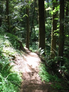 Glennwood to milepost 35, turn off the road on the right side and follow the signs one mile to Gales Creek Campground. Park in the day use section, just before the bridge. The trail begins at the west end of the parking area.
Travel time to trail head: You should be able to navigate this in about 40 minutes.
Elevation change:
Conditions: nicely maintained trails, but also used by mountain bikers. Be careful of speeding cyclists.
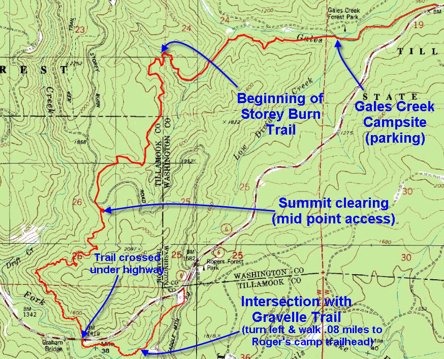
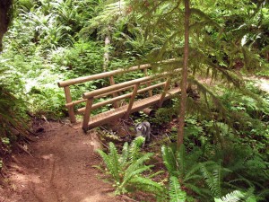
To access Storey Burn Trail from the Gales Creek Campground, start at the west end of day use parking 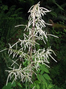 near the bridge. For .08 miles this trail traverses a steep fern-covered slope above Gale’s creek. Shortly after you enter the trail from the parking area look for a beautiful specimen of Goat’s beard (Aruncus sylvester) on the uphill side of the trail – depicted here on the right. The Northwest Indians used this plant to help heal sores – maybe that’s why it’s at the end of the trail…
The junction which marks the beginning of the Storey Burn Trail is just beyond the second wooden bridge. 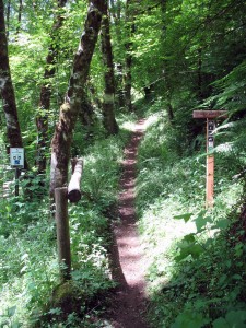 As of July, 2010 the
 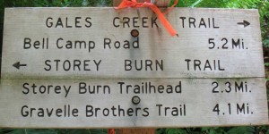 trail to Reeher’s Camp (right hand turn at junction) was closed due to an earth slide that wiped out the trail – it’s slated to be fixed later this summer. But for now our route (left hand turn at the junction) takes us 2.3 miles up the Storey Burn Trail from this juncture to the the Storey Burn Trail head
 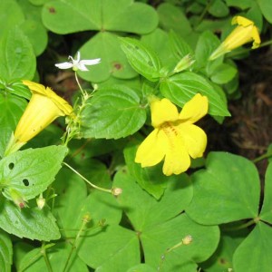 located at the summit. If you walk this stretch of the trail in June or July you will probably notice the colorful blossoms of the Monkey Flower gracing the trail-side. The bright yellow flower of this Snapdragon family member blooms particularly early in the summer, and has often been remarked to have a funny face – hence the “monkey” moniker.
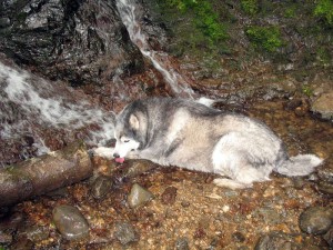 A mile above the trail junction at the second bridge, you will encounter a lovely waterfall that cascades across the trail and serves as a well deserved respite for any four legged companions that may be accompanying you. Loki, my Siberian Husky promptly lay down in the water and declared he was staying indefinitely!
I took the interlude to observe the lush, water-loving plants that flourished in that misty ravine, including the 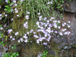 aptly named Streambank Spring Beauty (Montia parviflora). Growing in wet habitats at low and middle elevations, it is not that common. Indian children used to abuse this flower, among others, to play a game. Holding a stem in hand the player would try to hook his flower around the base of the opponent’s flower and then pull. One of the two would “lose their head” to the winner of this floral tug-of-war. Players repeated this keeping score to establish the ultimate winner.
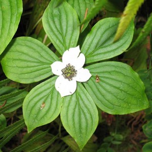 As you approach the summit note the widely spaced trees. This area has been selectively “thinned” to promote the growth of understory plants. Among these plants you will find the a flower that could easily be mistaken for a dogwood flower, except that it’s a ground flower. This is the easily recognized and ubiquitous Bunchberry. The Indians throughout the Northwest enjoyed this flower for its pulpy fruit which they ate raw.
Arriving at the Storey Burn road and large graveled clearing that marks the summit of this trail, you can see an uncommon specimen of the the 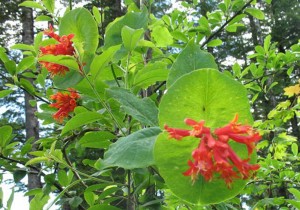 Orange Honeysuckle (Lonicera ciliosa). This plant attracts hummingbirds to help it polinate – hence its bright colors. The sweat scented varieties of the honeysuckle family rely instead on night-flying moths whose visual appreciation is justifiably deficient. The Indians thought of this plant as embodying “woman’s medicine” and used it to stimulate lactation, add luster to the hair, etc.
This summit area can also be accessed directly by logging road and serves as a convenient way to break this trail up into two easily walkable segments – one segment from the Gale’s Creek Campground to the summit and the second from the Summit to Rogers Camp. To reach this summit trail head, exit Highway 6 at milepost 33 (at the big pull-off located at the summit of the coastal divide) and proceed 1.8 miles up the logging road that heads north from the highway. The gravel parking lot is located just off the left side of the main gravel road just where the road levels out at the summit. Look for “Storey Burn TH” on the attached copy of the Tillamook State Forest map.
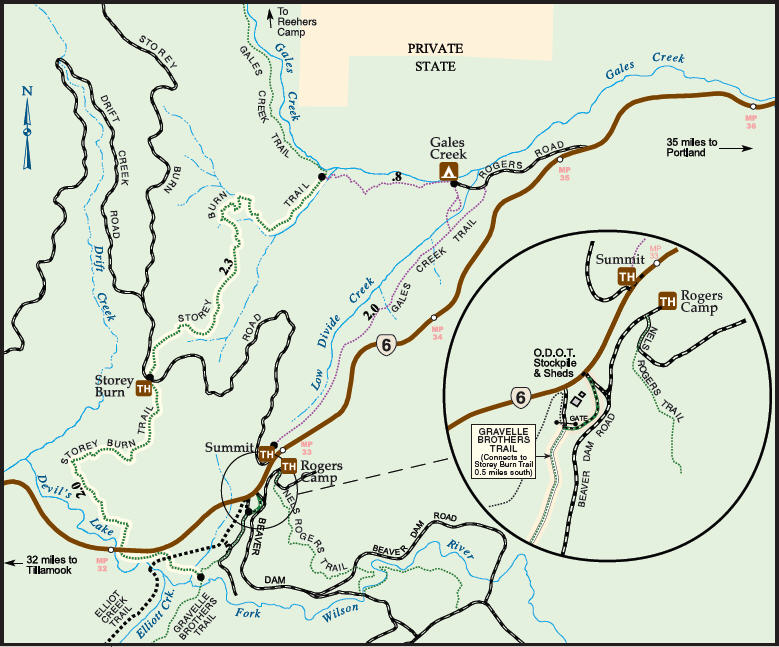 The second part of this trail traverses the upper slopes of Drift Creek in a generally Southwesterly direction for about another mile. Then the trail turns abruptly and begins the descend sharply to the Devil’s Lake Fork of the Wilson River. The trail passes directly under Highway 6 as it crosses a bridge to span this aforementioned tributary. Shortly it crosses an ATV track that crosses Elliot Creek (the bridge is visible from the trail) before plunging into a dense river-bottom forest with thick vegetation alongside the trail and a thick canopy of Vine maple and Alders overhead. As the trail rises out of the valley floor it intersects with the Gravelle Brothers trail (turn right to head towards University Falls) and turn left to reach Rogers Camp a half-mile eastwards.

I just found your blog and book on the coast range and am looking forward to learning more about this area. Do you know why Storey Burn is called Storey Burn. I assume it has something to do with one of the Tillamook fires, but could not find any reference to “Storey” after searching old newspapers and asking at the Tillamook Forest Center. If you have any thoughts on where I could research this, I would appreciate it.
Thanks.
I have checked all my materials but could find no references to Storey Burn. I know the road well and will continue to search for answers.
Jim