Be careful what you ask for.

In the mid- 1800’s when the settlements on the lower Columbia River and in the Nehalem Valley were just beginning to proliferate, it was the practice to bring in a preacher to officiate at local marriages – and thus the opportunity to get married was only infrequently available.

It was this fact, that motivated Eunice Huntington to convince her beau to attend the marriage of Charles Fox in Rainier. By all accounts is was a joyous occasion, but near the end of the festivities the preacher asked if anyone else would like to take advantage of his presence, since he did not plan to return to Rainier for another half-year.

At this point Eunice stepped forth and announced that she was ready to be wed, but unfortunately her beau was somewhat less enthusiastic since he hadn’t accumulated a sufficient “stake” to offer her. Perhaps, thinking he could bide his time, he declined and was seen exiting the hall shortly thereafter.

But the local stage driver, Henry Windsor had no such compunctions and immediately offered his hand. In less time than it takes to read this account the two were married. Eunice’s father was furious! And then to make matters infinitely worse, it turned out that Henry was already married to a women he had left in the east. But that was soon sorted out when it was confirmed that the ex-wife had died. According to the contemporary accounts, this news interrupted the bride’s family plans to annul the marriage and the recently widowed Henry Windsor was eventually accepted into the Huntington family.

Eunice had come to Rainier in 1848, crossing the prairies with her family at the age of 13. Henry turned out to be quite the businessman, and he eventually controlled much of the stage business between the Cowlitz River and the Puget Sound. In 1903 the couple celebrated their Golden Wedding Anniversary! You might say things turned out rather well for Eunice, considering the unexpected turn of events.

Posted in Lower Columbia Trails, Pioneer Lore, Uncategorized | 1 Comment

The Grange movement – the Internet of its day.

The national Grange Movement was founded in 1867, immediately after the conclusion of the Civil War, when the country’s agriculture was in dire shape. Six years later the Oregon State Grange organization was established to help rural communities work more effectively together. Politically, the Granges consistently supported better roads, technological improvements for the small farmer, flood control and rural electrification. But there was another side of the Grange that was just as important! The Granges also encouraged the enlivenment of the local community by throwing great country dances!

It is difficult for many of us to understand the isolation of the remote rural Oregonians that pioneered homesteads in the Coastal Range or in the Nehalem Valley. They rarely got to see their neighbors, who might live 15 to 20 miles away through dense forest inhabited by cougars, feral pigs, and bears. “Visiting” took determination, pluck and stamina and sometimes required an overnight stay. Social life was hard to sustain when the roads were hip deep in mud, the skies were dumping oceans of water, and a foggy dusk presided from dawn to darkness.

The establishment of a Grange Hall was considered quite an accomplishment and a validation of a community’s advancement from “bachelor flats” to the foundation of a new town. In fact there was some considerable rivalry about who was the first Grange in Columbia County between the citizens of Vernonia and those of Yankton. The opening of a local grange was a big deal and was celebrated all along the Lower Columbia. In 1915, when Beaver Homes (sometimes referred to as Redtown) opened its grange “an excursion boat was run down from Portland. On it was a piano, and a full orchestra, horses and hacks to supplement the company’s rigs and a crowd of celebrators bent on dedicating the hall in dancing.

Most of these country dances went all night long, not simply because they had the stamina to do so, but because an earlier finish would have resulting in people trying to walk home through the dark cougar-infested forests dressed in their best party clothes – so they simply stayed and danced until dawn.

The stairs going up to the dance hall were lined with muddy overshoes, lanterns, and the occasional nosebag full of oats for the horse’s trip home. While the older women sliced up the cakes, the old men hunkered to some serious poker fueled by ample stock of buttons reserved for that purpose. At mid-night there was a break when the ladies served a feast of cooked ham, sliced  with buns, pies, cakes, pickles, and washed down with lots of coffee – all for $1.00 per family!

All around the hall, children slept on the chairs and benches, covered in lap-robes and coats. After dinner, they’d put down another layer of wax and announce, “This will be the ladies’ choice.” Out from the kitchen came the matrons, but their old-timer partners had already escaped down the stairs. All the wives and sweethearts would grab hold of their men, while the unattached girls would rush any boys that could actually dance. The others then sought out any uncle or neighbor that could dance a quadrille with a “right and left through”, or “circle eight with a full allemande.” Once the pace picked up and they began a Paul Jones or a feisty tag-waltz the old-timers would reappear just in time to be pulled into the vortex by their patiently waiting wives  and immersed into the exuberantly whirling dancers.

But woe-betide those that tried to drink, for these affairs were entirely sober. And if you got caught, you were not just expelled from the dance, but were also likely to lose your job on the morrow.

Today, the granges still operate under similar circumstances. Pinochle, Bunco and Bingo are prominent on their calendars, and many still hold social events several times a year. One of my favorite annual events is the Strawberry-shortcake Festival put on by the Dixie Mountain Grange every year on Father’s day! Complete with a kaleidoscope of handmade quilts for sale, red gingham table clothes, and the girls tending to the tables – this event reminds us of how we used to live in small and tight-knit communities before the Internet came to our rescue…

Sources:

Columbia County History – Vol 1, pg 52, 1961

Columbia County History – Vol 6, pg 20, 1967

Columbia County History – Vol 2, pg. 53, 1962

Columbia County History – Vol 12, pgs 18 & 22, 1973


Posted in Indian lore, Lower Columbia Trails, Nehalem Valley Trails, Pioneer Lore, Uncategorized | 6 Comments

“Animals to Avoid”

I recently was given a treatise on “Logging Road Layout and Related Subjects” hand typed by “Bull” Durham in 1997.

Here was a candidate for the New York Times best-seller list, I thought, as I began to sort through the details of laying a tagline, but then suddenly the voice of the writer pierced through the technicalities and I was captivated.

Right on page one, he starts you off, with this choice piece of advice, “ After the office interview have the client take you to the property  and show you what he knows: roads, line crossings, line tags, mean dogs, crazy hermits, and hostile widows.”  Now that changes the proposition a bit…

But “Bull” isn’t about to go charging into the lair of any slavering dogs or pernicious widows lying in wait. “Don’t think of a project as an unfriendly foe and don’t attack it. You should caress it and surround it …sneak up on it,” he advises. “get to know the property intimately…the more you know of her secrets the more she will cooperate and the less pitfalls she’ll have for you to stumble over.”  They sometimes talk about “lonesome cowboys”, but I’ve never, until now, considered the possibility of a “lonesome logger”…making amorous advances upon his special stand of timber…

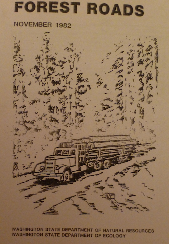
Forest Road ManualBut my favorite piece of advice that Bull gives us, after his many many years in the field, is contained in his section entitled Animals to Avoid. After quickly listing off bears, elk, deer, skunks, feral dogs, rabid bats and even pot farms he warns of two particularly dangerous beasts in the forests. Would it be cougars, spiders, bees or log truck drivers?  Nope, none of those…

His first warning is about “Game Hunters (Homo Stupidus)“! He categorizes them as “unpredictable, may shoot at anything, they go a little nuts at hunting season,” he confides. “Avoid whenever possible; stay in your vehicle” he advises and as a final caution he adds, “Don’t wear bright colors to give them a target.

But it was his final choice of fearsome and dangerous beast that really floored me. He relates a story emanating “a few years ago”  in Coos County. It seems that,

the rigging crew on a yarding job were setting chokers down in a draw where they turned up a Salamander…some of the boys dared another to bite the head off of the Salamander. The boy took the dare, bit the head off, went into convulsions and died before anything could be done for him.

Now there’s advice I wouldn’t have thought to include in a manual on how to build logging roads. I’m sure it avoided lots of convulsions and headless salamanders.

Posted in Animal lore, Logging history, Uncategorized | 1 Comment

The Wreck of the 104

About 46.5 miles out of Portland on the Sunset Highway (US 26) we reach an important junction on the way to the coast. Most people go flying by the rest area located there, unless the kiddies in the backseat are wailing for a pit stop. But this is the original way into this area, before there was a Wolf Creek Highway, later renamed the Sunset Highway. About 100 yards beyond the entrance to the rest area is a dirt road that leads northwards (to the right) up the Rock Creek Valley and eventually it used to lead to Keasey and Vernonia. This was the route that the railroad loggers used to gain access to the huge stands of trees in the Coastal Range situated south of the “Wolf Creek” highway. The rest area sits to the north of a huge bowl that drains a vast ring of  coastal headlands into the North Fork of the Salmonberry River. It was this timber rich landscape that the Oregon American Logging Company had in their sights when they extended their railroad spur #26 across what is now the sunset Highway and began logging in the highest slopes of the Coast Range right above the Lower Nehalem and the Salmonberry River.

By 1948, the Oregon-American Logging Company was operating at the top of the coast range along a rim of forested peaks that loomed above the Lower Nehalem River. Located at the furthest extremity of a narrow ridge jutting over the precipitous slope was Windy Gap, one of the most remote logging sites in the Pacific NorthLidgerwood Cable Skidderwest. From this isolated perch the loggers could look over the tops of the last coastal range and see the ships plying their way up and down the Oregon Coast. It was also utterly at the mercy of the violent storms that crashed ashore from the vast stretches of the Pacific Ocean. Only a few months earlier a gargantuan winter storm had lifted the watchman’s cabin right off its foundations and had flung it headlong off its mountain perch.

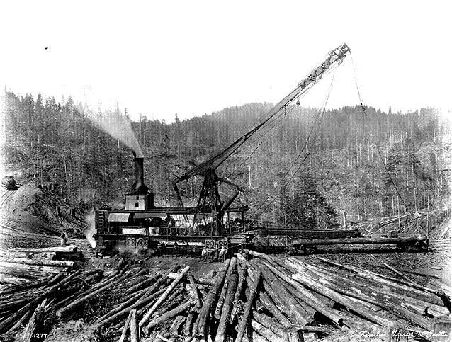
And it was to this remote logging site perched at the top of the Coast range that the Oregon-American Lumber Company had brought the greatest steam punk behemoth of the logging world, a 300 ton Lidgerwood Tower skidder.  These huge “aircraft carriers” of the logging business had been developed during the high-balling era of steam logging. With their huge tower extended they could log a 360-degree arc and lift the huge  old-growth logs from nearly a mile away and pull them up 3,000 feet in elevation to the waiting rail cars on the ridge high above.  It was reported that, “The canyon walls were so steep that the skyline angled down as much as 45 degrees.” All the crane operator could see of the choker setters were their helmets that looked like little specks of grey metal lost in the jungle of massive old growth forests.

On June 3rd, 1948, the Oregon-American Logging company had wrestled this monstrous rail carriage up to the top of the CoaLidgerwood skidder.st Range with four locomotives pushing and pulling the Lidgerwood Tower Skidder into position. And from its commanding heights it began to log the practically inaccessible slopes of the Middle Fork of Cronin Creek.

At about 8:30 AM the 104 “lokie” was bringing down an empty oil car and 13 big car-loads of logs down a narrow sinew of iron rail lines snaking along the rim of Windy Gap. Below the slowly descending train clouds flowed over the Coast Range turning the peaks into islands on a vast ocean of fog. And above the creeping train the clear blue sky of that June morning was so close the engineers could almost reach out and grab it.

For the last 25 years until that morning the Oregon-American had managed to haul 2 million board feet of wood out of the Coast Range without a serious railroad accident. And considering the tenuous network and rickety trestles that held this delivery system together – this was no mean feat. But as the train slowly  sank through the blanket of clouds and maneuvered its way towards Camp Olsen all that would change.

The train was inching its way down the steep grade of Line Spur 26, but had come to a stop about a mile from Camp Olsen, because the section foreman was making repairs to the track. The braking process brought the train to a halt on a fairly steep slope near the junction with Spur 26-8 . In the locomotive were the Jeff McGregor, the engineer, Jerry Manning, the fireman, and Frank Willis, the time keeper. Three brakemen were riding along further back amongst the carloads of logs.  Up to that point everything seemed to in order and there was no apparent cause for concern.

After a short wait the section foreman completed his work and waved the train onwards. But from the moment it started it was clear to all who witnessed the event that the train was picking up speed too quickly. It continued on at an alarmingly increased speed, and as it tried tho round the bend at the 26-8 junction it jumped the track on the curve and overturned immediately. This is where it gets a bit gruesome. George Lee, the head of the construction crew describes the scene with brutal frankness,

The engineer wasn’t alive when I got there. He got half-way out the cab window and that’s as far as he made it. He was cooked. You don’t get two hundred pounds of live steam goin’ on you and survive. . The time keeper ‘ol Frank Willis, he was just squashed right between the boiler and the tank. The other guys, they weren’t squashed, they were just cooked.” – George Lee, from The Oregon American Ain’t No More!

As I try to penetrate past the official perspective that these damage reports present, one does get the sense that the loss of these individuals was a real blow to the heart of the company and to its employees. The five that rode the ill-fated train accounted for more than 120 years of experience in railroad logging experience – an utterly inconceivable feat in this era of volatile career options.

Not surprisingly the company’s reports and it’s semi-official history,  The Oregon American Ain’t No More! both draw the conclusion that the cause of the accident will never be known – especially with conflicting reports of the two brakemen and the deceased engineer.

The contemporary Oregon-American internal records quickly move on to explaining how the engine was pulled upright again – so that it tipped right back on the rails. And how most of the damage was insured; The Oregon-American was only at risk for only $5000. By Monday they planned to have the scene cleared and the enough trains moving to keep up the twice daily delivery of 13 car-loads of lumber to the sawmill in Vernonia. The 104 was eventually repaired and rejoined the service. The same cannot be said of Jeff McGregor, the engineer, Jerry Manning, the fireman, and ol’ Frank Willis, the timekeeper.

Harvesting logs near the ceiling of the Coast Range was and remains a bodacious undertaking. In the heady days of the post-war reconstruction period, timber companies were regrowing their labor force and were high-balling production. These were the days of the “boomers”, the “short stake artists”, “gyppos” and career loggers, but as this story relates – it was still a dangerous business being a steam engine logger.

Posted in Logging history, Nehalem Valley Trails, Railroads, Salmonberry Trails, Uncategorized | 4 Comments

32 Indian and Pioneer Trails in the North Coast range – compiled by R. L. Benson

Although I have been collecting materials about early Oregon coastal trails and paths for many years, I was pleasantly surprised to find some original historical research compiled by Robert Benson in 1981. It included this unusual map and this uniquely expansive list of significant trails.

I have presented this map and the associated list with as few editorial (italicized) additions as possible. I can’t say I know more than a handful of these putative trails, but nonetheless I publish them here in part to preserve the record, but also to see if I can conjure some of you out there to respond if you have something interesting to add to the record. Maybe we can coin a new term and call it “crowd researching”.

Here’s Robert’s nicely drawn map:Indian-Trail-Benson-map-opt
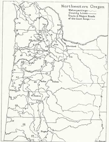
And here is his list of the various trails:

Indian Trails:

1. Jason Lee Trail, used by missionary searching for a location for his mission.

2. Logie Trail, Fort William Bend on Sauvie Island to Glencoe.

3. Klickitat raiding trail, perhaps same as fur traders’ main Westside route.

4. Ecola Trail, used by Captain Clark’s party going to see whale at Cannon Beach.

5. Pafaan Trail, from Patton Valley via S.Saddle Mtn and Hembree ridge.

6. Tualatins’ steelhead trail to Trask headwaters (from Trail Street in Gaston?)

7. Nenamusa Trail, rumored in use by Tillamooks for vacations and honeymoons.

Explorer’s Trail:

8. Dr. Elijah White’s route from Spencer Butte to ocean via Siuslaw River.

Military Routes:

9. Astoria-Plains Military Road, scouted by Lt. Geo. H. Derby in 1855

10. Doak’s ferry Road, by which cannons reached Siltz (or Forts Yamhill, Hoskins?)

Settler’s Routes:

11. Cattle trail, over which herds were driven to Tillamook and Clatsop farmland.

12. Harris Trail, gave Tillamook access to civilization in all weathers.

13. Cape Horn Wagon Road, west of West Dairy Creek and on to Vernonia.

14. Washington County, Nehalen & Astoria Wagon Road of 1873

14a. Wilson River Stage Road, Gale’s Creek (Gale’s City) to Tillamook.

15. Trask Toll Road, North Yamhill to Tillamook via Fairdale Mineral Springs.

16. Elk Creek Toll road, Cannon Beach to Necanicum River.

Major Hiking Routes, now usable at least in part (in 1981, when this list was compiled)

17. Big Nestucca logging road, unsafe but favored by bicyclists and hikers to the coast.

18. Oregon Coast Trail, planned throughout; officially open at the north end (much more since this was published).

19. Linear trail, on defunct United Railway grade; held up by local opposition.

20 Dallas – Coast Trail, planned along old logging roads; possible for equestrians.

21. Corvallis-Coast Trail, mostly for hikers only, in part for bicyclists too.

22. Eugene – Coast Trail, begun by Boy Scouts; frustrated 10 miles out.

Long Trails Planned, or in use in the 4 major proposed wildernesses.

23. Mt. Hebo Trail, planned to join the Three Rivers and Central Nestucca.

24. Drift Creek Trail, behind Waldport, planned as part of 21 above.

25. Coast Creeks Trail complex, gives views of unique coastal wilderness.

26. Windy Peak Trail in small wilderness between Deadwood and Lake Creeks.

Short but outstanding Scenic Trails:

27. Wolf Creek Falls Trail, with possible extension along Highway 26.

28. Low Divide Trail, joining gale’s Creek Forest camp with Wilson River Stage Road.

29. Munson Creek Falls Trail, through sub-tropical rain forest.

30. Hart Cape Trail, steep but scenic, just north of Cascade Head.

31. Valley of the Giants Trail, access to grove of near champion Douglas Firs.

32. Sutton Creek trail, with a special viewpoint for the handicapped.

I would like to add other trails like those connecting the Tuality plain with Willamette Falls, those trails along the Gorge that bypassed the treacherous rapids, trails along the Nehalem River, the Salmonberry River trail and the traditional crossing routes for the Cascades in Oregon and Washington. But I will leave this entry as un-embellished as possible. 

Instead of offering my commentary, I invite you, dear reader, to add your observations! Please comment if you have updates on any of these routes. I also have updated information, but will offer it up elsewhere as we gradually refresh the details of the trails mentioned therein.

Jim


Posted in Coastal Trails, Indian lore, Misc Trails & Trips, Nehalem Valley Trails, Pioneer Lore, Trails | 15 Comments

Shoot-out at the Sophie Mozee homestead!

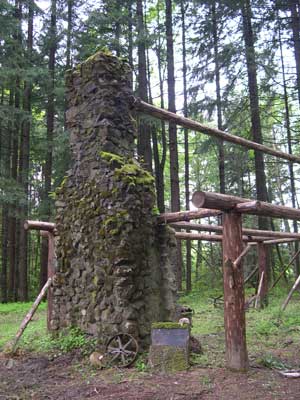
Here is is an excerpt from a piece I just completed and added to the roster of  trails listed under the geographic tab for the West Hills. In this “historic trail” description I try to use nuggets of contemporary opinion about the Jason Lee Route to “Hillsborough”, my own knowledge of the landscape, some old maps and the wonderful recollections captured in the locally published, Dixie Mountain Legacies.  It was through this source that I first learned the real history of the Sophie Mozee place.Bobjohnstoncabin-opt

…No more than a half mile onwards you will emerge onto a level area, and on your right inside a copse of older Douglas Fir trees you can see the chimney of an old ruined cabin. Humble as it may seem to day, this place has history!

Standing next to the cabin you can look out from the trees that surround the cabin site and see a small valley that is no doubt heavily populated with deer every evening and dawn. To your left, looking eastwards is a magnificent view of the Pacific Northwest skyline. Lined up like white capped sentinels you can count off the snowy peaks from Mt. Baker to the north, to Mt. St. Helens and Mt. Adams to the East. Just out of sight around the end of Rocky Point is, of course, Mt. Hood.

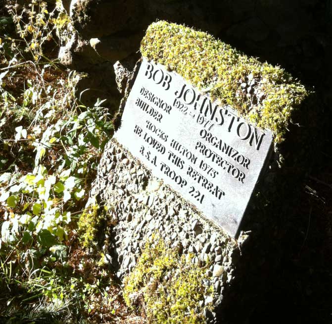
Near the ruined log cabin, a plaque stands embedded in a concrete block. It commemorates Bob Johnstone, whose age would make him a late WWII vet or a participant in the Korean conflict if he served in the armed forces. He was just 55 when he died – maybe one of those whose lives were shortened by a lifelong habit of smoking Chesterfields and Marlboro’s? Were he alive today to tell us about the cabin, he would be a frail 91 years old. But in any case “Hock” as he seems to have been called loved this place he called his “Hilton” and his Boy Scout Troop 221. Looking about one it is easy to understand why Bob “loved this retreat”.

b-johnston-cabin-plaque-optI have not been able to discover more about Bob Johnston, but one can almost feel the presence of an unseen caretaker, even as the Sword Ferns and Oregon Grape reconquer their space in the quiet that has reclaimed this beautiful spot. I can certainly appreciate his love for this remote cabin. I believe that during the time of his involvement with the cabin, it was fully functional, and later burned down under mysterious circumstances. If there are those out there that know more about this location and its benefactors, please contact me so that I can fill in the details, beyond what we know from the plaque.

But this place has a deeper and older significance – one that befits a dramatic retelling around the Boy Scout campfire. You see, originally this place was the homestead of Sophie Mozee, but like many of the original pioneers she seems to have cashed in her land leaving behind only her name tied to a tidy little valley on the side of Dixie Mountain. It appears the location was not that convenient and the place stood empty for a while. But around the end of 1893 and into the wintry months of 1894, it seemed that quite a number of homes were being burglarized, but no one knew who was doing this. But one day a settler homesteading the tract of land next to the Sophie Mozee plot was surprised to find a stranger eating his dinner, after he had gone out to get some fresh water from the spring. Seeing the man was heavily armed, he opted for geniality and the man finished the meal and slipped off into the woods. Later efforts to track the culprit(s) divulged little except that they often hiked out to Scappoose. But in August came the proverbial, “lucky break” in the case. The chief burglar’s mate had a falling out with his associate and he quickly volunteered all he knew to the St. Helen’s police. According to the informant the chief burglar was an escaped convict called John Bain and he was determined not to be taken without a fight. Constable Ed Fowler was soon dispatched to Dixie Mountain and as they were riding up Rocky Point Road they actually rode past Bain, who was on foot and armed with a rifle. It took some persuading, but eventually Constable Fowler was able to round up a posse of six settlers to help him apprehend the villain. At midnight the six slipped out of their homes and made their way silently down Rocky Point Road and along the track that led to the Mozee place. There they took up positions all around the cabin hoping to surprise Bain when he came out to wash in the early morning.

But morning came with its damp breezes chilling the men as they stood silently waiting. All remained still, but still no one emerged from the cabin, though one of the posse thought he spied movement within. The sun began to rise and still nothing happened. But just then one of the posse, Abe Nelson, happened to look back at the forest behind them and saw John Bain emerging from the forest with a sack over his back. Bain saw him and the constable and defiantly told them that they “better get out damn quick!” With the posse lining up opposite Bain, the Constable quickly rose and pointing his revolver at the alleged burglar and demanded him to “throw up your hands!”  To this Bain replied, “No! Go to hell!”.

Reportedly he stood looking at the posse for a moment longer, sizing up his chances with this rag-tag brigade of farmers. Suddenly he leaned over, dropped the bag and produced a revolver and starting shooting. Jumping around wildly to avoid being hit Bain emptied his revolver at the posse and then sprinted for the woods when he ran out of bullets. Abe Nelson, who had first spotted Bain, now drew careful aim at the vanishing figure and got off one more shot as he vanished into the woods. It was this final shot that was thought to have brought him down. But at the Constable’s advice they decided not to give chase, but instead seek out the figure they thought they’d seen inside the cabin.

Battering down the door, the group now searched the cabin, but found no one inside. A few days later Bain’s friends came looking for him, only to find him lying dead just outside the clearing at the cabin. Though mortally wounded he had retrieved a shotgun from a hidden stash and had been lying in wait when he finally died. Bain it seems was seriously determined not to be captured and he had good reasons for this.

As a teenager Bain had been convicted of killing a Chinese-American with an meat axe while employed in a butcher shop. He served out his time, but shortly after being released he killed both his children. He was convicted again, but this time he escaped after serving only a short time and had been leading a lawless existence ever since. And so it seemed the story came to an end. But there was still that loose end about the figure seen through the window – what had happened to that mysterious figure?

Many years later, one of the Dixie Mountain kids, Robert Service Jr. was working on a logging crew cutting wood around Rocky Point Road. It was the custom then to pass the cold nights in the bunkhouse telling stories and swapping yarns, there being precious little else they could do in that pre-electrification era. One of the loggers, William Gentry, then volunteered a story of how he’s been invited to go deer hunting by a fellow passenger on a Scappoose-bound riverboat. Climbing up to his cabin, they had supped on venison and shared a double bunk. But in the morning, William had awoken to an empty bed and an absent host. being hungry he was about to fix himself breakfast when all hell broke loose outside with gunfire resounding all around the solitary valley. Seeing no chance of escape out the door, William locked the door from the inside and pried a board from the boarded up chimney. Slipping inside he replaced the panel and climbed up into the chimney bench, where he sat silently through all the ensuing search. After everyone finally left he quickly exited the cabin and ran all the way down the hill. Never had he been so scared, he admitted to his bunkhouse mates.

Nor did this spell the end of dubious goings on on the Sophie Mozee spread. During the prohibition from 1916 to 1933 moon-shining became a rather profitable business in these remote canyons and obscure  clearings in the dense forest. While it is said that many were profitably engaged in the production of illicit drink, there were also considerable incursion made by the local police. Clarence Nelson, a relative of Abe Nelson who got off the final shot during the melee at the Mozee place, discovered a still operating at a spring not far removed from the old cabin. He decided to take his eldest daughter and son down to see what moon-shining was all about. But upon approaching the site they were surprised by an old woman brandishing a six-shooter which cut short their education as they raced for safety at the top of the hill. It is said that there still remain many old remnants of these illegal stills buried deep in the ravines below Dixie Mountain – as well as along the entire Eastern face of the Tualatin Hills from Burlington to St.Helens and beyond.

Posted in Indian lore, Lower Columbia Trails, Pioneer Lore, Trails | 1 Comment

How to avoid becoming a statistic in the Oregon Forests

Three pieces of practical advice for the Oregon Hiker

While Oregon is undoubtedly one of the most scenic states in the nation, it is also one of the most deadly when it comes to getting lost in the woods. Since 1997, 189 men and 51 women are reported missing as a result of walking into our forests – that’s 16 people getting swallowed up every year. Every dry season hikers with a wide variety of woodsman’s skills descent upon our wilderness areas and after just a few turns find themselves hopelessly lost in the dense Coastal Mountains. 89% of the missing are found, but 8% perish and another 2% are never even found.

What separates the 89% that are rescued from our sylvan “disappeared” can be as simple as lacking fire-building skills, or failing to bring adequate clothing and insufficient food and water.

1. Carry emergency supplies to sustain you overnight:

I always carry a “hip pack” that contains maps, emergency rations, a compass, a whistle, some fire starter, a “Leatherman”, a “bivvy sac”, a tube tent, and an assortment of medical supplies. There’s room on top for my camera, but essentially the bag is dedicated to carrying stuff that I hope to never use. That way it stays fully stocked and is handy to grab on the way out the door. In cold weather I often carry an extra pair of wool socks, and plenty of chocolate for quick energy. To be even more careful, you shouldn’t wear any cotton next to your skin. But to be honest, I usually forget to do this. The careful hiker should, if possible, wear a synthetic undershirt next to your skin, because when cotton get’s wet it can wick up to 26% of your body heat.

For added safety (since I’m out in the boonies at least once a week) I also carry a GPS – mainly for recording where I’ve been, and a locator beacon that I can activate to alert my wife that I’m in trouble. Keep in mind that phones usually don’t work when you need them in the woods. That takes care of the first challenge – staying dry and warm.

2. Making good decisions:

The second challenge is making good decisions. Oregon’s cold wet climate induces hypothermia in those unfortunate enough to get stuck in the woods without adequate protection from the damp. Hypothermia is no joke! It’s main characteristic is a tendency to become befuddled, make poor choices and refuse to reassess the situation as things go from bad to worse. It’s also very insidious because the first symptom is denial that you might be suffering from hypothermia. The best strategy is to converse body heat zealously.

There’s another caution that I would add to the challenge of good decision-making in the woods. Since I often hike alone and am no longer the spry youngster I once was, I try to avoid situations where I could fall and seriously injure myself in remote hard to find places. There are certain situations like traversing steep and slippery heights that I will avoid. Scrupulously observing such limits will force you to reconsider whether you should go on. If the risk is making you uncomfortable it may be wiser to turn back and retrace your steps – which is presumably less dangerous.

Sounds simple. Right? But I have learned that such a logical approach isn’t always reliable. It all depends upon the investment in time and effort one has expended to get to the present physical location. The longer the hike behind you, the more likely you are to take on additional risks just to avoid having to retrace the long outbound journey. That’s when your decision-making logic goes awry. Suddenly it’s no longer about the imminent danger ahead, but it’s all about the huge expenditure of energy and time it will take to retrace one’s steps. This is when mental discipline and firm guidelines can keep you from becoming a statistic.

3. The Pacific Northwest is Upside down!

Finally, there’s a basic element of geography that all hikers in the Pacific Northwest should learn to ignore! It’s the old adage about finding civilization by following water into the valleys. It is the absolute worst strategy in any commercial forest anywhere in the Pacific Northwest! The reason is simple; logging roads in the Pacific Northwest are built across the tops of the mountains, not along the valley floors.

In the Pacific Northwest timber is harvested by pulling it UP the slope to a landing pad built at the top of the ridge or mountain. That means that all the major roads, except major highways and county roads run along the spines of the hills and mountains, not down along the river like everywhere else in the world. To find people and roads you must ascend the slope, not descend them. Besides, it is virtually impossible to penetrate the thick thorny vegetation located at the bottom of the ravines. Many of these mountain stream beds descend over waterfalls or are clogged with gigantic logjams that are virtually impossible to scramble over. Dogs have an even more difficult time with such impediments. During the colder season these ravines are also full of wet cold fog that will rapidly induce hypothermia and eventual death.

Whenever you find yourself in a forest that is being logged or has been logged, remember to reverse the polarity of your woodman’s sense. Climb up to get out; not down! Once you’ve located the logging roads follow those roads that show the most use. It may take awhile, but you’ll walk out alive this way.

Like most things in life that can bring profound joy and inspiration; it’s important to stay on top of the situation and not let circumstances dictate the outcomes. Travel lightly, but be prepared.

Posted in Misc Trails & Trips, Trails, Uncategorized | 5 Comments

Hindu gems hidden in the hills above Scappoose.


It is unknown, but to a few, that in 1936 the Vedanta Society of Portland purchased 120 acres of newly harvested hillside in the Tualatin range to house their future spiritual retreat. This acquisition is all the more surprising since it occurred during the harshest years of the Great Depression and was organized and financed by a relatively minor chapter of the Hindu church in the US. Officially known as the Ramakrishna Order, the Hindu presence in the United States had begun only 100 years prior, when the first Hindu representative Sri Vivekananda had toured many of the major cities of North America with the intent to introduce Hinduism to its thriving population. Sri Vivekananda was graciously received by “cultured circles” in many of the major cities from New York to San Francisco and Seattle, but he never came to Portland. And yet it was here, due to the efforts of his primary disciple who was familiar with Portland that a local chapter of the Ramakrishna Order was founded.

Oregon in those days was not a very “culturally diverse” community and acceptance by the locals was hard to come by. Initial efforts to establish a Hindu center in progressive Lake Oswego failed due to local resistance. Thus, it is even more astonishing that the Hindus found peace and acceptance in a rural community that had only recently begun stringing the wires to bring electric light to its rural citizens.

Despite these odds, the Portland Ramakrishna Society managed to scrape together the payment and secured a 120-acre property that included a log cabin, a tool house and a small shed. In 1954 the Society replaced the original buildings and completed an octagonal temple topped by a golden dome in a clearing set above the property. This rustic temple became the first Hindu Temple in the Pacific Northwest.

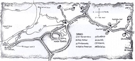
But challenges were afoot. Multnomah County, in its efforts to raise tax receipts objected to granting the Society tax-exempt status for the entire 120-acre tract, and would only grant an exemption for a single acre upon which temple stood. Transcendence not being a particularly practical response to this secular challenge, the Society took umbrage and sued the county! During the contentious proceedings it became apparent that the county interpreted the tax exemption as extending from the church building itself, and it seemed possible that the Society might be forced to relinquish the tax exempt status for lands that lay too far away from the temple itself. But, it appeared, the penumbra of tax exemption depended upon whether the structure served a spiritual purpose, no matter how large or small it might be. This revelation gave rise to a novel response. In case the tax collector fail to note the intrinsic spirituality of these hallowed groves, the Vedanta Society began to construct tiny little shrines all across the property, each with its own spiritual umbrella that extended into the forest around it. In 1974 the first wooden shrines were constructed to the Sri Ramakrishna (the founder of the Order) and the Holy Mother. The following year shrines to commemorate the Buddha, Christ and Ramakrishna’s disciple Swami Vivekananda were added. An Islamic Shrine followed in 1976, and finally in 1977 the American Indian Shrine was built on a slope overlooking Sauvie Island and the site of the first known Native American settlement in this area.

While this is private property, the Society allows respectful visitors to enter and wander amongst the shrines. The members of the Society have been repairing the buildings after a period of neglect took a toll upon them. The Shrine to the Spirit of the American Indian was recently rebuilt due to winter storm damage. On one of my many visits to the property I spend several wonderful hours conversing with the Lakota artist that was adding a series of symbols onto the structure. Later I returned to find Vedanta Society mapthe structure adorned with symbols of buffaloes and lightning – an iconography indigenous to the plains Indians. But as the Society explained, it was the Lakota that responded to their appeal so it was the influence of the Sioux that prevailed in this land usually associated with the Salmon and Raven.


Posted in Lower Columbia Trails, Pioneer Lore, Trails, Uncategorized | 37 Comments

What the Indians really smoked in their peace pipes.

Tobacco twistIn the pioneer days tobacco was sold in pretzel-like twists weighing about an ounce, and referred to as a “carrot”. They were ubiquitous throughout the west, part of every story and included in every important meeting. At the time, everyone focused on what was said or what was hauled away, but on each occasion someone had to break out a carrot of tobacco to make it all official.

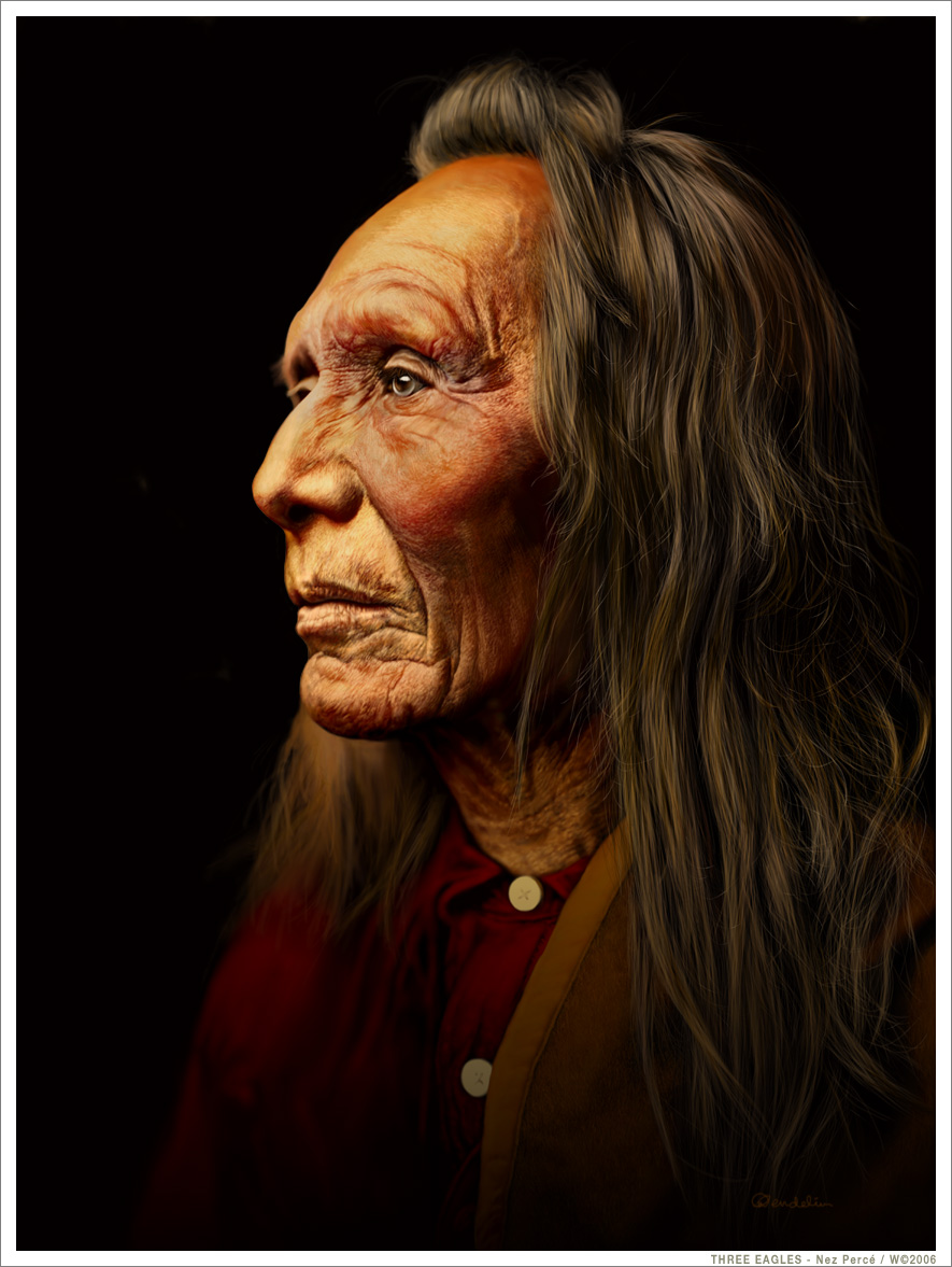
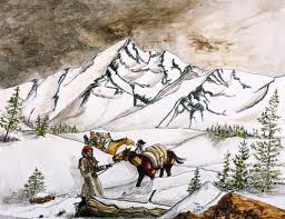
THREE_EAGLES___Nez_Perce_by_wendelinChief Three Eagles was cautiously observing the group. They clearly weren’t Shoshones, Blackfeet, or Peigans. And besides they moved too methodically without taking defensive measures. There was a woman with them and a child. And there was a man painted entirely in black – possibly a powerful shaman. This was clearly not a raiding party. Much of their route had led them through heavily timbered hillsides, and at times across steep slopes that ran along the top of precipitous heights. lewisnclark descendingSeveral of their horses fell; one rolled several hundred feet before becoming wedged into a tree. Miraculously the horse shook himself off and walked away uninjured.

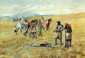
Three Eagles sent an Indian boy to lead them into the village. It was the first meeting between these “western” Indians and two distinctly different races: the bearded “white” people and a huge man with black skin – who was a slave, no less!

salish mtg 2This meeting has come to symbolize the beginning of a lucrative trade in furs that would span the entire continent, cross a major ocean and then become the catalyst for a burgeoning international trade that has become the hallmark of our current economic age.

Translation was tough. Lewis conveyed his questions in English to fellow expeditionary Francois LaBiche who passed it on to Charbonneau in French. Charbonneau then asked Sacajawea in the Hidatsa language, and she in turn conveyed the message in Shoshone – which the Salish could understand. Needless to say, much was lost in the translation.

But one matter was not misunderstood. The Salish were low on smokes. But initially they balked at the distinctly harsh flavor of the Virginia-cured tobacco. The Captains quickly mixed in some Kin nick-kinnick, a ground covering shrub whose leaves were smoked across much the the Pacific Northwest. The resulting herbal mixture was less harsh. This was critical since the Indians were in the habit of “swallowing” their smoke – that is, they never permitted any smoke to be exhaled. Under such circumstances, flatulent side effects were inevitable. I can only imagine the sidelong glances that Lewis and Clark exchanged as satisfied farts issued from under the lifted cheeks of their Clatsop or Chinooks hosts.nicotina quadrivalvis

Tobacco cultivation and ritual usage was deeply rooted in the Indian culture, but with the influx of fur traders from Hudson’s Bay to the lower Columbia River, tastes began to shift. “Traded tobacco” had begun to filter across the north as the fur traders of the Hudson Bay Company and the Montreal-based Northwest company began to send brigades into the interior to expand their trade contacts. Remarkably , the tobacco they brought for the Indians was produced by the Indians in the Brazilian Amazon.  “It is a bewitching weed amongst all the natives”, was the opinion of one trader. It was this Amazonian variety that the Indians in the north much preferred. It was moist, sweet in flavor and triple the price.

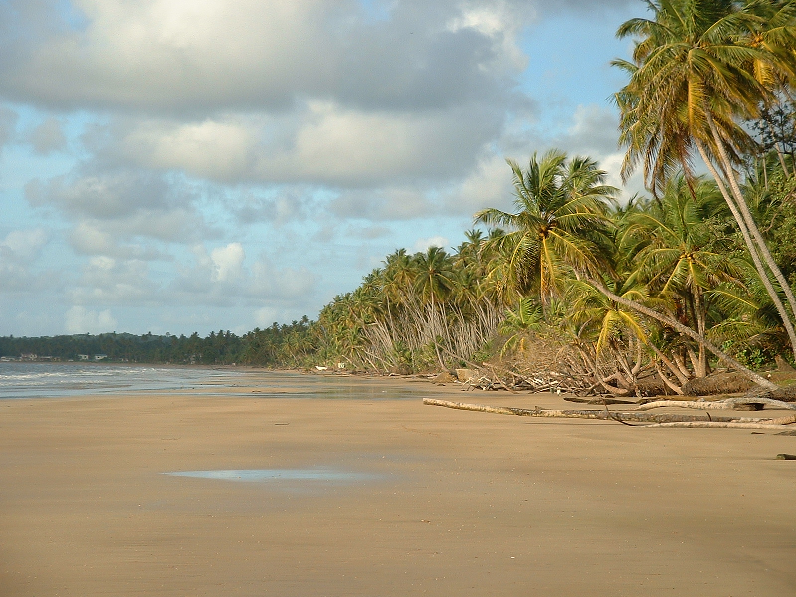
Mayaro_Beach;_Trinidad_&_TobagoThe so-called “Brazil roll” was first shipped to Lisbon from Trinidad, where English intermediaries purchased it and shipped it to London – where it was transshipped onto vessels bound for the Canada and Fort Vancouver – an overall journey of over 20,000 miles.

The expansion of trade across the North American continent has for many years been counted as one of the early achievements of the commercial system that we call capitalism.

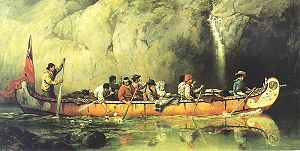
Voyageur_canoeA vast river of animal pelts was siphoned out of the northern wilds in exchange for a steady supply of mirrors, nails, combs, knives, printed fabrics, buttons and other European utensils. But chief among these trade items were the numerous bundles of Amazonian tobacco that were transported into the interior by the fur trading brigades. Tobacco was more than an incidental element of their inventory;  it constituted more than a quarter of the HBC’s inventory of trading goods.

Now consider this development in the context of British trading practices elsewhere. In 1780, Warren Hastings, the Governor of India exported the first shipment of opium to China in a bid to stimulate demand for imports, since the Chinese had proven stubbornly disinterested in western wares. In just a few years this stratagem proved so successful that 17-20% of India’s trade revenues were derived from booming exports of the highly addictive opium. And this lesson was not lost on the Hudson Bay Company. They began to import tobacco in larger quantities.

Within a reasonably short time, the demand for tobacco among the Northwest Indians increased so much that a quarter of all the trade goods stored in Fort Vancouver were tobacco! By the summer of 1844 they had 96,000 pounds of tobacco on hand. That’s about 5 lbs for every Indian residing from the mouth of the Columbia up to Celilo Falls – on both sides of the river. But there was just one problem.

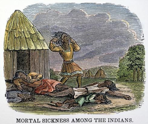
smallpox-epidemic-native-americans-grangerRecent epidemics had just killed off about 90% of those Indians. The HBC strategy had started as a typical colonial exploitation stratagem, but it failed because disease inadvertently exterminated the labor force. The unintended consequence was the collapse of the Indian tobacco demand, and the abandonment of this unique stock of 19th century “trade goods”. The epidemics had the effect of freezing everything in place. Innumerable “carrots” of tobacco waited in vain for their aficionados to turn up, but instead more than 90% of their clientele died.

In a very demonstrable way, this trove of forgotten tobacco emphasizes the essential role that addictive drugs played in catalyzing trade between populations that had hitherto never traded with each other. Tobacco created an immediate demand that helped to establish an effective market. It wasn’t the combs and calico that launched the trading; it was the tobacco that motivated the Indians to trade their pelts. And soon it would include alcohol, which was already becoming an essential trade good by the 1840’s. The seeds of addiction and alcoholism were  sown in the interests of establishing ongoing trade relations with the indigenous tribes. Unfortunately, many were spared the ignominy of addiction by a series of epidemics between 1831 and 1840 that effectively wiped them out. By the 1850’s the Indians had vanished from the Lower Columbia.


Posted in Indian lore, Pioneer Lore, Plant lore | 14 Comments

My “deliverance” hike on Cronin Creek

For weeks I had had been itching to explore an old logging road down the promontory that one can see from Four Seven Ridge – the narrow and slopping shoulder that squeezes itself down into the ravine on the southern flank of the North Fork of Cronin Creek. According to my older maps I saw that an old road had once twisted and turned down the descending terraces of the ridge until it got too steep and narrow and it slipped across a slope to connect with the upper reaches of the North Fork of Cronin Creek.We followed these tracks down into the the depth of this remote valley, warily following the logging roads as they went from solid downhill to steep, to nearly impossible to navigate without toppling over forwards – and tall the time the roads led ever downwards.

At lunch we stopped as one particularly steep portion where our forearms began to give way. The slope had been so consistently downhill that we were having trouble tightly grasping the handbrakes for so long. But as we descended the map clearly showed the old road looping down the steep slope and then doubling back and down into the v-shaped ravine bed. Down we rolled brakes squeaking and one leg stretched out at the side in case the bike slide away on the steep slope. A series of drops finally brought us to a level patch that led out to the northern edge of the shoulder, where the dwindling road now crested the corner and disappeared down the outside slope toward the creek below.

I was apprehensive as we neared the bend, because I could clearly see that the portion beyond the bend was rarely used and much overgrown. “Hold on”, I urged before Andrew and my dog Zoe lurched down the overgrown pathway. This was not looking good. To have the trail disintegrate this early in the descent did not bode well as we had miles to cover before we might emerge on Foss Road.

It became obvious to me that this was one of those wilderness decisions you have to make that will really test your mettle, and if you’re unlucky it’ll turn you into a statistic. I peered down into the valley floor trying the find that smooth dirt track that  I hoped would whisk me out of there. But all I saw were tightly packed alders and huge stumps that dated back to an earlier harvest. In front of me the opposing hillsides loomed thickly forested and interspersed with small cliffs. Behind I knew lay an incredibly steep ascent that rose over 2,000 vertical feet in less than 5 miles. This would be a grueling and punishing climb if we had to push our bikes up the slope as well.

Before committing to any further descent we decided to exhaust all other options. We returned to a side road we had just passed. The map described this road as running all the way out to the farthest point of the ridge to where the loggers had pulled the trees up to the waiting trucks. There was no path or road that led beyond this promontory. Nearby, a short skidder road led down to an old hunters camp overlooking the massive clearcut.  A thick alder jutted out from the embankment presumably to accommodate their multiple kills, but today it’s empty nooses simply signified the end of the road for us. This was a remote part of the Coastal Range and apparently a lot further from Foss Road than we had expected.

In Oregon, it is usually dangerous to descend into the river beds, due to the risk of hypothermia from all the wet and cold. And the rivers themselves could be astonishingly difficult to navigate even on foot. But this was a hot early September day, and the dark green jungle below me looked inviting – and besides there was that old road indicated on the map – so on we went rolling steeping down this overgrown trail and finally into a narrow animal trek that brought us to the river. Here we stopped amidst the green canopy of alders, big leaf maple and immense tangles of blackberries, thimble berries, salmon-berries, salal, nettles, and Devil’s Club. In the middle trickled a small stream of water amidst the giant tree trunks and huge log jams that blocked much of the valley floor. There was no sign of any road not in fact on in principle. The valley had reverted so completely to its native jumble of rocks and roots, that the very concept of “road” was foreign to this context. But we had cast our dice upon the brow of the hill and there was no turning back at this point.

From here on in we carried our bikes, suing them to shield ourselves from the vast swarms of nettles and the clinging tangle of back berries that blocked our progress through the tangled vine maple roots and up and over the towering log jambs. Down the stream bed we marched rolling the bicycles over the boulders, and over countless logs. Repeatedly we stopped as I scouted the best way to proceed with our cumbersome bikes slung over our backs. About a half mile further down the the stream bed, amid the wild clutter of branches and rocky embankments I first saw what was identifiable as the remnants of the original road. It proceeded onwards for 10 feet before being swallowed up by the landscape and its wild vegetation. We retreated to the stream bed to play limbo with the foliage that blocked our way.

I cannot recall how long we struggled through this rocky defile fighting the constant attack of the vicious vegetation. At first I winced and yelped as my bare legs repeatedly swished through the stinging nettles, but eventually everything below my thighs reverberated with a constant stinging throb, interspersed with bramble tears, and frequent lashing branches  as I forced myself through the thickets that blocked our way. The “best parts” were when we had to cross the big muddy bogs that covered the abandoned trails, and the mud sucked at our shoes and filled our socks with soil.

In all we descended several miles in such impossible conditions, before the erstwhile road became more prominent. Back and forth we went trying to follow the elusive trail, but eventually we arrived at the back end of a piece of private property that extended completely across the lower part of Cronin Creek. I have never been so glad to see a “Posted” sign, because it meant that civilization was right around the corner. Fording the creek on e last time we scrambled up onto a vast lawn that stretched across a majestic valley graced by tall Douglas fir groves, several ponds and a gaily painted helicopter!

The route we had taken marched us right through the middle of this idyllic scene passing just below several homes tucked along the valley’s length – but no one was in evidence to whom we would have to explain our unlawful presence. Finally reaching the far end of the valley undetected we thought we were “home free”. But as we sailed through the open gate we triggered the most alarm din. While just minutes ago the forest had been peaceful we were soon surrounded by alarms, and several cars all inquiring why we felt entitled to breach the landowner’s privacy.

While not exactly endearing ourselves to the local residents, an abbreviated version of this tale of poor decision-making in the wilds soon brought our critics to understand that we were not bow hunters with illegal entry on their minds, but rather two “damned fools” that had gotten themselves trapped up the creek without a paddle or an exit strategy. Shaking his head at the idea of descending the North Fork of Cronin Creek with two bicycles in tow the landowner, just exclaimed, “that’s a first!” and from my perspective I agreed suggesting it might also be the last.


no doubt. truck was held up by a tripod of branches replete with the pole jutting out from the embankment to hang the venison stood empty – a mute testimonial that even these determined souls had reached this last drop=off would venture no further.

dared ro go much farther.

at the end of the road. Behind us lay 13 miles of steep gravel roads clawing their way out of the ravince. It was an unwelcome proposition, especially with the temperatures rising traversed back down to the creek-side near the top of the North Fork of Cronin Creek. I had no idea of how badly this portion of old logging road had been affected by the ensuing floods of ’96 and ’06.


Posted in Coastal Trails, Misc Trails & Trips, Salmonberry Trails, Trails, Uncategorized | 5 Comments