
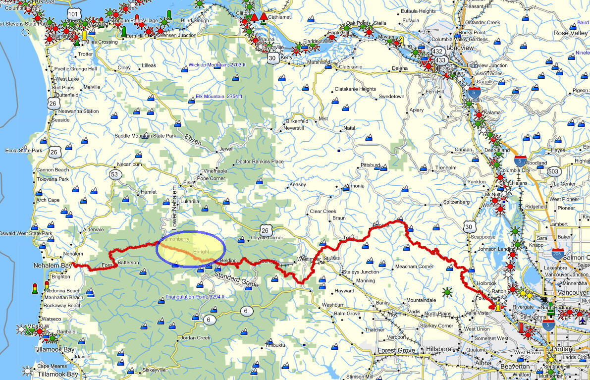
 North Fork of the Salmonberry Trail
Brief summary: This trail really goes to the heart of what led me to write this guide: the desire to find the truly beautiful places that exist way out beyond where most people will venture. This hike begins with a bone-jarring, but awe-inspiring drive that creeps along the edges of steep cliffs and reveals panoramic views into the fortress of mountains surrounding the Salmonberry River. It is a landscape that conjures up the presence of natural forces that are far from pastoral and quiescent. For me this “back way” down to the Salmonberry River is a very special experience. If you really want to get “out there”, this trail will take you there (and get you home, as well).
Distance/Duration: From the Sylvan exit to the bottom of the North Fork Salmonberry Road is 54.8 miles. Just the portion on US 26 (from the Sylvan interchange to the “Section 10 Road”) is 41.3 miles or 45 minutes. The dirt road from US 26 to the end of the North Fork Salmonberry Road is 13.5 miles long. Expect that it will take you at least 1 hour and 30 minutes to complete. The footpath that descends along the North Fork of the Salmonberry River is only about 1.4 miles long and will take you 1 hour and 5 minutes to traverse. The total trip (one way) will take 3 hours and 20 minutes of travel time.
The “North Fork”
Remember to add in rest stops and time to enjoy the river to your travel time. Depending on the condition of the road, I often park about a 20 minutes walk from the end of the North Fork Salmonberry Road. This portion of the road has several significant run-off gutters that cross the road diagonally, and can be challenging to cross without scraping the bottom of your car. Drive as far as your comfort level will permit, and consider unloading passengers to lighten the car. These precautions can add another 20 to 30 minutes to your travel time. That said, I have successfully navigated this rough road with a Honda Odyssey at least a dozen times, but “slick and muddy” conditions make me more cautions about how far I want to go…At a minimum plan for six and a half hours to get in and out, and back to Portland.
Trail Log:
From Portland to “Section 10 Road”: Head west on the Sunset Highway, and be sure to reset your odometer to zero as you pass by Exit 71B, also known as the “Sylvan exit” at the summit of the West Hills. From there travel 42 minutes or 41.3 miles to reach the “Section 10” road that diverges from US 26 on your left side. Should you miss this exit you can also take the Salmonberry exit, .2 miles onwards. The Section 10 Road is easier to spot since it emerges alongside Highway 26 and debouches into a wide gravel area on your left. The Salmonberry Road junction is harder to spot since it’s in a corner and the side road is not visible until you’re nearly through the curve – so go slowly if you miss the Section 10 Road.
The “North Fork” is among the best Steel head streams in the country!
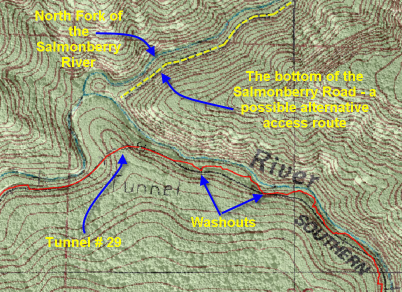
From US 26 to end of the North Fork Salmonberry Road: Reset your odometer as you leave the highway since subsequent distance measurements are given in terms of distance travelled after departing Highway 26. We leave Highway 26 at the entrance to the Section 10 Road, at an elevation of 1585 ft. To get all the way down to the Salmonberry River will require navigating past two mountain ranges each approaching 2500 ft. in elevation and then descending down to the confluence at 760 ft. elevation.
The route starts following Section 10 road, but this quickly merges with another access road (the Salmonberry Road), coming in from the right. From here on the road is designated as the “the Wheeler Road”. Keep following the Wheeler Road as it ascends the first heights. There are many smaller roads that connect to the Wheeler road, but you will want to stay on the central road (that shows the most use). After 2.68 miles (odometer reading) you will pass another road coming in from the right: Shields Road. Immediately thereafter the main road begins to descend and at 2.87 odometer miles you will enter an intersection referred to as Coyote Corner. On your left is a well-travelled road, which is the continuation of Wheeler Road. It heads east to Reeher’s Campground located behind Timber. But we will bypass this road and continue straight – now travelling along the “Wheeler Cut-off road”. At 3.66 odometer miles we encounter another connecting road (Shields Road – yes, this is the other end of the “Shields Road” that we passed a mile back) coming in from the right. Bypass it and immediately thereafter the Wheeler Cut-off Road starts to drop dramatically. Near the bottom of this steep hill the road begins to sweep around to the left. On the right side is a small forest road veering gently to your right. This is the continuation of the North Fork Salmonberry Road and can serve as an alternate route. But today we will continue to sweep around the corner where we are confronted by a three-way split.
Chose the middle road that turns slightly to the right. On the extreme right a short “skidder road” peters out almost immediately as it ascends the clear-cut slope to your right. The left hand option, the Wheeler Pond Road, is also well used since it comes in from Cochran Pond. But for our purposes we will take the middle option, which is the continuation of the Wheeler Pond Road. Slightly more than four and a half miles later, you will reach the summit of the final ridge – the site of a long abandoned logging camp (“Camp Nine”) at an elevation of 2400 ft. If you need further confirmation on how to navigate these labyrinthine roads both Chapters 23 and 24 include descriptions on how to reach Camp Nine,
Using the aforementioned route, you will enter into the ridge top clearing known as Camp Nine from the a northeasterly direction. I recommend stopping here to take in the impressive views and to scope out the various roads leading out of this clearing.
On your right is another road (Salmonberry Road) coming in from a northerly direction. Straight across the clearing (looking South) you will see three roads leading onwards. The middle one is just a short trail into the woods – long enough to accommodate a pick-up and trailer. Just to the right of the camping driveway is another road heading off in a southwesterly direction. This is the North Fork Salmonberry Road – and this is the route we will want to follow. The final choice, on the left, is the top of the Beaver Slide Road described previously.
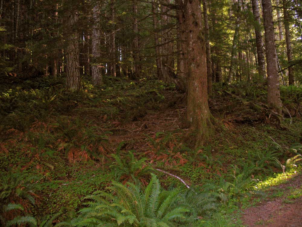
The afternoon sun filters through the forest casting a reddish glow.
Follow the North Fork Salmonberry Road from this clearing. For two miles it traverses the southerly face of this ridge and then it makes a sharp U-turn and heads along the top of a south-facing ridge with stupendous views. Soon the road turns north and begins the long descent into the basin carved by the North Fork of the Salmonberry River. The road continues in this northerly direction for about 1.7 miles (from the U-turn). During this stretch you will encounter the first “run-off gutters” that will take patience to navigate (take them at an angle). At the 1.7 mile point (from the U-turn) the road swings around and begins to traverse the slope heading in a southerly direction. This last portion of the road can be challenging, so parking the car at this turn is not unreasonable. The final part of this descent is steep, rocky and drops precipitously as it winds its way .7 miles down to the base of the slope, just above the North Fork of the Salmonberry. In all, the trip from the highway to the bottom of the North Fork Salmonberry Road will take you about 1 hour and 25 minutes.
This descent has been successfully traversed by my Honda Odyssey during the dry months of the year, but nonetheless it’s very difficult to navigate with frequent rocks and branches that need removing, and diagonal gutters carved into the road that require careful maneuvering to avoid damaging your car’s underside – not to mention retaining enough traction to climb the hill on the way out. The road gets rockier and the grade increases to more than 15% as you descend. It is quite sensible to park your car anywhere next to this road and complete the descent on foot – if you are not comfortable with the steepness and rough conditions. Such precautions are especially appropriate if conditions are wet or if you have passengers.
Trailhead: The trailhead itself is a bit anti-climactic especially after crawling your way down the steep and rocky approach road. Yes, now that you’ve reached the trailhead you can unclench your hands from their death grip on the steering wheel! During hunting season it’s customary to find one or more hunters encamped in this remote location, but at other times of the year it’s quite deserted. The easily visible footpath leaves the open area on the left side (southwesterly direction) and heads southwards along the North Fork of the Salmonberry River.
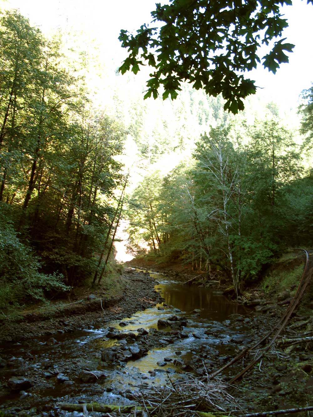
Trail condition: The trail is fairly rugged with lots of fallen trees to cross, and several areas where the path has been buried in fallen rocks – you have to pick your way through the rocky slope. At other places the river has eaten away the supports for the rail bed and you’re left clutching at branches as you try to cross the slippery slopes overlooking the river. The trail also crosses a number of streams that can be quite active in the winter and spring.
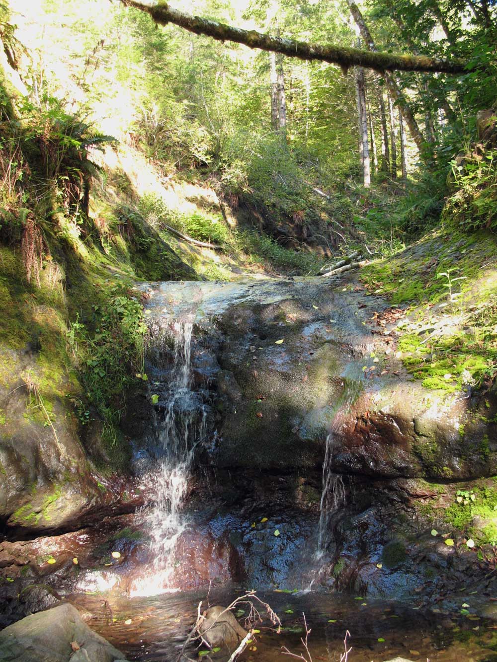
The hike down along the “North Fork” is crossed by numerous little tributaries.
Elevation change: The elevation loss experienced on the footpath leading directly to the main stem of the Salmonberry River is a negligible 240 ft. The toughest descent was accomplished in your car.
Trail Log: The footpath down to the main stem of the Salmonberry River actually follows a rail spur that climbed the North Fork of the Salmonberry River. The original spur line terminated at the trailhead. The road that leads down to that point was added much later. Years ago, the southern end of the rail spur we’re following crossed the Salmonberry on a high wooden bridge that connected this spur to the main line of the Pacific Railroad & Navigation line, which ran along the entire length of the Salmonberry River.
As we follow the old rail bed down and around a corner we are soon confronted with the damage wrought by a vengeful nature. At some places the rail bed has been buried by rockslides. At others it has been eroded to a whisper of a footpath. But in between you will find wide, level stretches of trail. And all along the way you’ll love the charming waterfalls that gurgle and leap their way down the valley.
The hike down this valley always seems longer than the return. It’s probably due to the fact that I tend to forget the many different types of terrain we encounter along the North Fork of the Salmonberry River. Eventually, we turn the final corner and begin a gentle descent into a cozy sunlight clearing. This is a favorite stopping place for the hunters and anglers that seasonally frequent this area. Indeed, it was through reading an angler’s guide to Oregon rivers that I first learned of this provisional trail and the “easy” access it provided to the river.
Confluence of the North Fork of the Salmonberry River and the main stem of the Salmonberry River.
Entering into the clearing, I recommend that you walk to the southern edge where the lush grass ends abruptly above a cliff overlooking the river. It was from this elevated clearing that the original bridgehead crossed the river. To get down to the river, turn around and walk to the northern edge of the clearing. From there you will see that a small path leads west and wraps around a small knoll before descending down to the riverside.
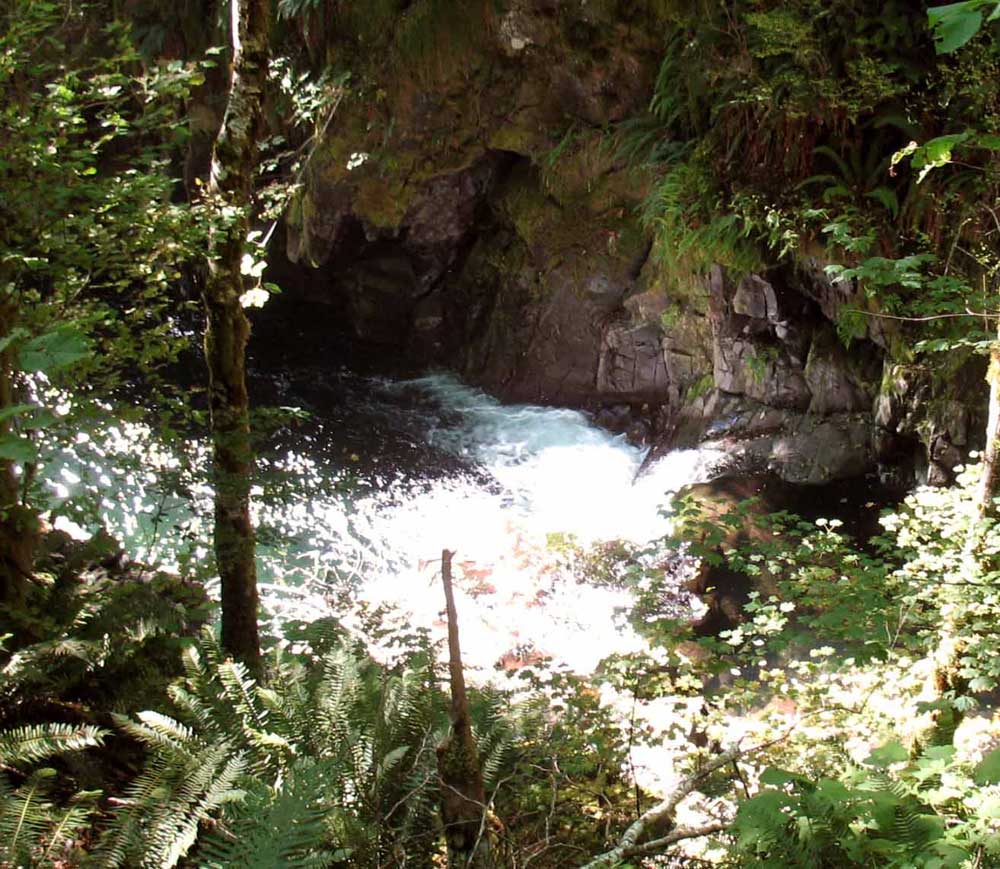
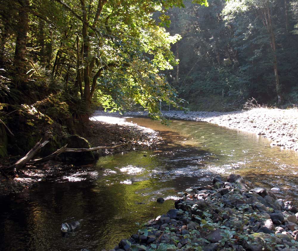
Loki’s Pool – where the North Fork meets the Salmonberry River.
To cross the main stem of the river (during the warmer seasons of the year) I recommend turning left immediately after descending the final drop to the riverbank. To the left you will find a pool big enough to soak in, but also shallow enough at its lower end to cross on foot. On the other side climb the shelf of river rocks and head “upstream” , while at the same time getting closer to the heavily vegetated slope the separates the river bank from the forest growing above. There among the ferns and tree roots you will notice a track that leads up the steep slope. Look closer and you should find a rope dangling down the slick slope; use it to haul yourself up and into the forest above.
Once up the slope, head to your right – to an area that seems relatively open – this is where the rail spurs that went around the end of the ridge are located. Once you’ve found them, follow them upstream through the dense underbrush until you emerge on the main rails near the mouth of the tunnel. Now you’ve found the PR&N, or as the old-timers called it, the “Punk Rotten and Nasty.”
Next on our agenda is to walk through the tunnel. This tunnel is relatively short so you can stumble your way through without a flashlight, but you would do well to come equipped with a flashlight. As we emerge from the other side of the tunnel you should note the sign that says “808”. Its significance is that the Southern Pacific, which owned this difficult stretch of railroad numbered all the tunnels to reflect their distance from the heart of the Union Pacific rail system – on Market Street in downtown San Francisco. So you are now standing 808 miles from downtown San Francisco!
Right here is also where the Edwards incline incident occurred. Had you been standing here on that fateful day in 1928, you’d have been mangled beyond recognition. But luckily for all, no one was hurt even though the valley echoed with the impact of the fully loaded rail cars as they flew across the river and were obliterated as they struck the main line of the PN&R and the cliff face beyond the tracks. Read the anecdote on gyppo logging in Chapter 21 for the full story of this dramatic incident.
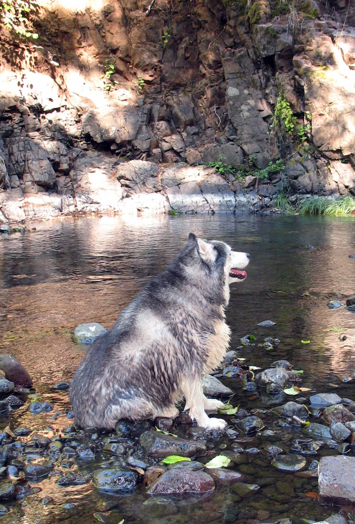
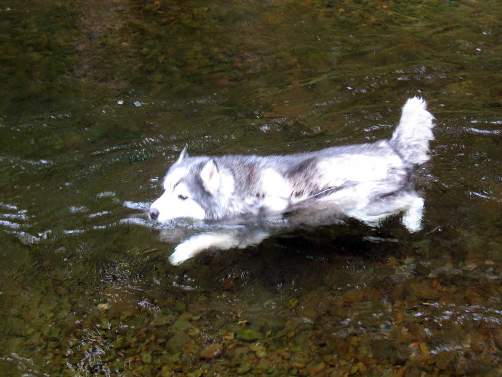
Loki basking in the afternoon sunlight after swimming in his favorite pool.
If you have time before the light fades, hike along the rail line. There are many more spectacular examples of what an angry river can do to massive rails and iron bridges along the way.
To walk all the way down to the Foss Bridge from the 808 tunnel will take you another five or six hours. To walk the 2.5 miles upstream to the junction with the Beaver Slide road will take several hours because of the unusually heavy damage in this stretch of the river. As you plan your excursions along the main stem of the Salmonberry River remember to leave enough time to climb out of the canyon before nightfall! Remember there is NO WAY to call home from the bottom of this gorge to let them know you’ll be late – unless you carry a satellite beacon.


Hi Jim-
You have an amazing body of work for the Salmonberry Trail. I’m working on some upcoming visual communication projects for marketing & fundraising. Ross Holloway, with the Tillamook Heritage Trust, is heading this phase for Dept of Forestry & State Parks (as you know, a lot of hats are in the ring). I’m in need of images (old & new), maps, and technical content. I’m hoping you might be interested in loaning some images and content for limited usage? Please reply and let me know. I appreciate your interest in project.
As part of my search today, I want to say how lucky I am to have found your site. What a marvelous resource. Will visit again soon for less timely endeavors 😉
Rick Yurk
Bam Agency
503-566-7878
Give me a call, or let’s arrange to meet. You can call me at: ate-six-oh, three-two-nine-seven.
Jim
Rick:
Nice talking with you today. Hope we can collaborate on the outreach for the Salmonberry Trail project.
Jim
Can someone tell me how to get to salmonberry river railroad/trailhead from Portland. These directions are very confusing. I have driven past all of these roads, salmonberry, wheeler rd, and also lower neheleam rd. And I am wondering if this is an easier route? I have tried to get to salmonberry river two times and got lost both times with directions written down and mapped out beforehand. The problem is that I always end up on logging roads that are inaccessible for my vehicle. The first time I tried to make it through with my old car, 4×4 truck I got a flat tire. And there were so many logging roads that I was lost for like 30 minutes while driving on a flat tire. The last time my new car couldn’t do it. I ended up at reechers canp and could see a river but I didn’t want to chance getting lost because I kept seeing bear scat. And advice?
It really is that complicated. In my book, Hiking to the Coast, I devoted two maps – one dedicated simply to getting to the trailhead, and the second one covering the trail. On my site http://Www.foresthiker.com you can buy full 8×10 color maps that show the access much more clearly. From US 26 to the trailhead is at least 17 miles. And then you walk at least a couple of miles depending on whichever route you choose.
Fantastic site. I’ve read it numerous times. Today I rode my bike from cochran pond to the end of the N fork road and hiked within 1/4 mile of the main river. Gave foresthiker credit in my IG post. Thxs so much! Dave g
https://www.instagram.com/p/BwgBwIulwGP/?utm_source=ig_share_sheet&igshid=1ctjmrgzlt6no
Glad you liked it. Had you gone on further to the Salmonberry River, you could wade across and see the “808 tunnel” on the main stem of the abandoned railroad. Jim