
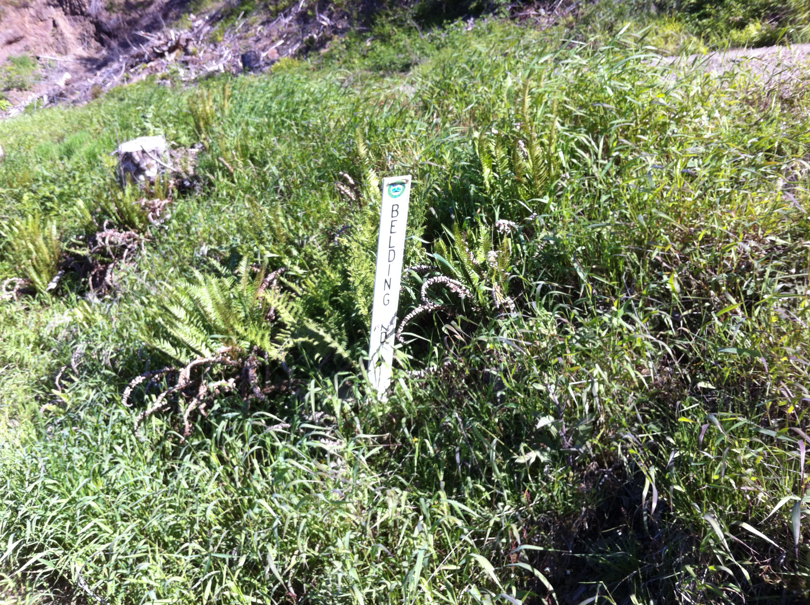
The false beginning of the Belding Road.
The Belding road is an old logging road that descends way down to the Salmonberry River. No one I know (and that includes forestry types) have been down this abandoned road that crosses back and forth for 11 miles as it sinks nearly 2,500 feet in elevation down into the Salmonberry River Canyon.
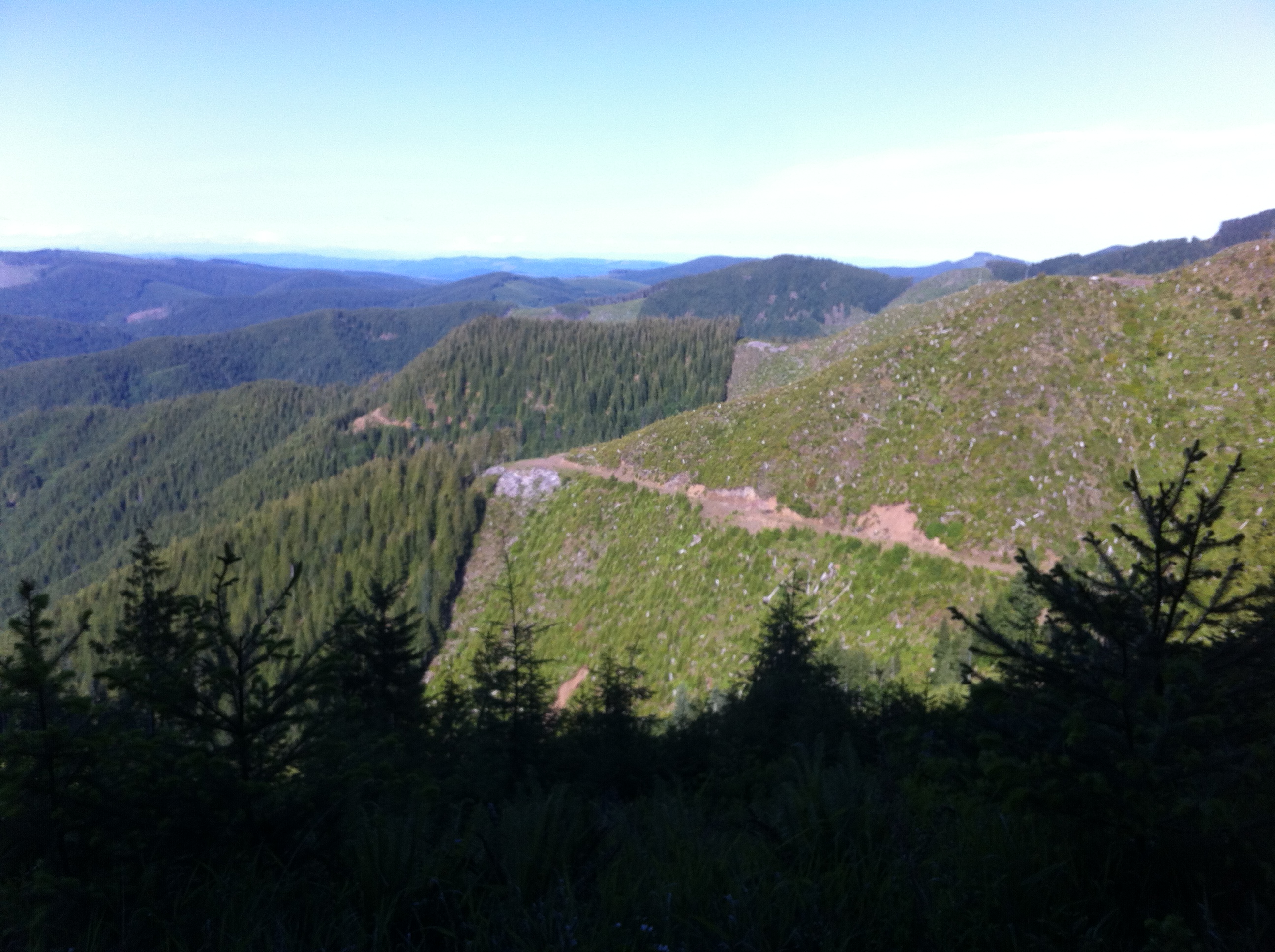
Belding Road descending into the Salmonberry canyon.
Some people get a kick out of climbing up things. In my world the rivers run along the bottom of deep canyons and I’m always descending from above. Because the only roads out there are logging roads, they all lead too nowhere in particular. But they’re also everywhere – all along the ridge tops.
Sometimes, to get out into the really remote rivers, you have to drive a labyrinthian route that unspools itself linking one ridgeline to another. Ridgeline roads built to carry heavy loads of timber snake out along the heights pushing ever outwards until the very last ridge has been traversed.
The Belding Road is one of these sinuous and convoluted trails cut into the steepest slopes along the Salmonberry Canyon. It is both primally beautiful and terrifyingly brutal at the same time.
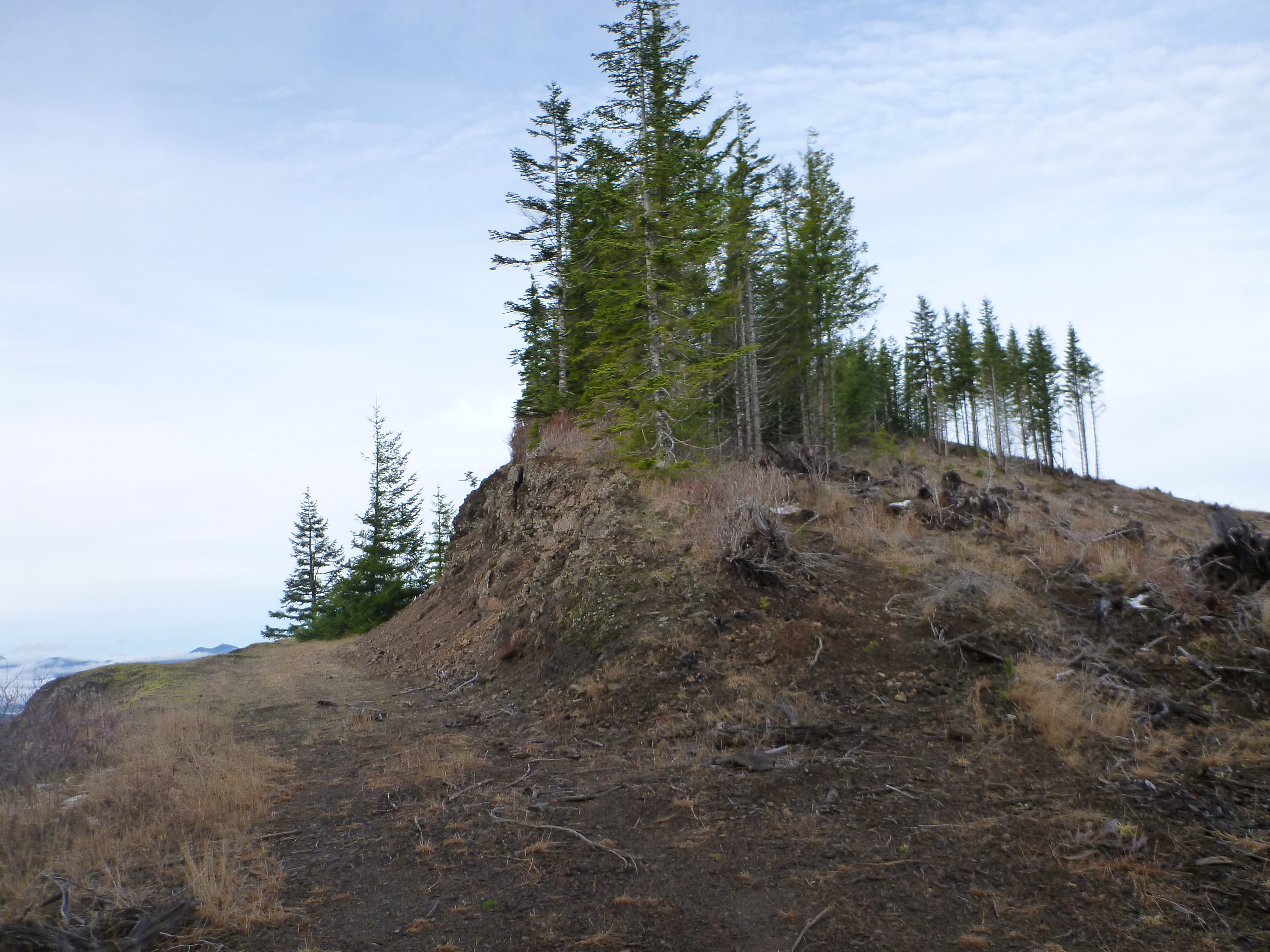
Lidgerwood Roost – near the infamous Windy Gap.
This close to the Coast the landscapes become fiercer: precipitous ravines with towering timbers growing off the cliffs. One of my favorite eyries is a place called Windy Gap. From there, on a good day, you can see the ships sailing up the coast. But when the gales came in 1955 this was no place for mortals. That winter it blew Lee Carrigan’s cabin right off the mountain.
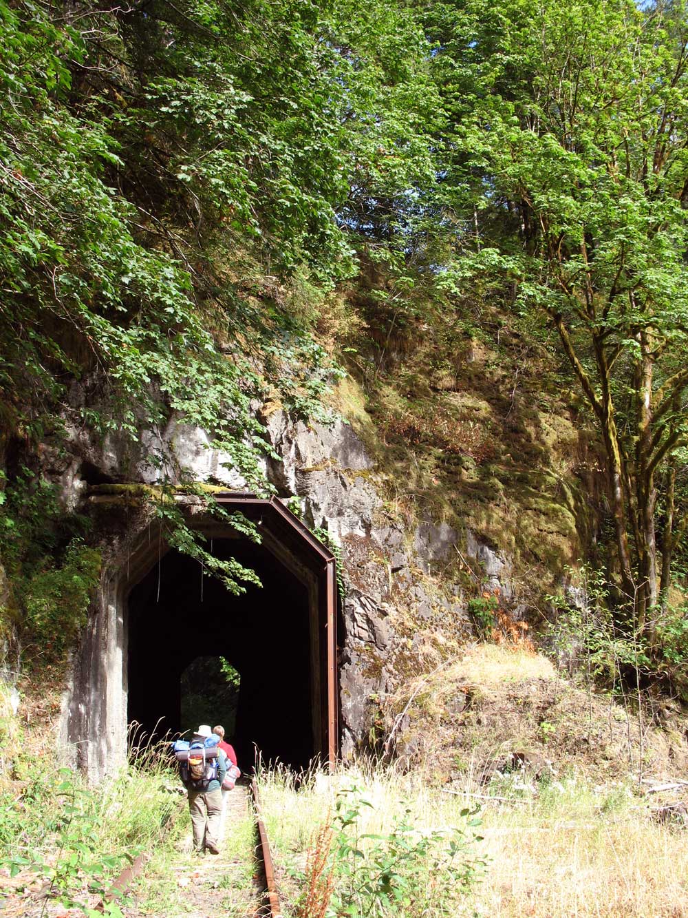
Tunnel 32 – note the bare rock above.
When the big expected gale comes roaring ashore tomorrow, these slopes will be the first landmass they encounter. The barometer is dropping, there is an edginess in the air,
the elk are hunkering down, and the Doug firs are clenching their roots. There is a promise of violence in the air that Coleridge would appreciate.
In 2006, a gargantuan log jam blocked the Salmonberry River at Tunnel Creek. Caught in the tightly twisting canyon the river breached its banks and poured through the train tunnel. A roaring brown whirlpool swept back up the valley pulling the steep slopes down upon itself.
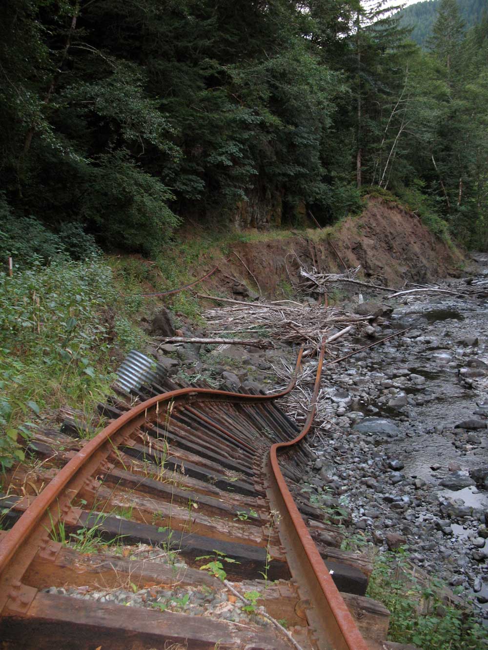
Widespread damage on lower Salmonberry River
I bet that by tomorrow when the first storms are due to hit, the river will churn once again. This once placid stream will be transformed, as the heavens open up, the storm roars up the canyon, and the syrupy brown water is whipped and churned with great chunks of wood and rock. As the storm intensifies the Salmonberry will froth and thrust forth great gouts of muddy water. Tossing rocks and limbs as much as 50 feet above the river, it will scour the cliffs of vegetation.
Now can you understand why I want to descend the Belding Road to see the chaos at the end of the road?


No, no, that much ruggedness is not for me, nonetheless I can appreciate evocative writing. Looking forward to reading your book which now seats near my armchair. Having seriously sprained my ankle on my last hike, I, uh, can anticipate having plenty of reading time. Best of luck on your book and happy holidays to you and yours.
In the late 70sI use to visit my friend L Hunt whom actualy took residence at an older refurbished Cabin located at what used to be called ,,,,,,,The Enright logging Camp. up from the mouth of the Salomberry His grandfather purchased some eighty plus acres sometime in the fortys. and passed down the wonderful property to his son Larry. We would park at the Nehalem river and would take the hike up the tracks up the five mile twist and turns.To Meet up with my good friend and catch up on life in the wilderness. My friend had desighn a bicycle that fit the tracks for his girlfriend to bring up the needs of remote dweller. He would spend most his days chopping wood and tending to his garden . Huge proublems with Giant Elk tearing up his fences desighned to keep them away from damage to orchard slash Garden, My Wife and I really enjoyed our time with the Hunts, I plan to hike again soon to this Salmonberry Valley. AS I remeber there were two Dwellings at the Five mile mark up the tracks. I believe the other family name was the Hennings. I wonder if those cabins are still upright, STEWART,
the salmonberry was a great place for us to explore before the 96 floods
Hey Jim, yesterday I road my bike from Cochran Pond, looped around the north side of the N fork of the SB road which comes in at Beaver Slide road jct, more or less. I walked down BS road to the bottom, had lunch, then slogged back up. Next adventure is to drop in from the south on Belding Road. See how far I can get to the river. Hoping I can make this a loop from Cochran. As of yesterday, there were plenty of places to ford the river. It’s just that the roadbed of Belding at the river, is so overgrown. How far down have you traveled on Belding toward the river? Ridable by bike, not withstanding the possibility of steep grades?
I have been partially down the Belding Rd, but was stopped by a major avalanche. I suspect that the rather circuitous Belding Road may have further disruption before you get down to the river. I think that its a 13 mile hike down to the river, which means that its probably a two day hike – that’s assuming you take all the right turns going down. Studying the maps it looks like there are several opportunities to end up on other tracks that lead to other locations, but that do not approach the river. I’ve come to the opinion that it would be better to start ftom the bottom of Beaver Slide Road and cross the river at the bulkheads where the road used to cross. That way you can’t avoid finding the road back up the slope. I will probably take a full day to reach the top (intersection with Standard Grade) before heading back down to the pool at the base of Beaver Slide. This way you have a better chance of finding the correct route, especially if Belding Road is badly damaged.
Jim